2014 Big Bend… 4 Motorcycles; Alx 031 – Drive, Drive, Drive; Photos; Texas!!
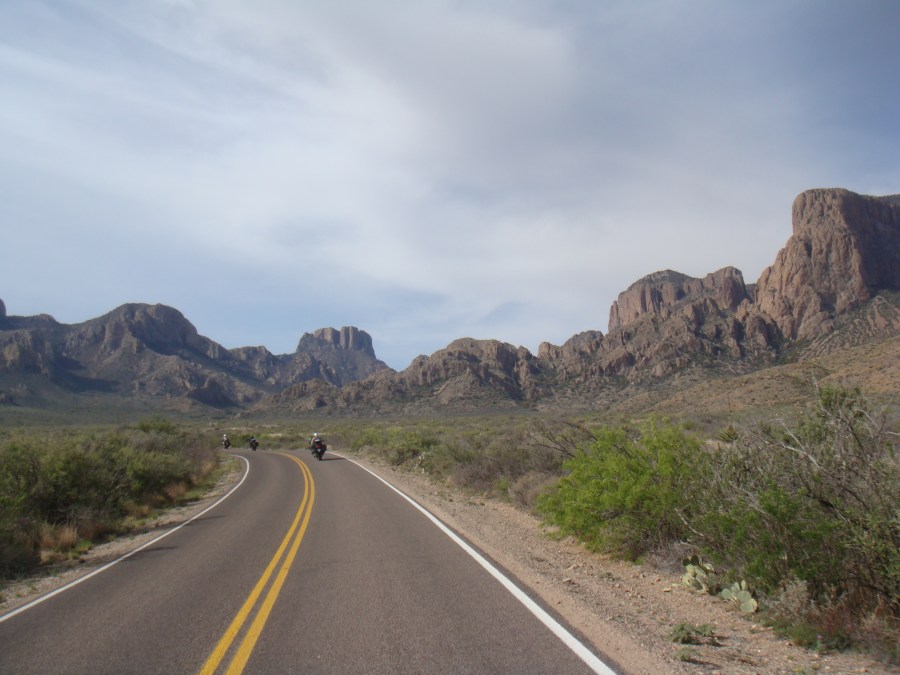

2014 Big Bend… 4 Motorcycles; Alx 031 – Drive, Drive, Drive; Photos; Texas!!
The next morning consisted of prepping the bike by washing off the plethora of bug guts, eating a bite of breakfast, loading the bike to make it road ready. It also meant a review of the weather – ugh, not looking good. There was rain and potentially snow heading up over the pass to make it into the Jackson Hole area. Lovely… We selected our final route, fired up the bikes and headed out.
The first part of the trip was not too bad. From Casper west on US 26. There is nothing in this part of Wyoming – flat, desert-like, nothingness. We passed this one area called Hiland that had a population of 6. First stop was in Shoshoni, WY. About a 100 miles down the road. Continued down 26 towards Riverton, but bailed off at Hwy 134 as a shortcut back to 26. 26 goes south to Riverton and then back northwest. Rather than following the pointy part of the triangle, we took the shorter route.
Along 134, we encountered road construction. Had to stop for the pilot car – same as on Day 5. Luckily, it didn’t take long. I did talk to the guy holding the sign. As you would expect, he was fairly “weathered” from having worked outside most of his life. I asked him if he was born in Wyoming or moved here. Born and raised about 90 miles south of where we were. He looked the part.
Once past the construction, the wind started becoming a problem. Gusting quite a bit from the south, southwesterly direction. We were heading west so this made for a very tough cross-wind. Cross-winds are explained on Day 2 so I will not go into details here. Suffice to say, we were a bit miserable on this part of the trip.
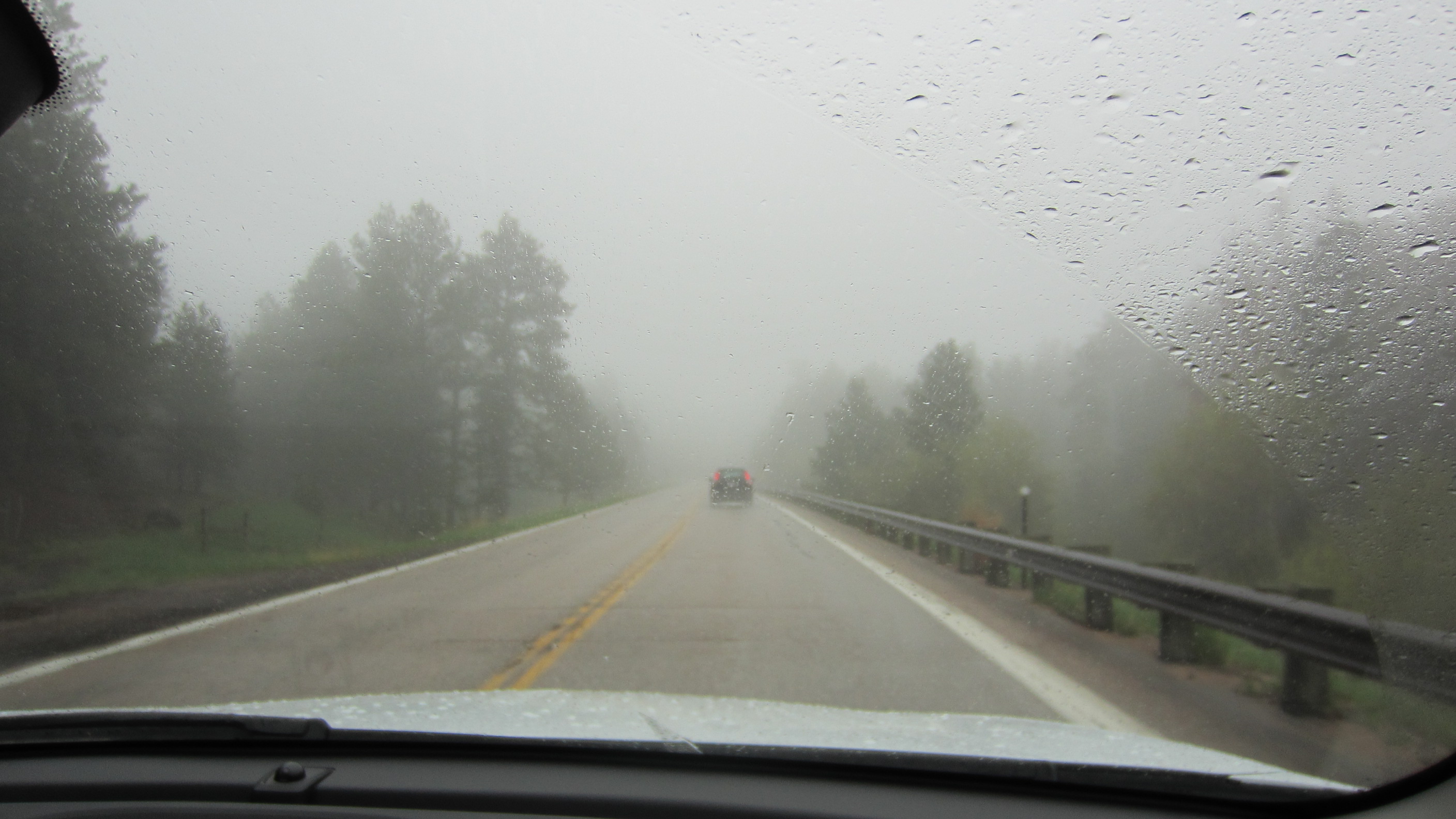
Back on 26, we started heading northwest. Wind was awful, but the outside temps were not too bad – high 50’s, low 60’s. We continued on to the next stop at Dubois, WY, which is just before you start heading into the mountains. We checked the radar again and the situation was turning worse. We saw plenty of snow on the radar moving up and across the pass where we needed to go. I called my wife who had already made into Jackson Hole the day before and she said it was cold and wet up there, but not snowing. Given our need to push on, we loaded up and headed out.
Almost immediately after leaving Dubois, the outside air temperature starting falling. We started around 52 degrees (f) and it quickly dropped to about 46 and started raining. As we continued to climb, the temps continued to fall and the weather worsened. We encountered snow pellets at one point. Balls of snowy ice bouncing off the bike and the helmet. I cranked the heat up on my heated gear! Shout out to the guys that encouraged me to buy it and a big Thank You! The jacket kept my body warm, the seat kept my butt warm, the grips kept my hands fairly warm and the heated socks definitely kept my feet warm. I became a big believer of heated gear at this part of the trip. Tucked in behind the big fairing on the bike, I was very comfortable as we continued to climb.
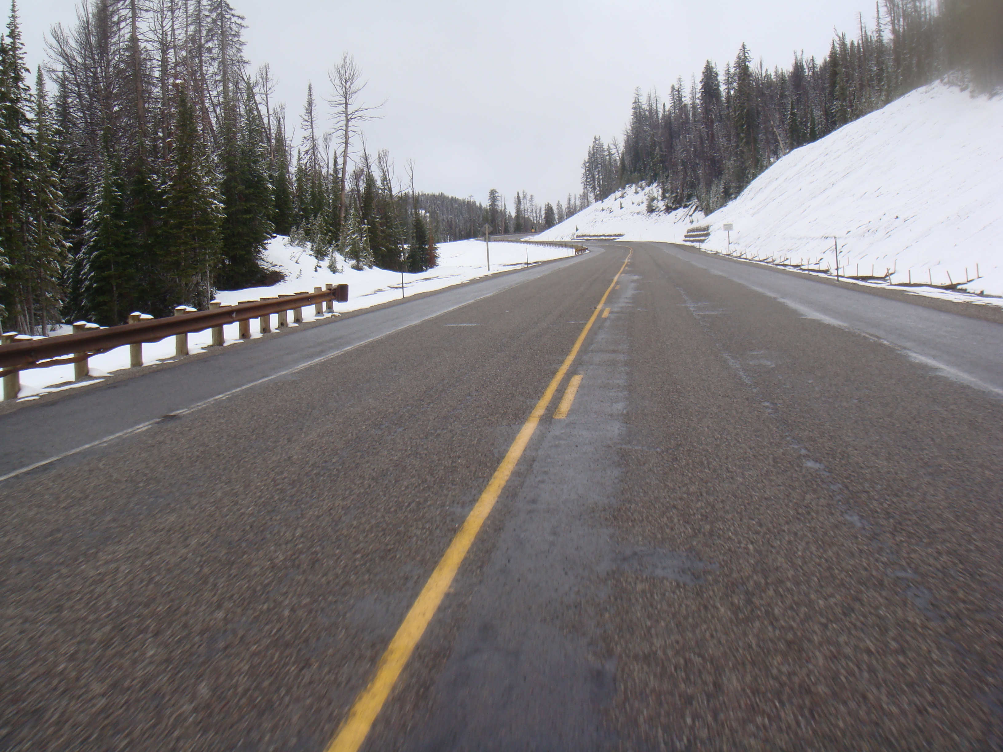
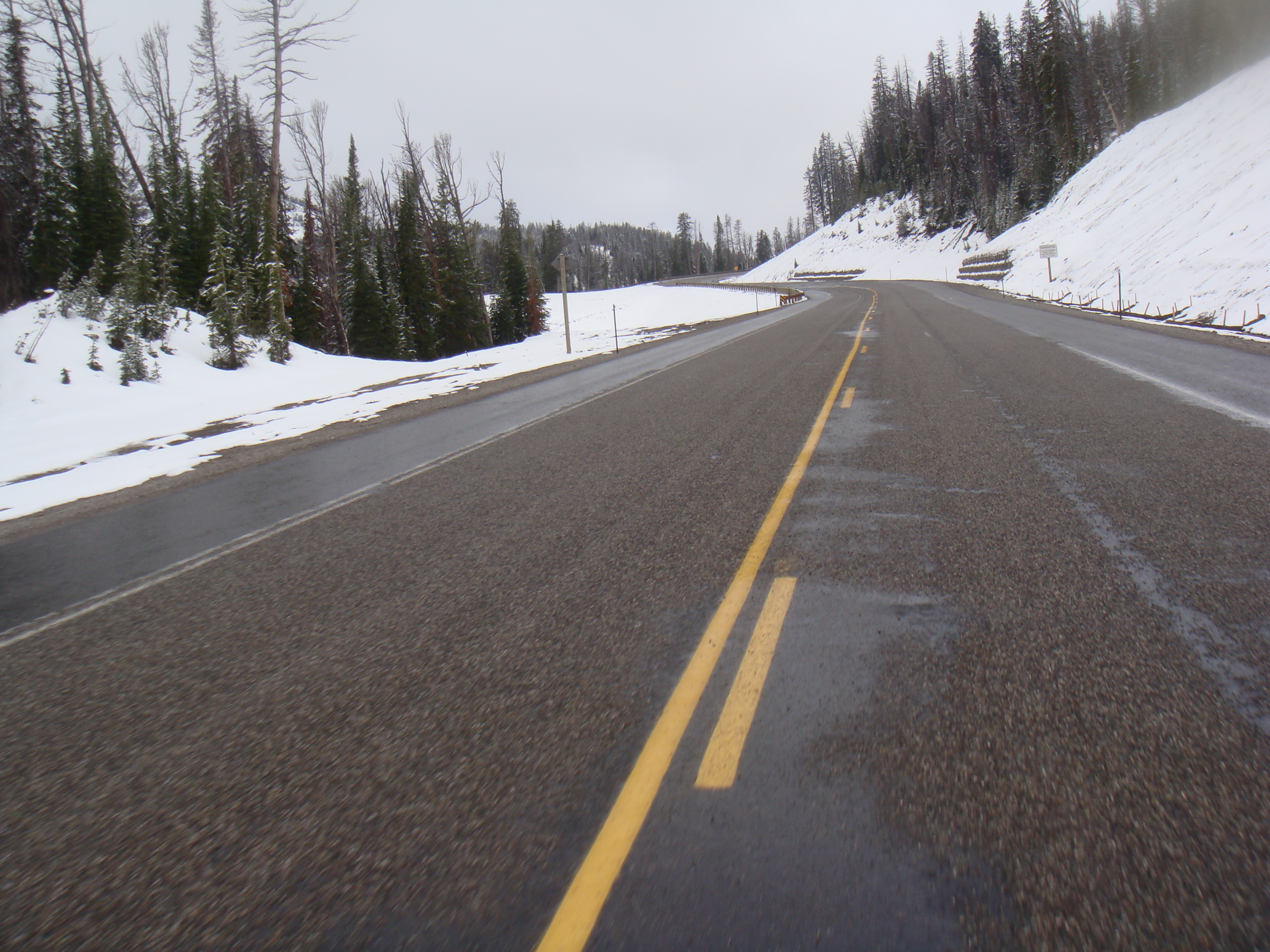
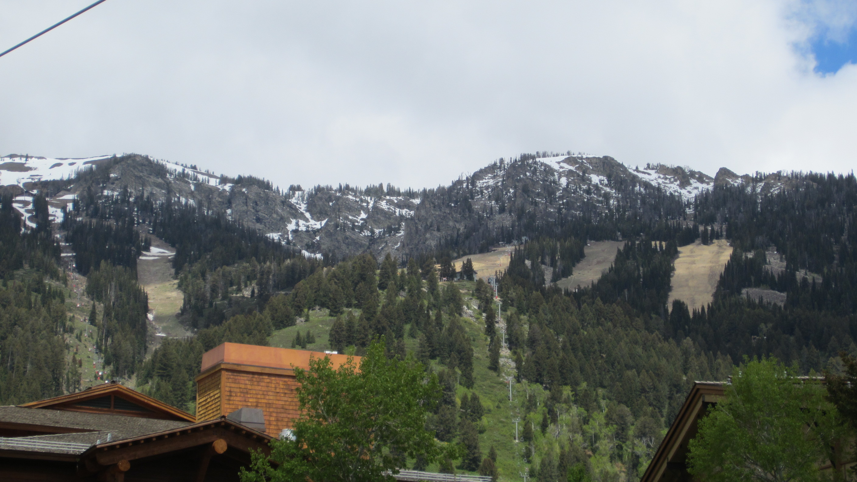
As we started to get close to the summit, the outside air temperature reached 36. At this point, a snowflake appeared next to the temperature as a warning that we were getting close to the freezing point – as if I didn’t already know that. If it reached 32 or below, then things would really get concerning as two wheels on black ice makes for a very bad combination. 35 degrees….34 degrees…still climbing. At this point, we saw two other bikes going the other way. They appeared to be more of the adventure bike variety – maybe a BMW R1200GS or a Suzuki VStrom. I did note that they had larger knobby tires more designed for off-road, than on-road. They passed with a wave…33 degrees…32 degrees.
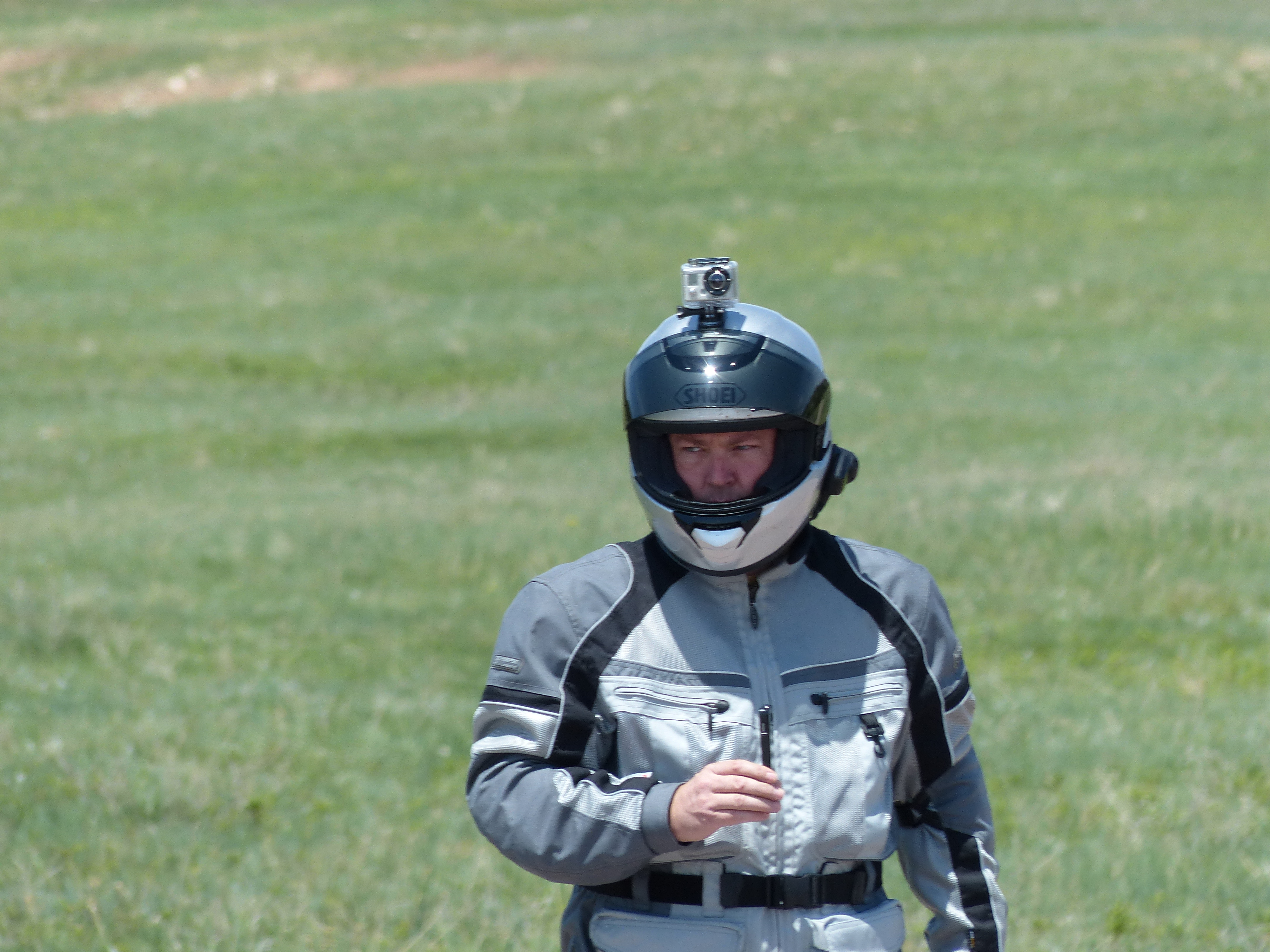
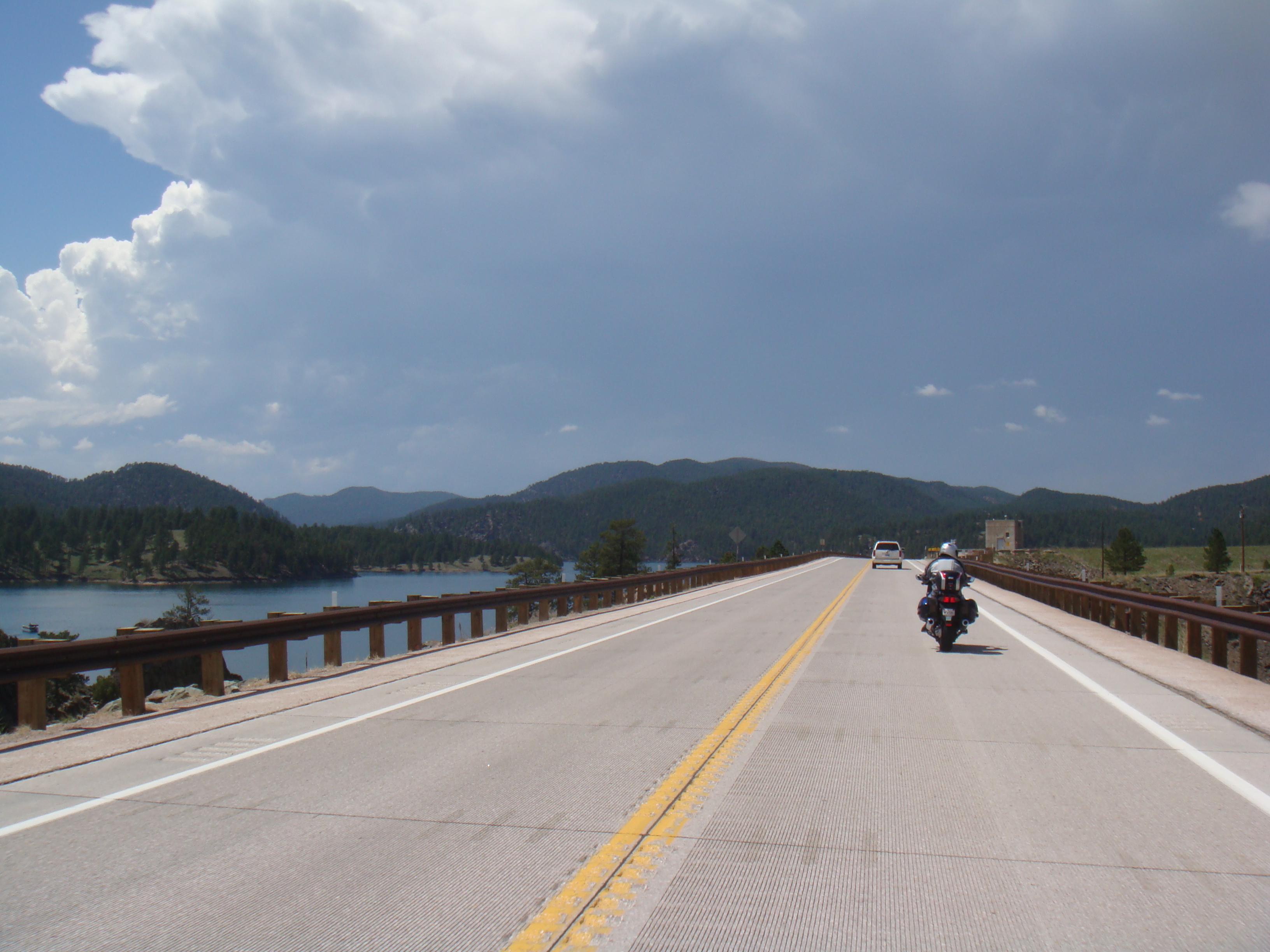
32 degrees, the road is wet, it’s snowing…the only good news is that we had reached the summit. Here’s some pictures of what that looked like from the bike.
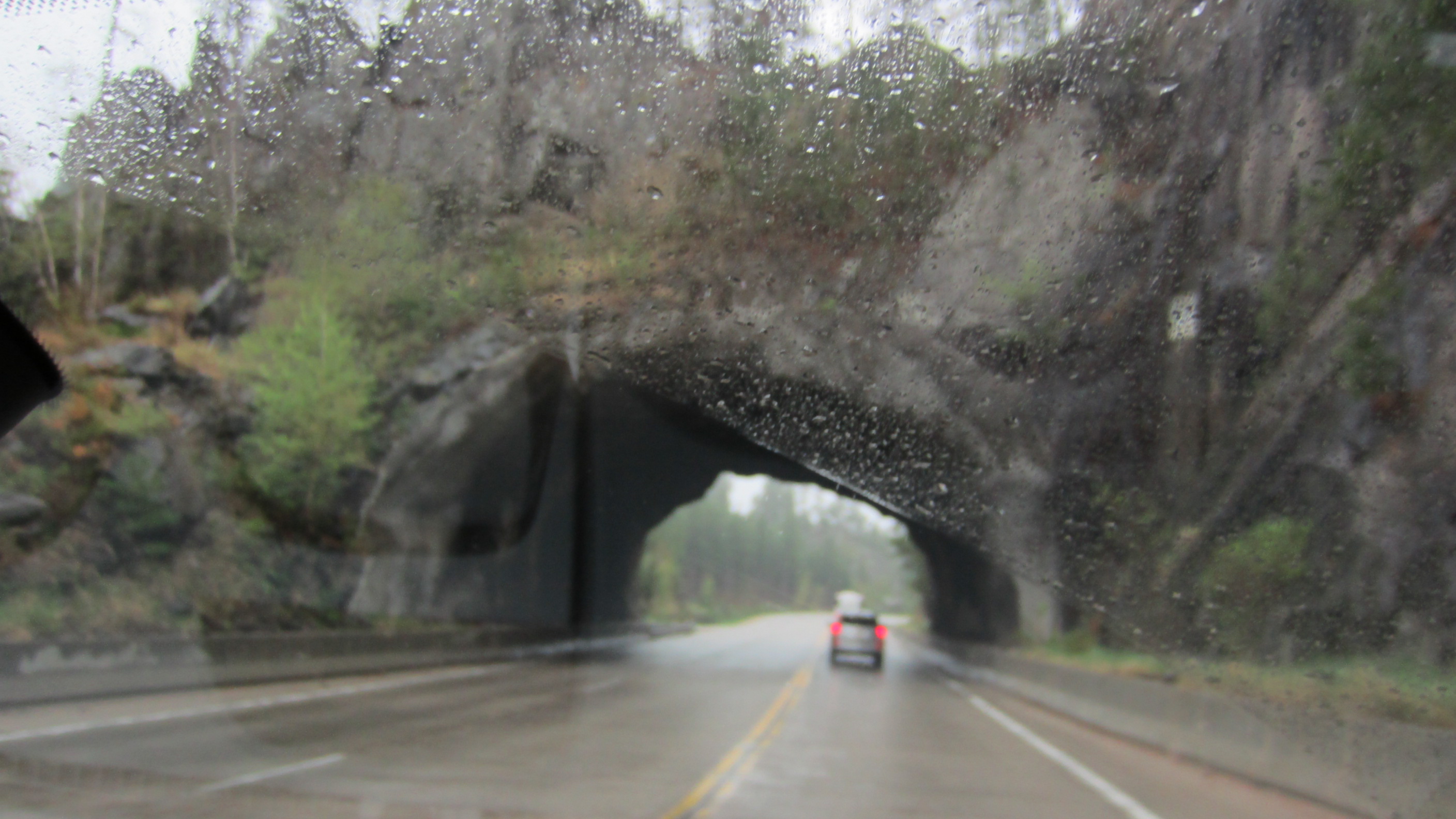
We carefully made our way past the summit and began heading down. The temperatures began to rise. This segment of the trip was one of the most nerve-racking parts because you just didn’t know if you were going to encounter black ice, a snow storm or what. We persevered and made it through on wet roads only. Very cold, but only wet. We felt fortunate and continued on down into the Snake River valley.
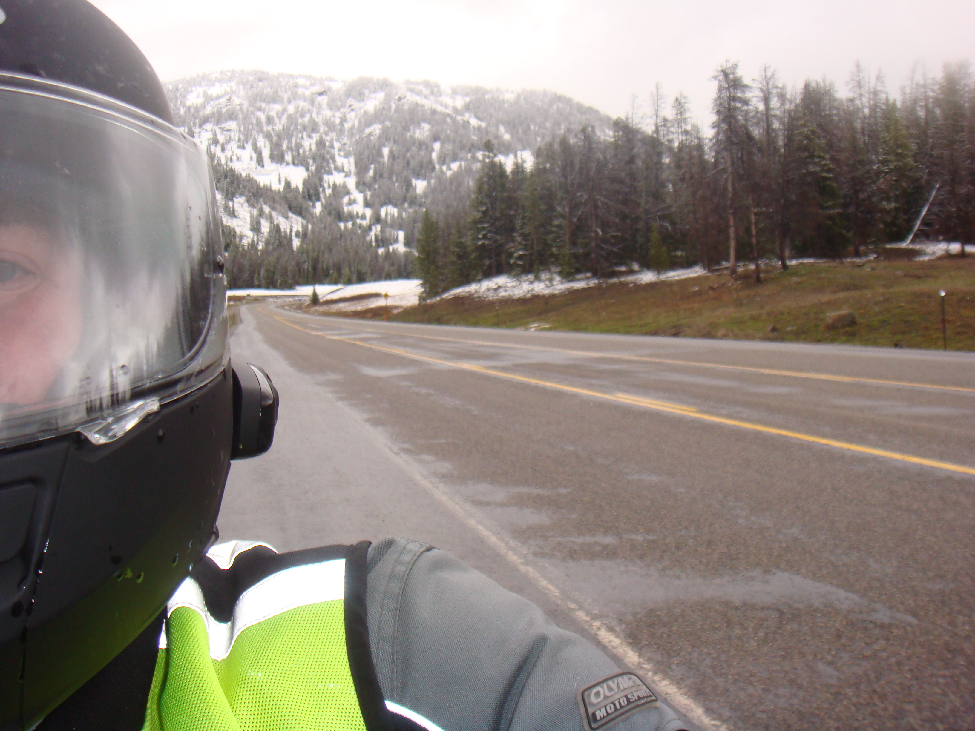
And then it happend…our first casualty. We had pulled over once for my buddy to put on some different gloves. He didn’t have heated grips nor did he have any kind of heated gear and the only complaint that he had was that his hands were cold. We pulled over to allow him time to put on some different gloves. No problem. Here’s a couple of pictures of that.
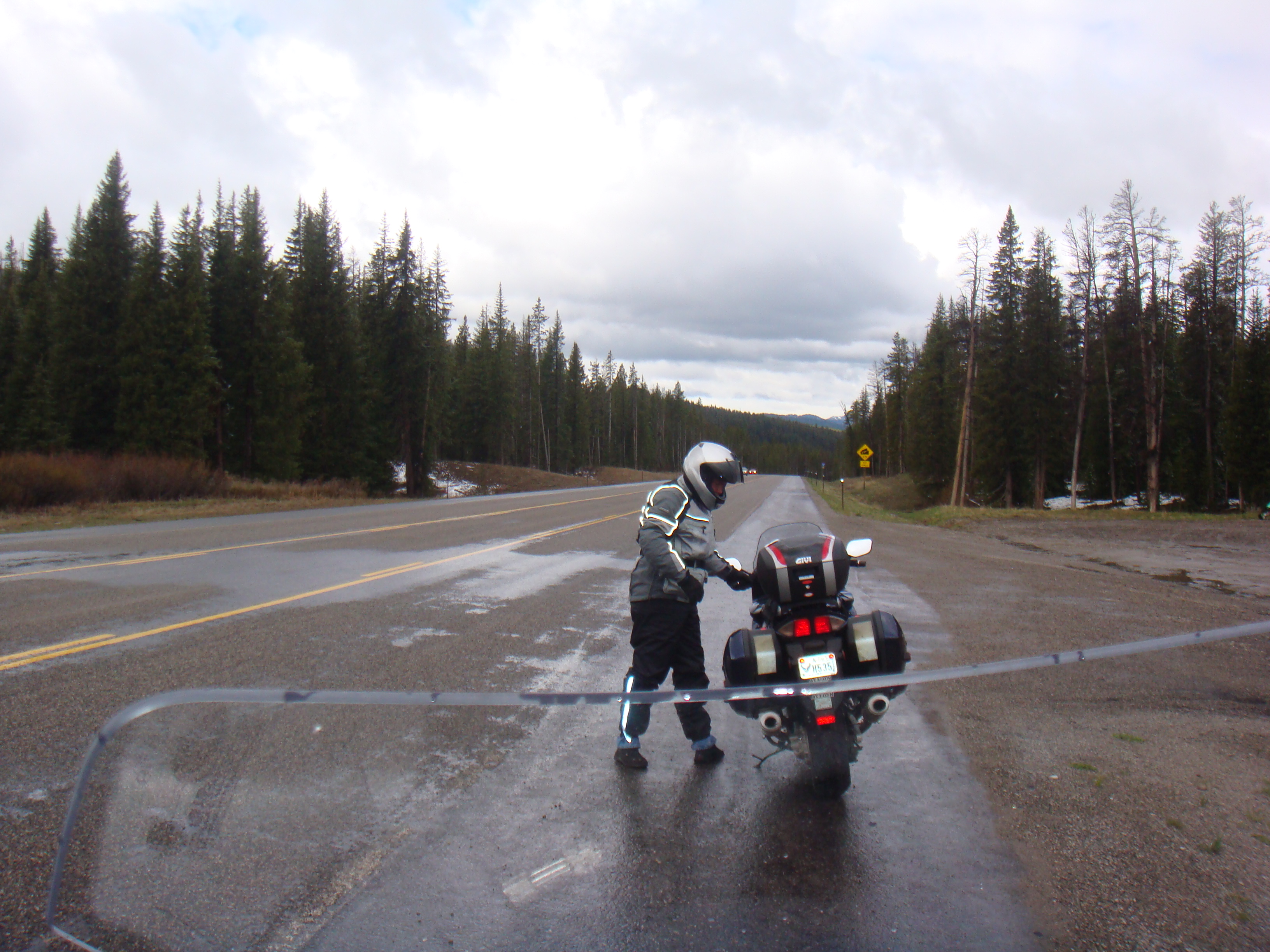
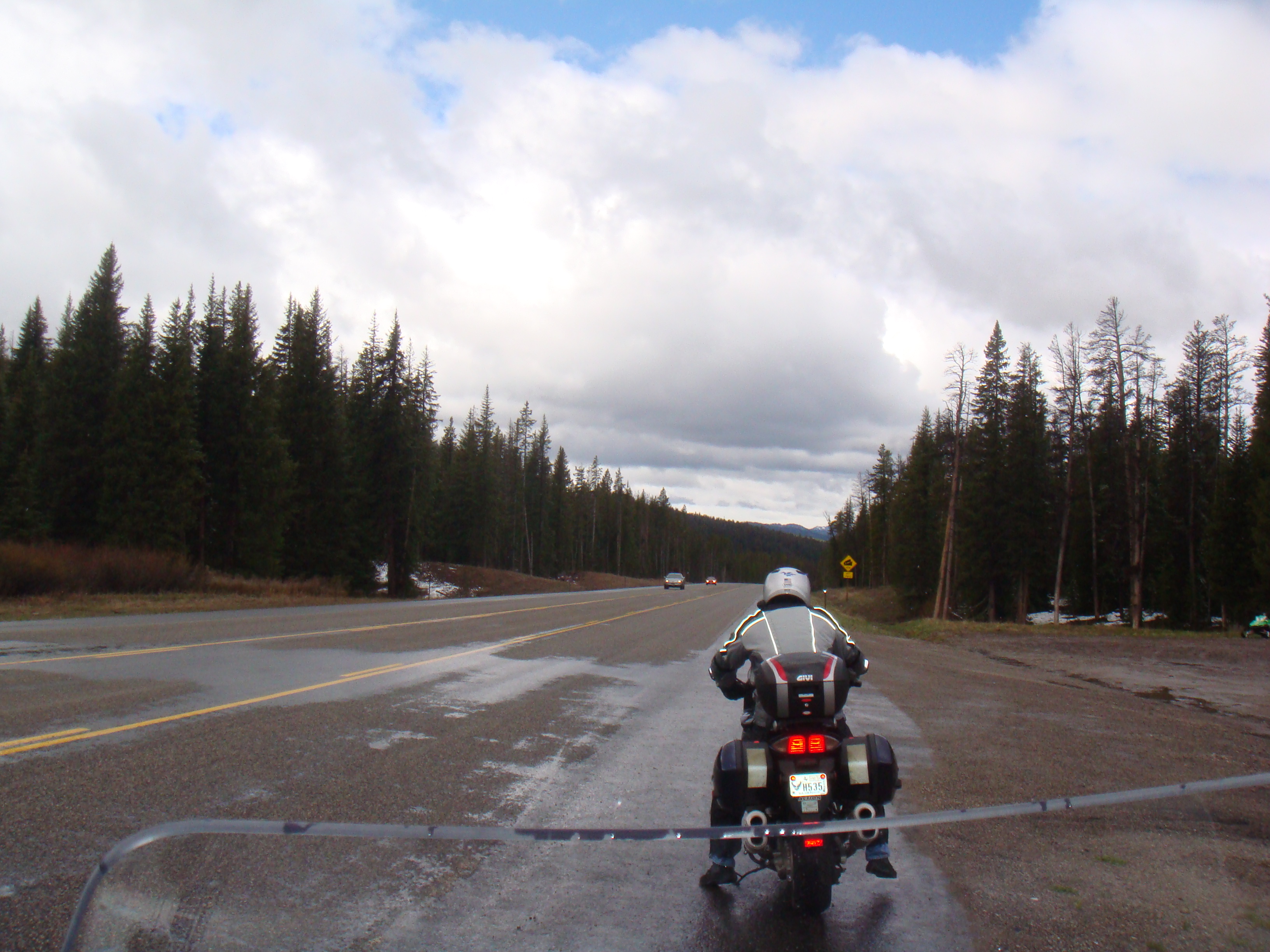
As you can tell, the roads are wet and it is very chilly, but we continued on. When we pulled over again to adjust some rain equipment, disaster struck. My buddy is behind me and we are chatting about where to pull over. We decide to pull over along the side of the road as that’s about all there is in this part of Wyoming. We still have the intercoms on and as I pull to a stop and put the kickstand down, I hear him yell “Oww…dammit” and hear a crash. I turn around in time to see him and the bike laying about halfway into the lane. Not good. I make sure my bike is secure and then go help.
Luckily, he is ok and not hurt. Maybe a pulled muscle here or there, but just stands up and starts bitching. I would too in that situation. His bike has never been dropped and so he is pissed that it had to happen now. I flag over a couple of pickup trucks and the two guys that stopped helped us get the bike upright. With all of the gear and luggage, it probably weighs close to 800 pounds.
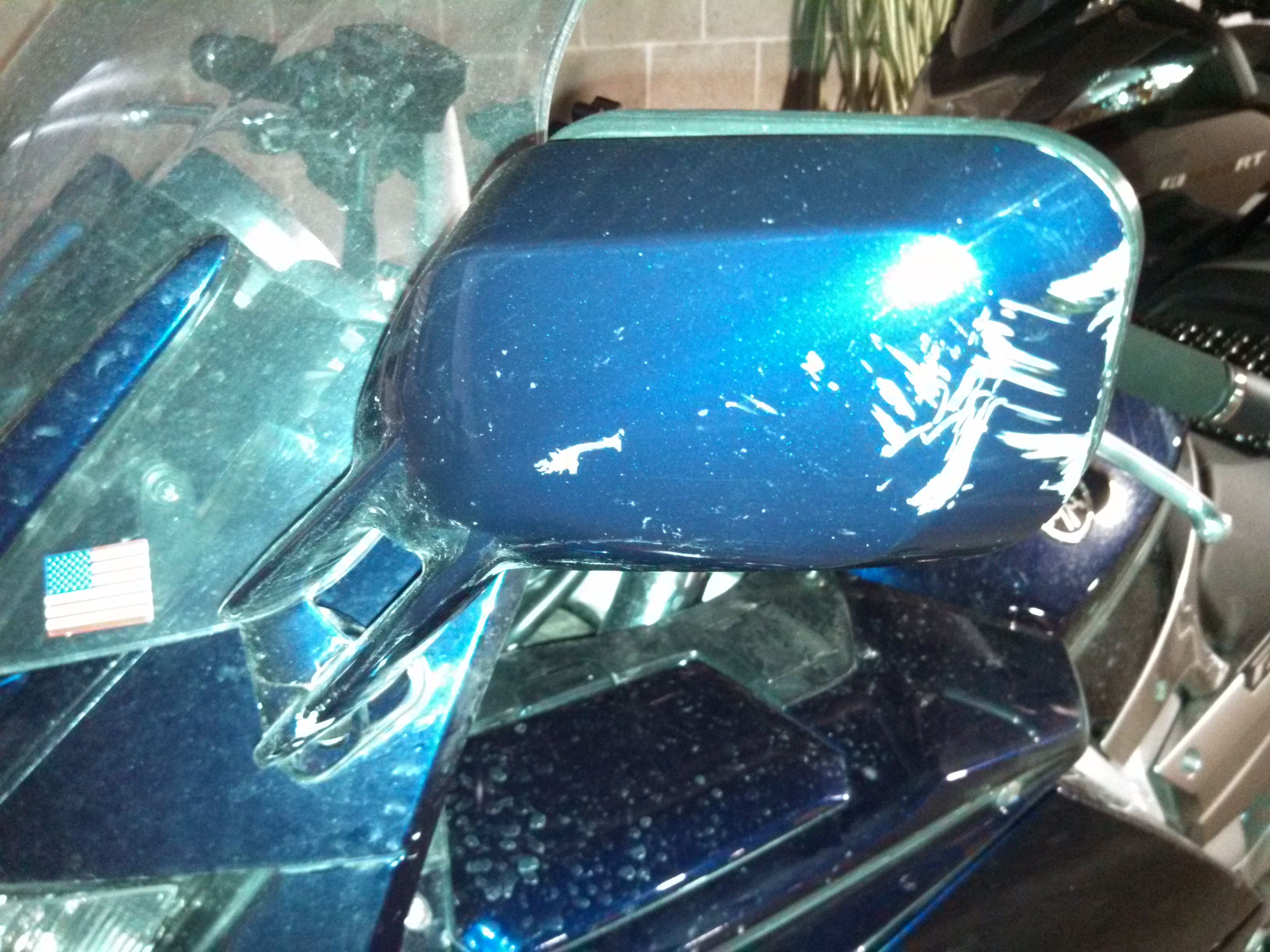
We get the bike upright and look for damage. The mirror on the left is damaged and, well, that’s about it. On his FJR, there’s a bit of rubber on the side case that helped prevent damage to the paint on the rear and the sliders he had installed up front helped prevent any further body or engine damage. All in all, he walked away fairly lucky from what turns out is a fairly common occurrence with the FJR. The kickstand doesn’t go all the way down and the bike just rolls right on over as you start to lean on it. I didn’t have the heart to stop and take photo’s of him and the bike laying in the road. Probably should have. 🙂
Here’s a picture of the damage:
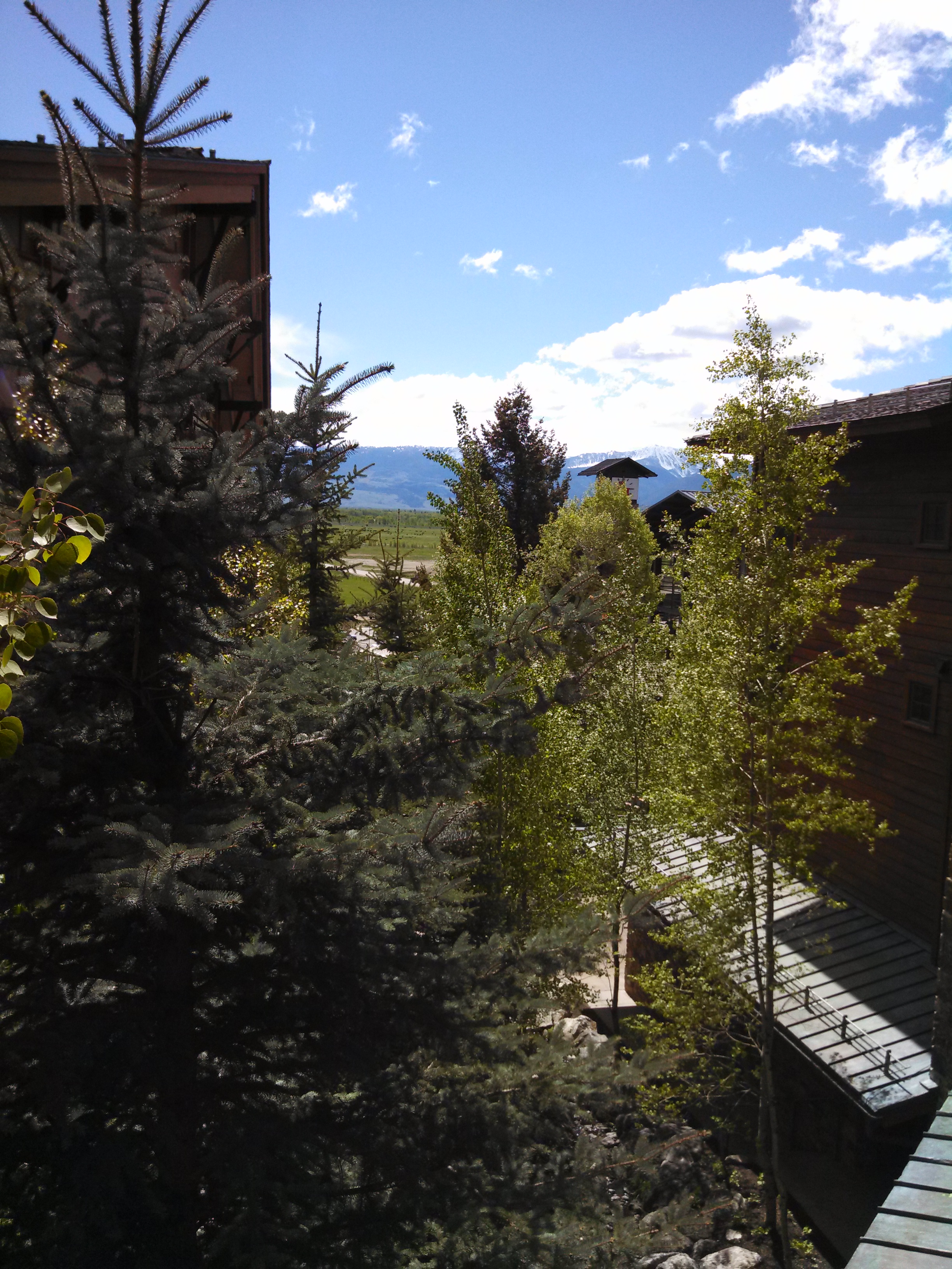
That now made two tense moments on this day. Dang, if we can only get to our condo. From that point, it was another hour and a half to make our way down to Jackson, WY and then back up into the Jackson Hole ski resort area where we were staying. Rained on us practically the entire way and the traffic through Jackson is terrible. But, we finally made it.
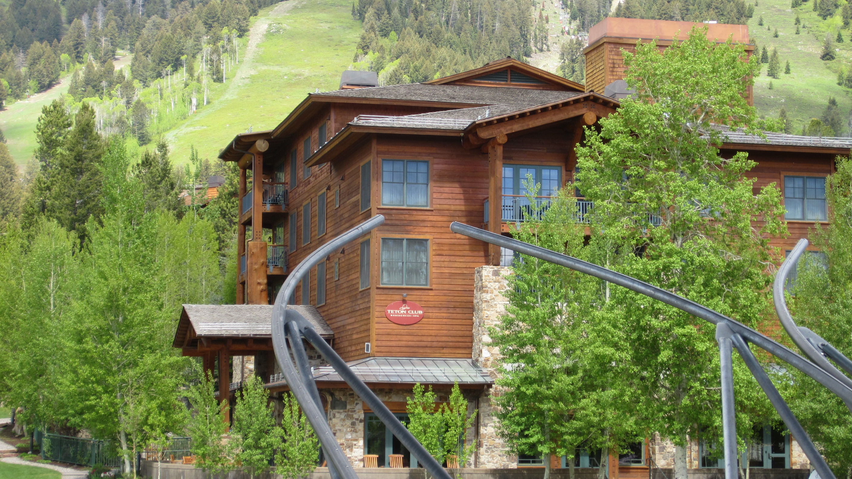
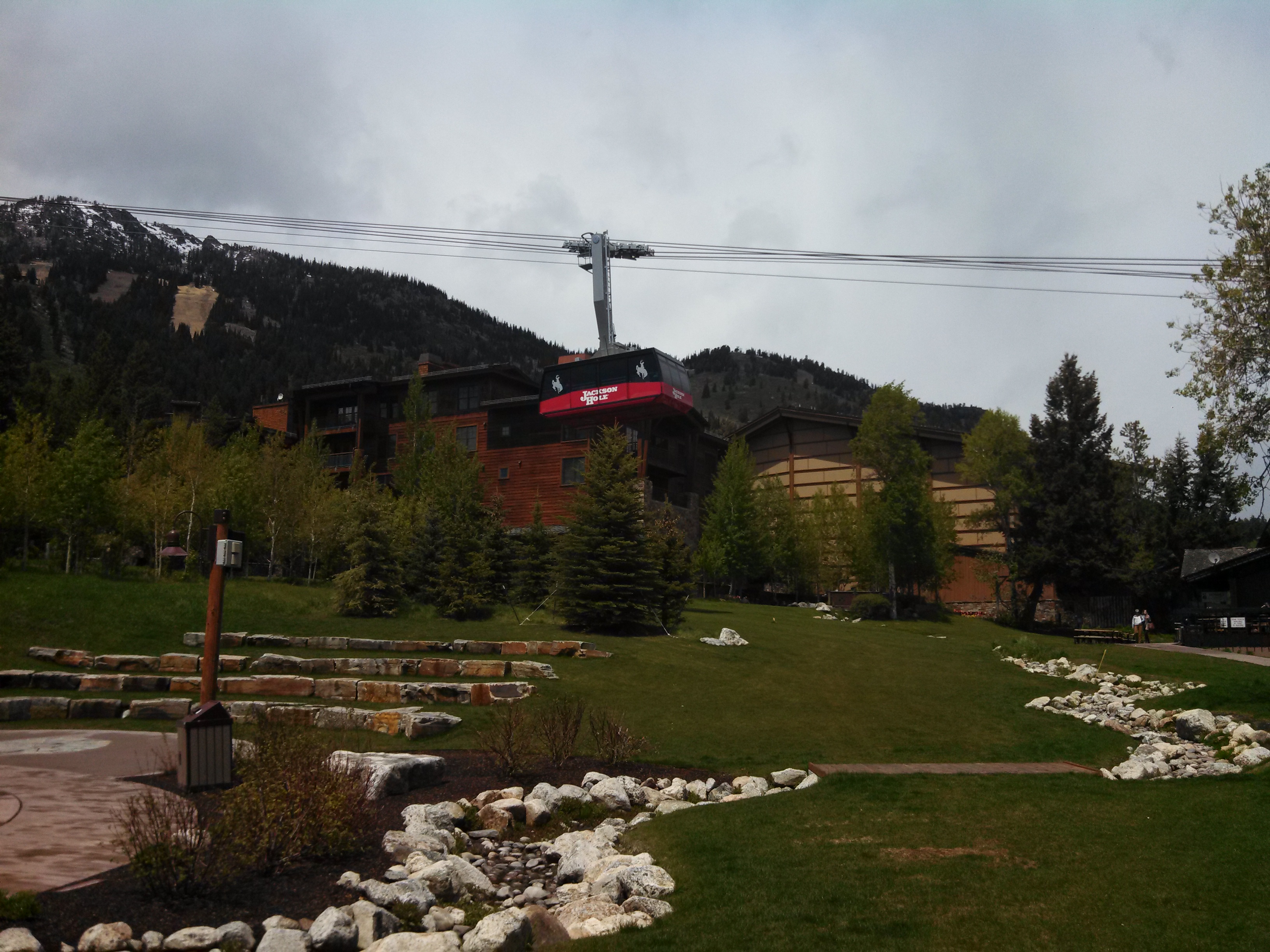
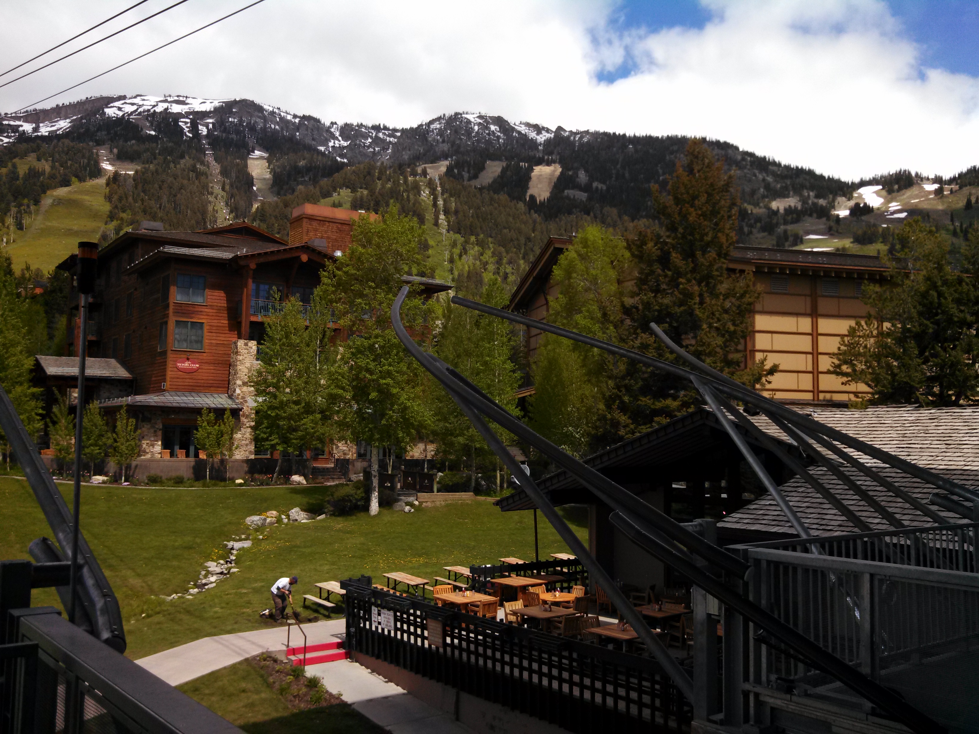
Here are a couple of pics of where we were staying – a very nice two bedroom condo.

The rest of the day we spent unpacking and finding some lunch and then dinner. We did do a little shopping that afternoon and found a cool place called Wool & Whiskey. If you have a chance to stop in for a drink, you should. I bought a few items and had a few Pendleton whiskeys literally on the rocks. They don’t offer ice cubes there, but do have frozen rock cubes to put in your drink to help chill it.
After the harrowing experiences we had encountered and endured, we were very much ready for some R&R. We made it back to our rooms and promptly crashed. A good day in that we survived and would be ready for the next part of our trip over the next few days.
Here’s the map for this day:
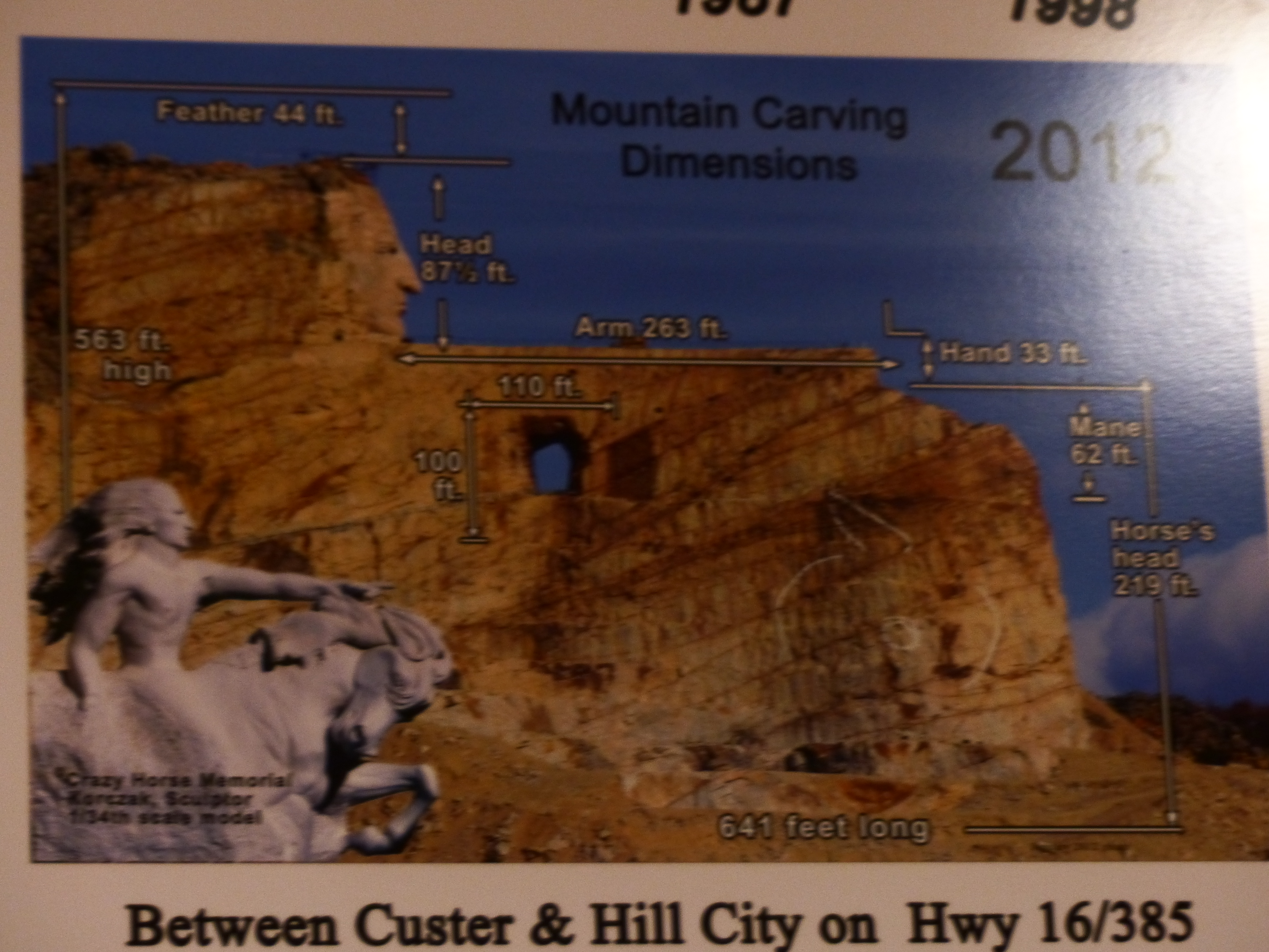
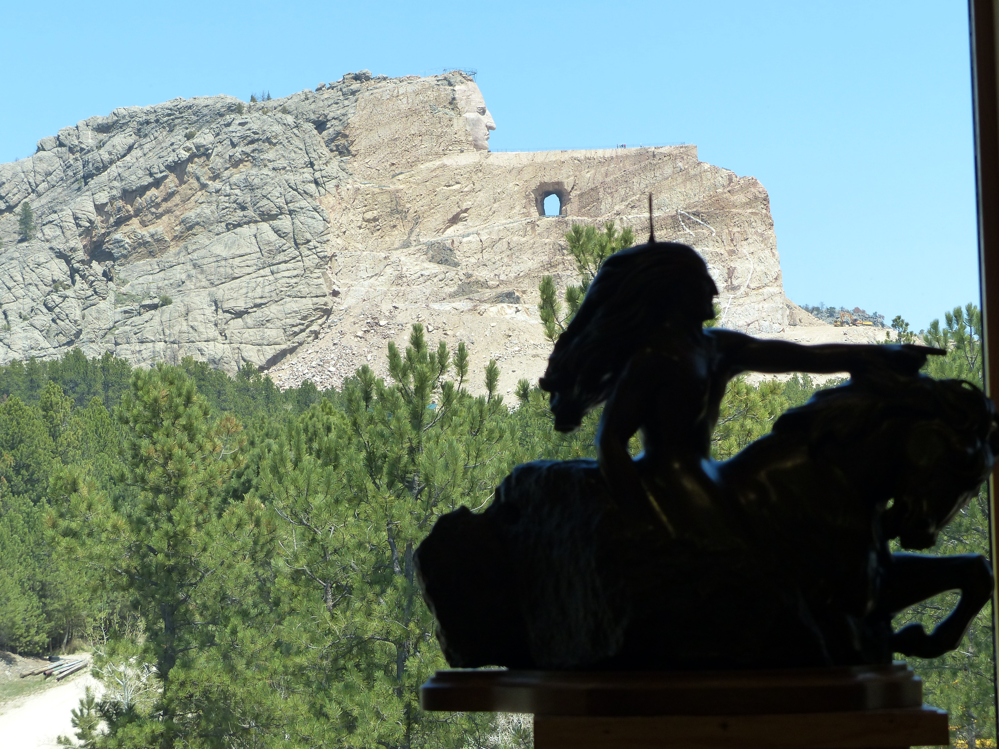
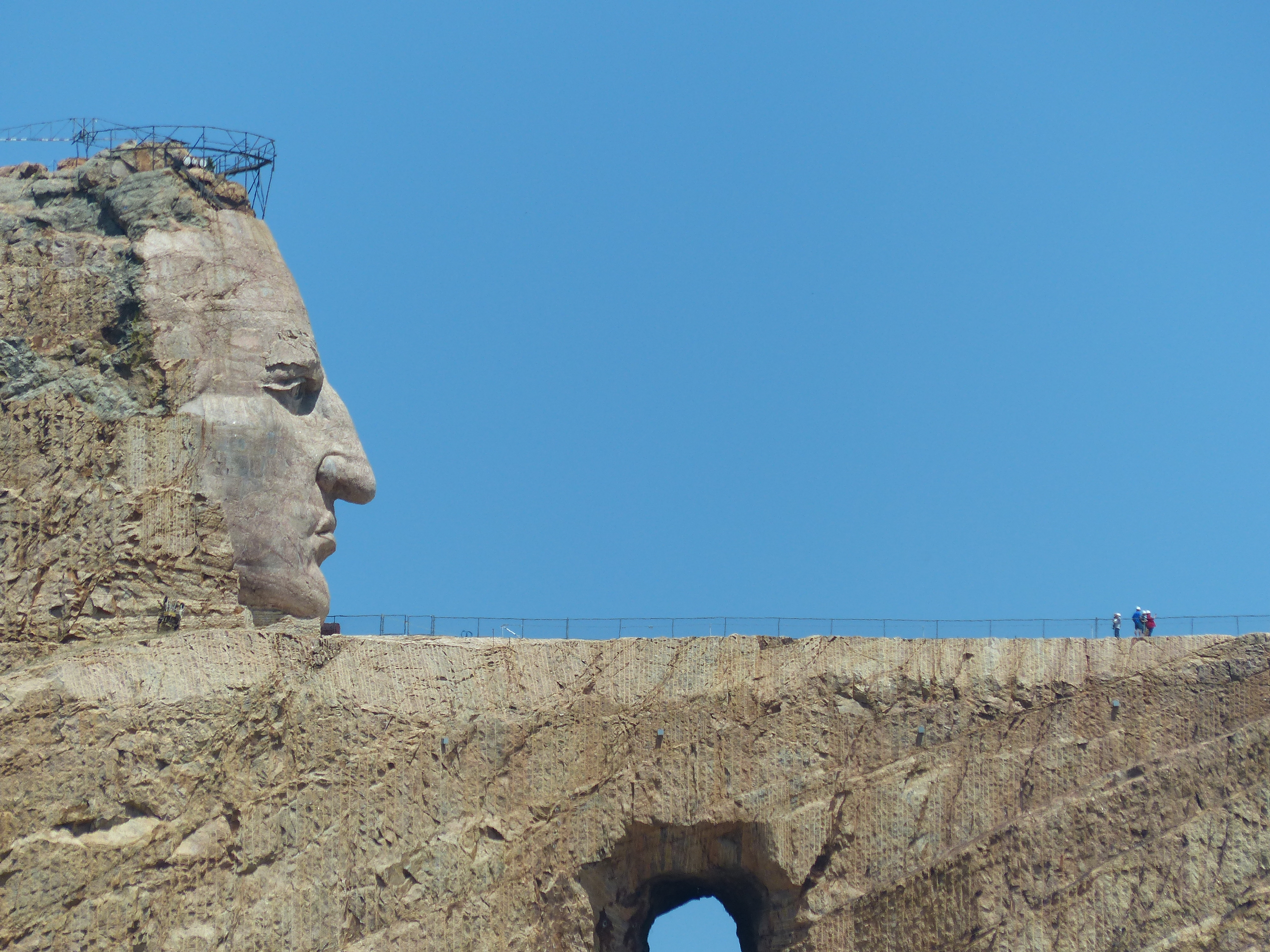
Time to leave the Lead / Deadwood area. We thoroughly enjoyed this part of South Dakota and can’t wait to return in years to come. The Badlands, Mt. Rushmore, Crazy Horse, Custer State Park, Deadwood – too much to do in too short of a time. We only spent 2 and a half days here and that didn’t do it justice. We could probably stay a week and still not see it all. But, we are on day six of a twelve day trip and more excitement is calling us on to the next adventure.
Here is our plan for Day 6 – get up early, drive to Devil’s Tower, stop in Sheridan, WY for lunch, through the Bighorn forest and then on to Cody for the night. It didn’t quite happen that way.
We did get up early and left the cabin dressed for chilly, wet weather which mother nature was more than happy to provide. We headed up highway US-14 Scenic from Lead up to Spearfish. This is a very nice road through a canyon with the hills rising on both sides. The road was wet from various light rain showers that would move through from time-to-time. The speed limit was a paltry 35mph and we cruised through there doing anywhere from 45-60 depending on pavement conditions and visibility. Not much traffic on a Wednesday morning.
We made it up to the interstate and began our trek on towards Devil’s Tower. As we got on the highway, I detected a faint hint of cigar smoke. Sure enough about a mile down the road, we caught up with a guy in a small car chomping on a big cigar. Strange sight, but we kept on going. Weather was cooperating – cool and cloudy, but no rain. Perfect conditions to sit back and cruise on the bike.
Our first stop that morning was a small town called Sundance, WY. You’ve heard of “Butch Cassidy and the Sundance Kid“? Yep, this is the town that the “Kid” was named after. The movie is about two bank robbers that end up in Bolivia and stars Robert Redford and Paul Newman. Redford plays the “Kid”. Another bit of irony here is that Sundance sits in Crook county. Sundance itself is named after the “Sun Dance” of the North American Indians.
We bought gas and made our way to downtown where we hoped to find a cafe for breakfast. After a bit of looking around and asking, we found the small cafe. Of the 12 tables available, 10 were open so we had an easy time finding a seat. At one of the tables was a group of men who you could tell worked outside most of their life. Nothing wrong with that by the way. I was amused at one of the t-shirts the guy had on. On the front, it had that outline of the woman you see on 18-wheeler tire flaps with wording around it of “Support your local hooker”. On the back was an advertisement for a towing firm out of Sundance WY. Grinning, we ate, paid and left.
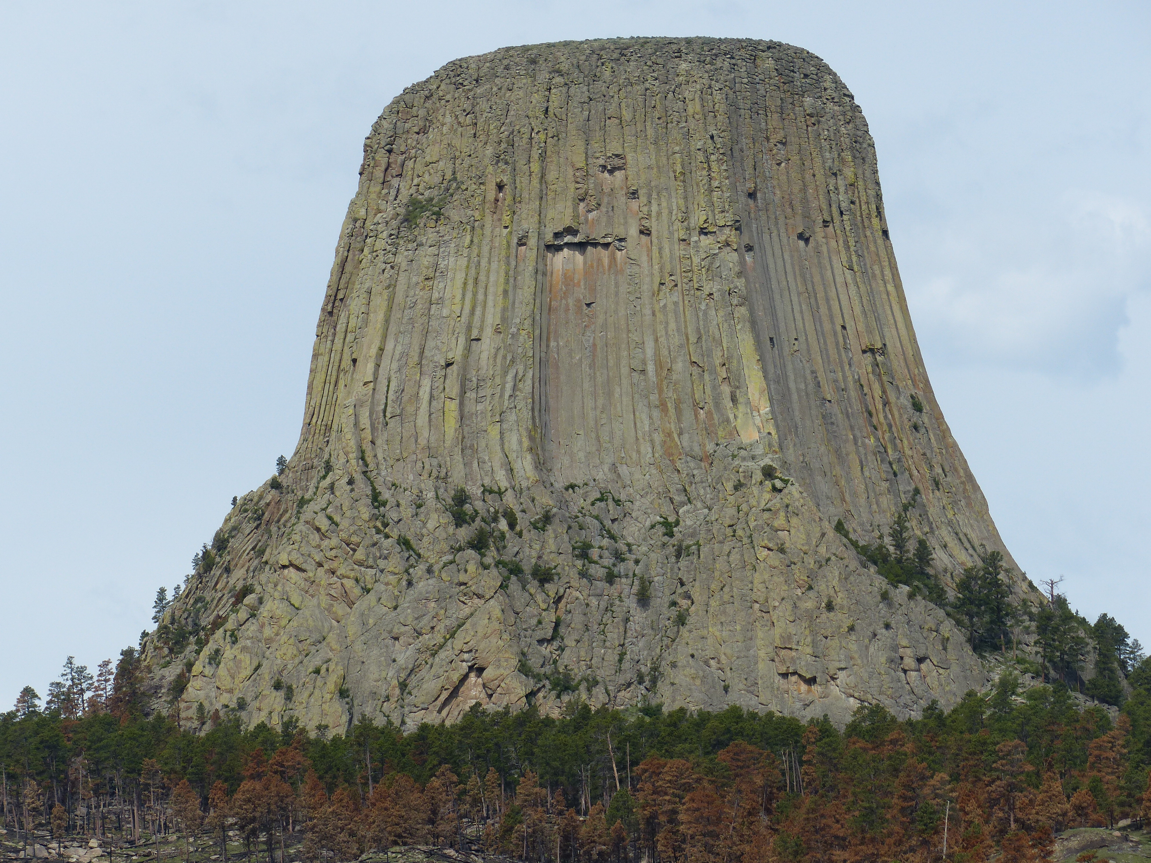
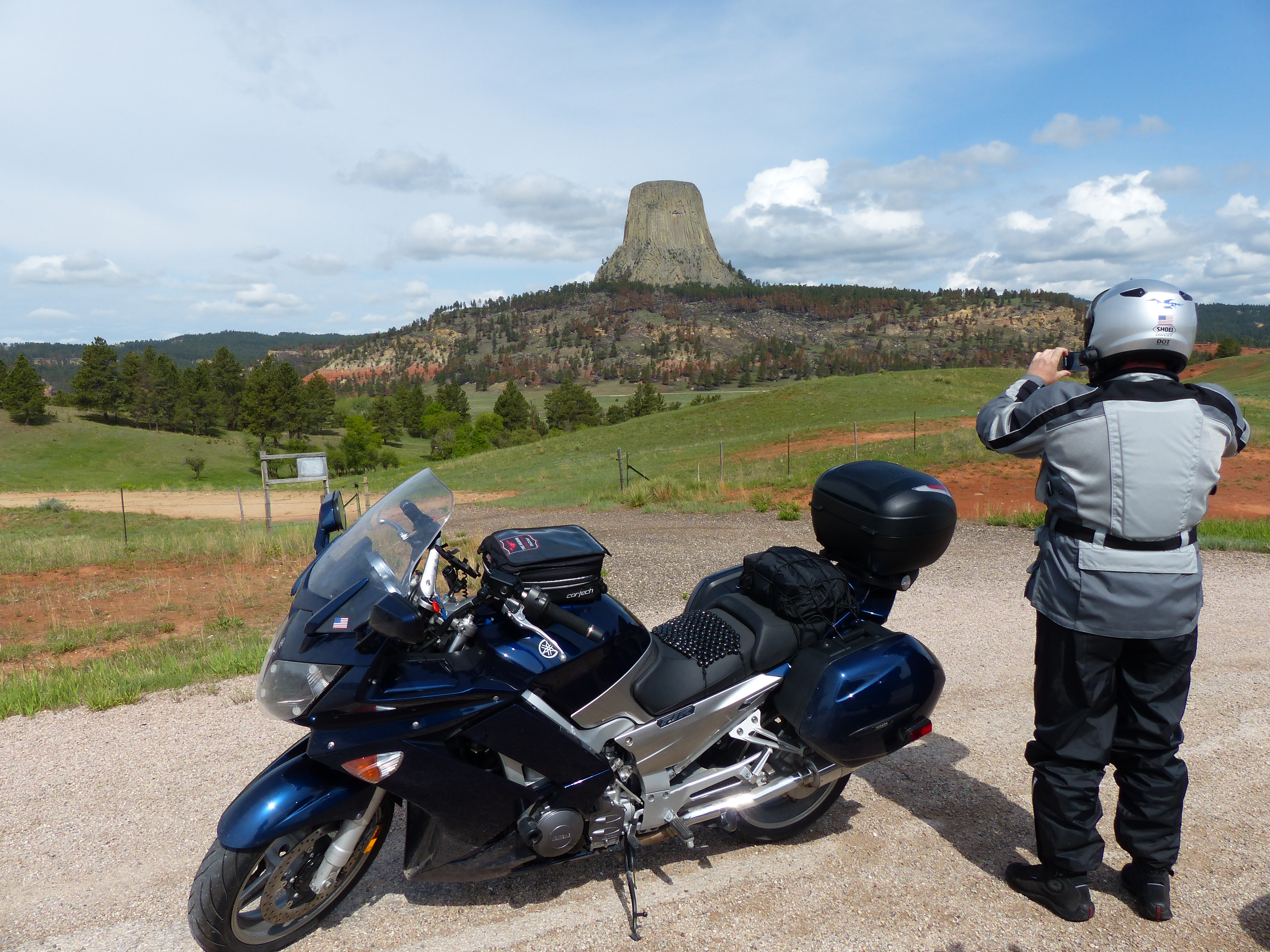
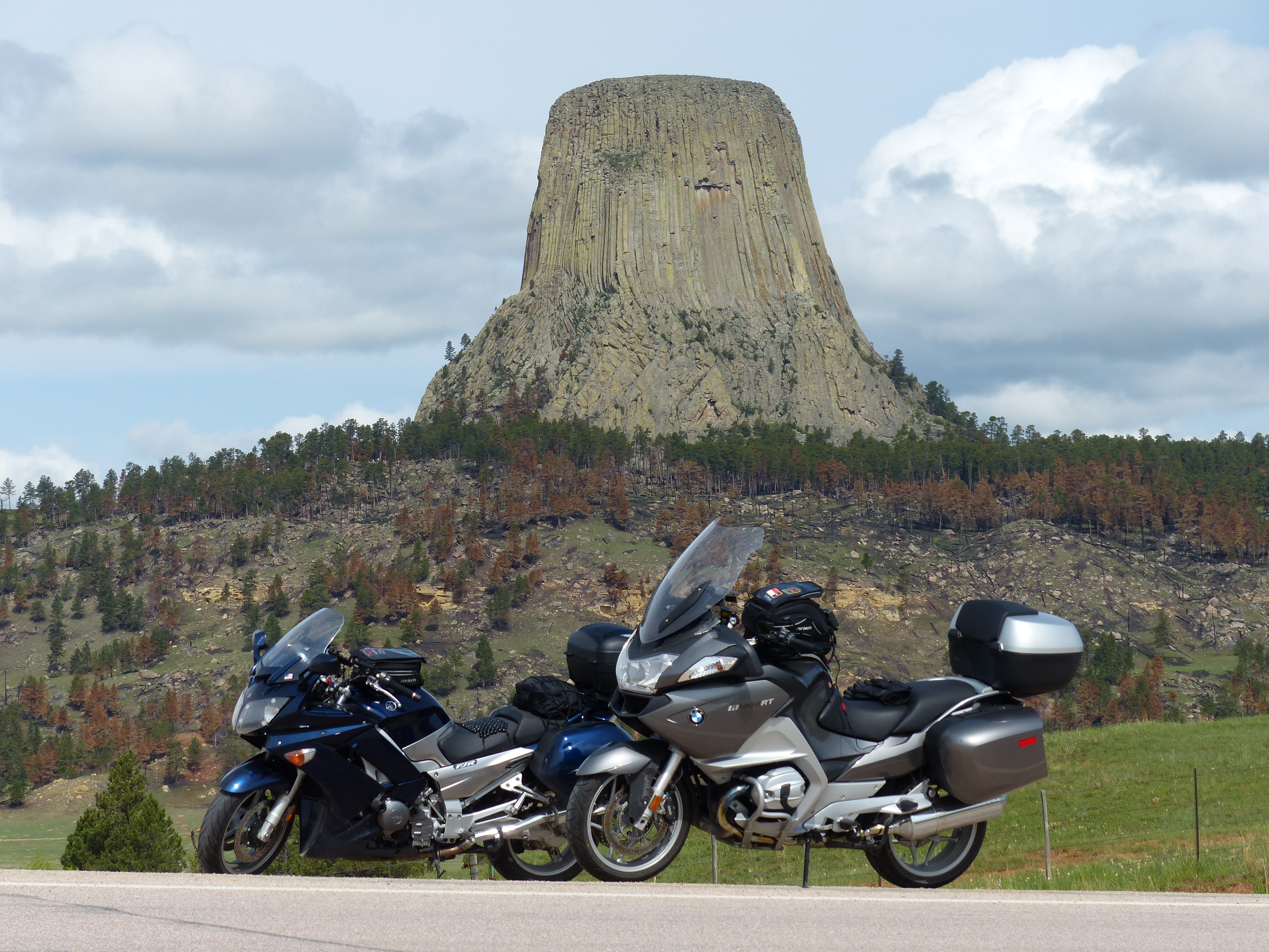
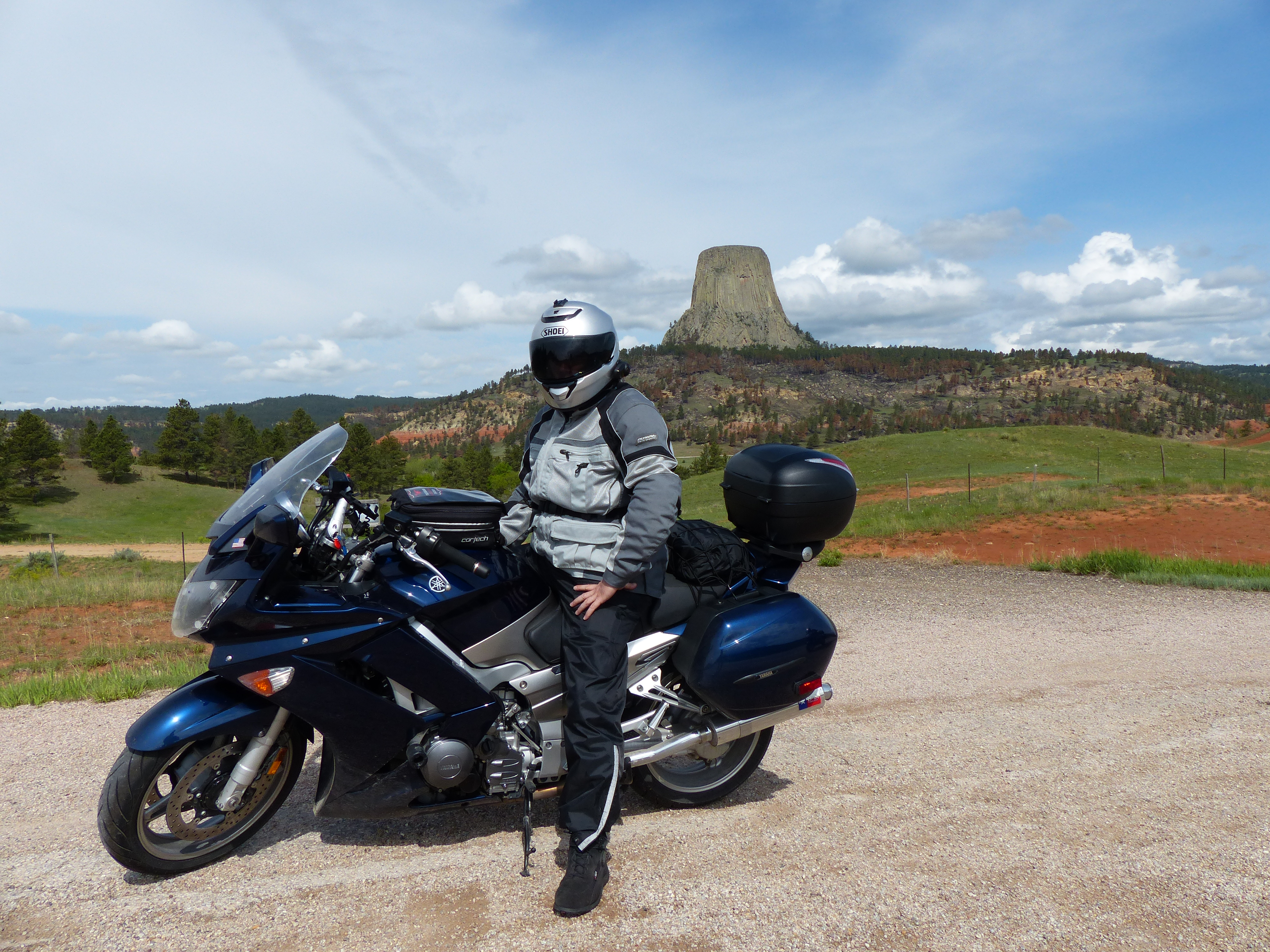
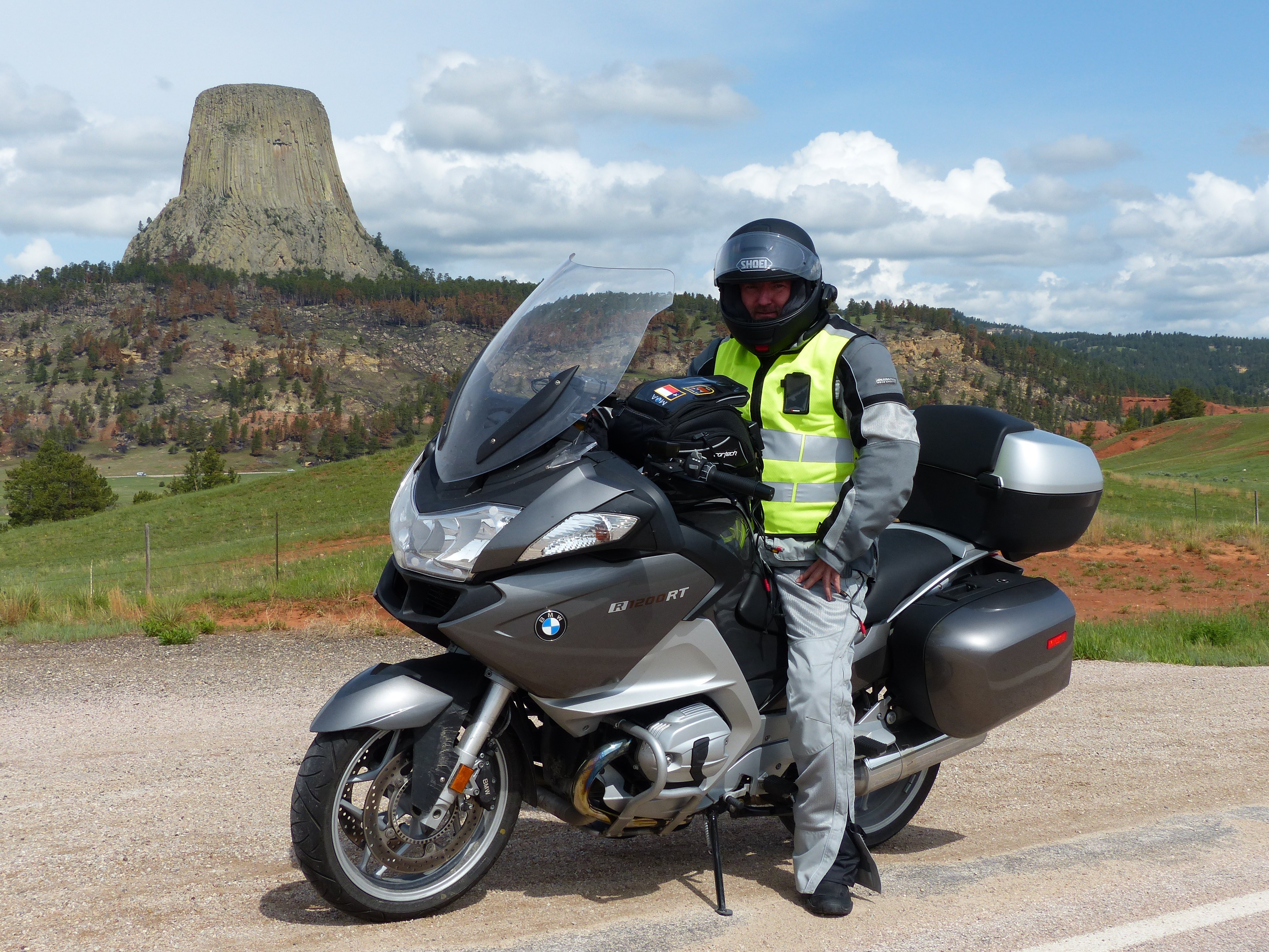
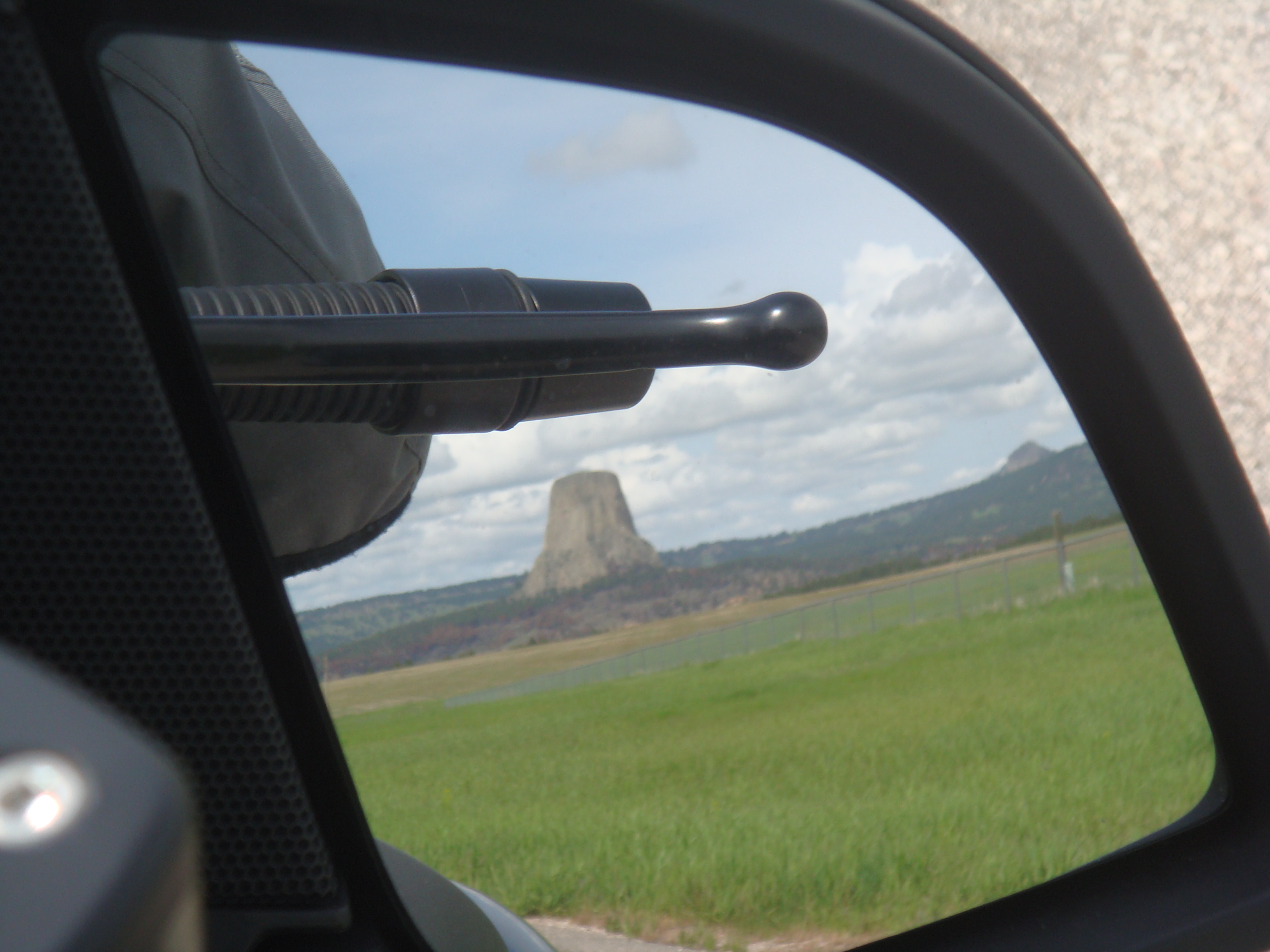
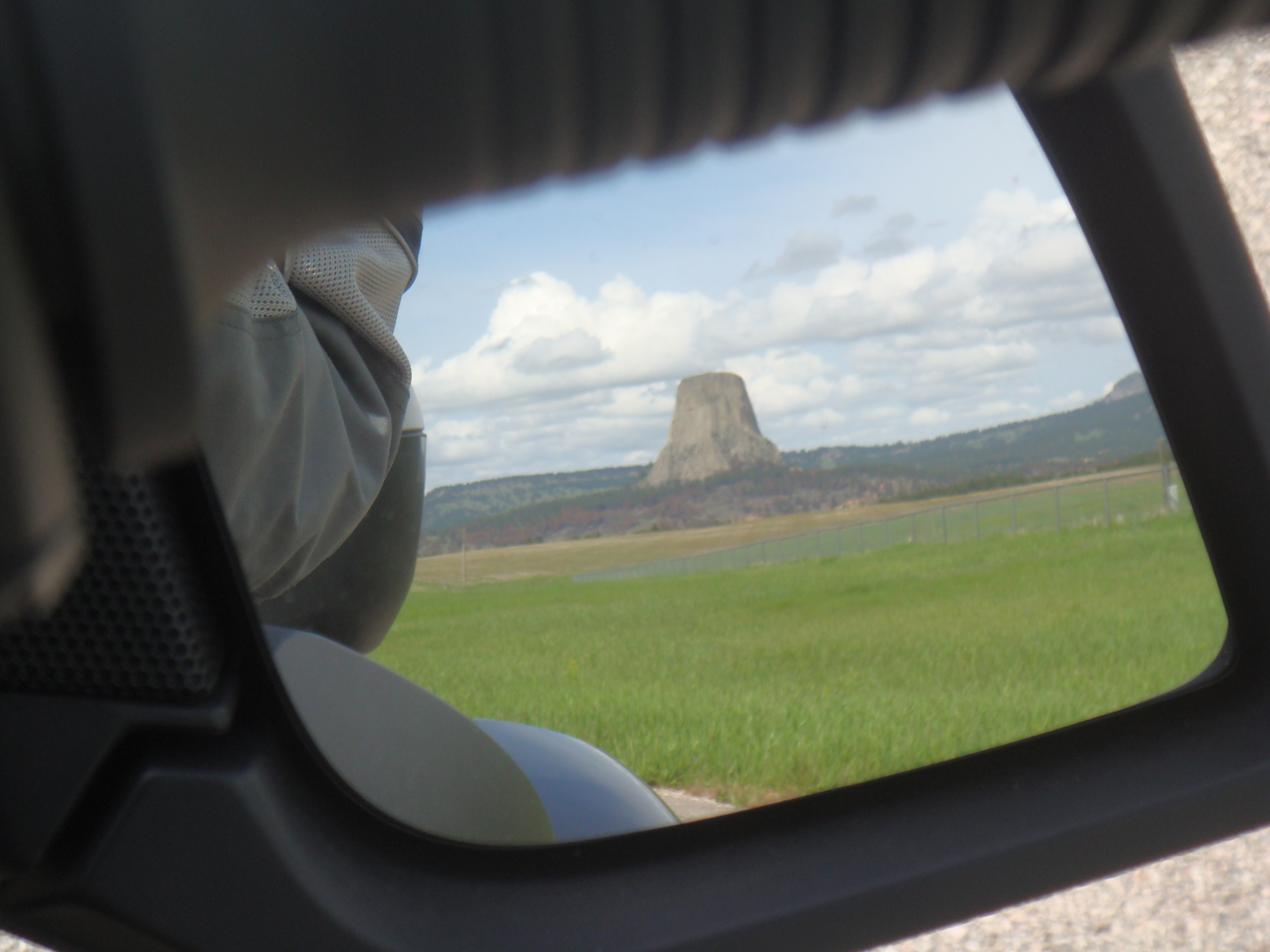
Just outside of town is the turn off to head up to Devil’s Tower. The Lakota Indians call it “Bear Lodge” or “Brown Buffalo Horn”. Interesting reading on Wikipedia about it. We cruised on up and pretty soon were greeted with this:
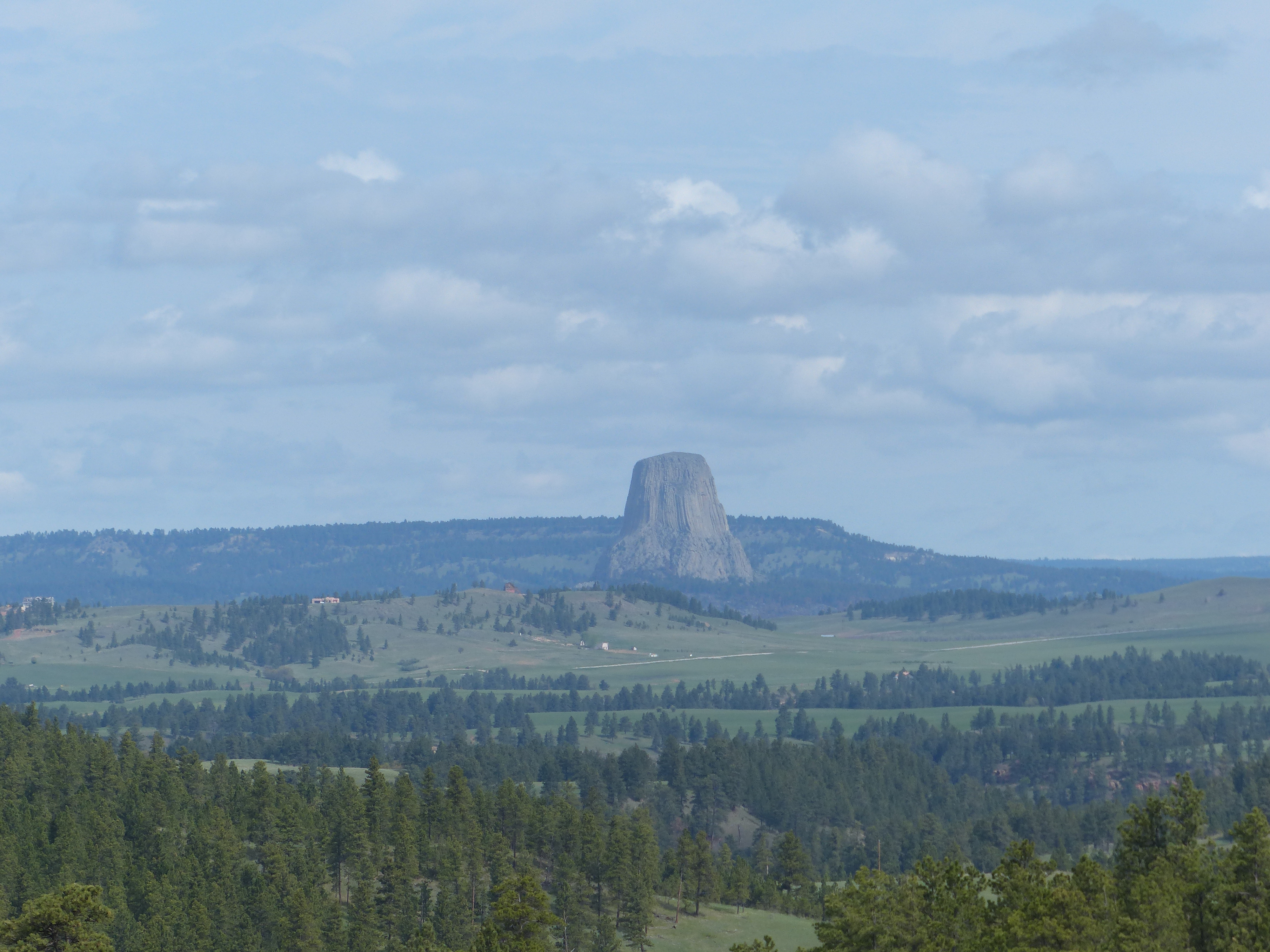
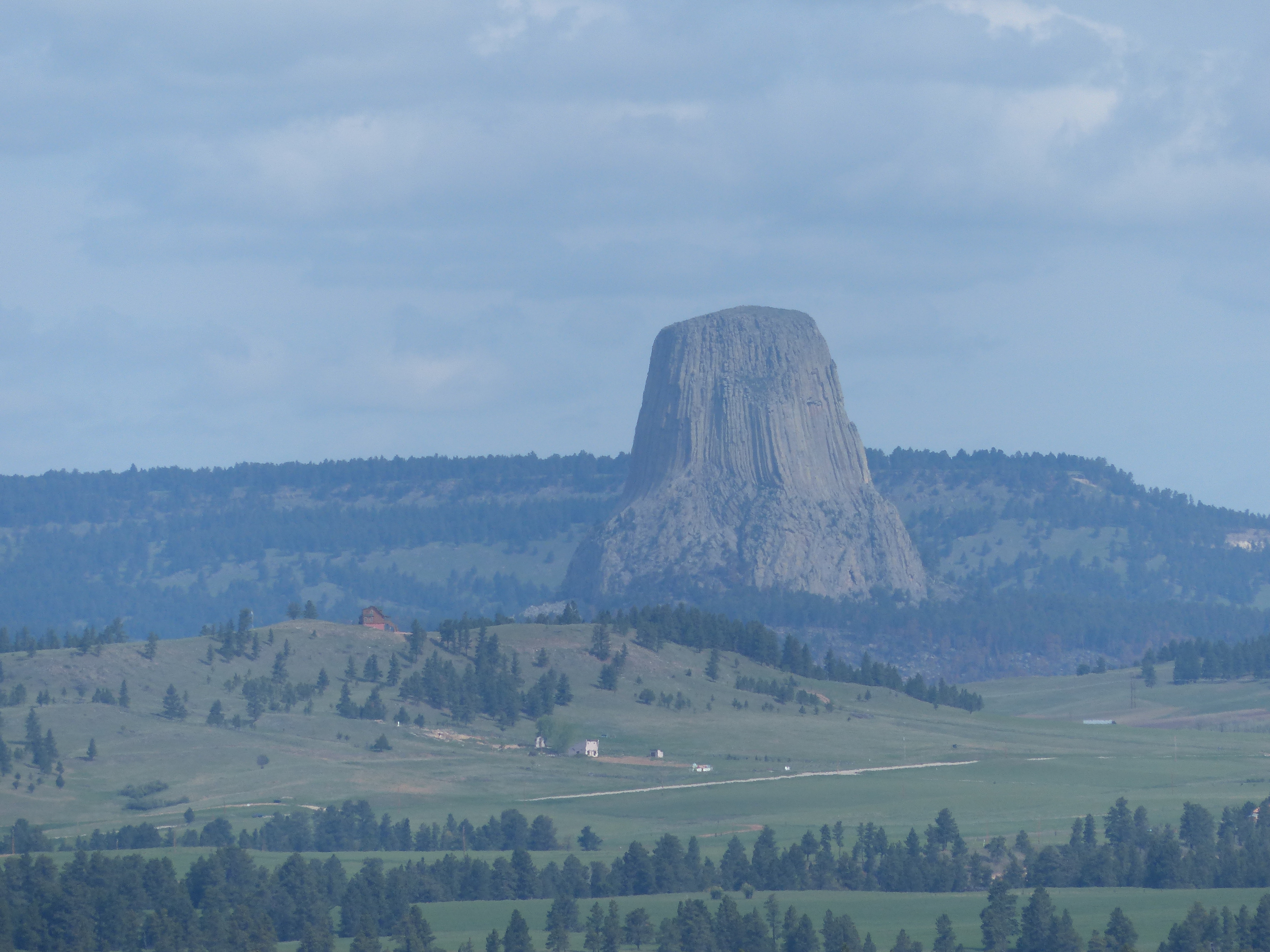 As you can see, Devil’s Tower just sort of sits in the middle of nowhere Wyoming. It is most famous as the tower where the aliens arrived in “Close Encounters of the Third Kind“. In the movie, Richard Dreyfus makes a replica of the tower first out of mashed potatoes and then dirt and mud in his living room. The movie is a classic and I highly encourage you to see it if you haven’t. Of course, we kept making jokes about dead sheep, alien probes, helicopters with knock-out gas and hoping we would get to see at least a UFO or something. Alas, it didn’t happen so we took a few more photos and headed out.

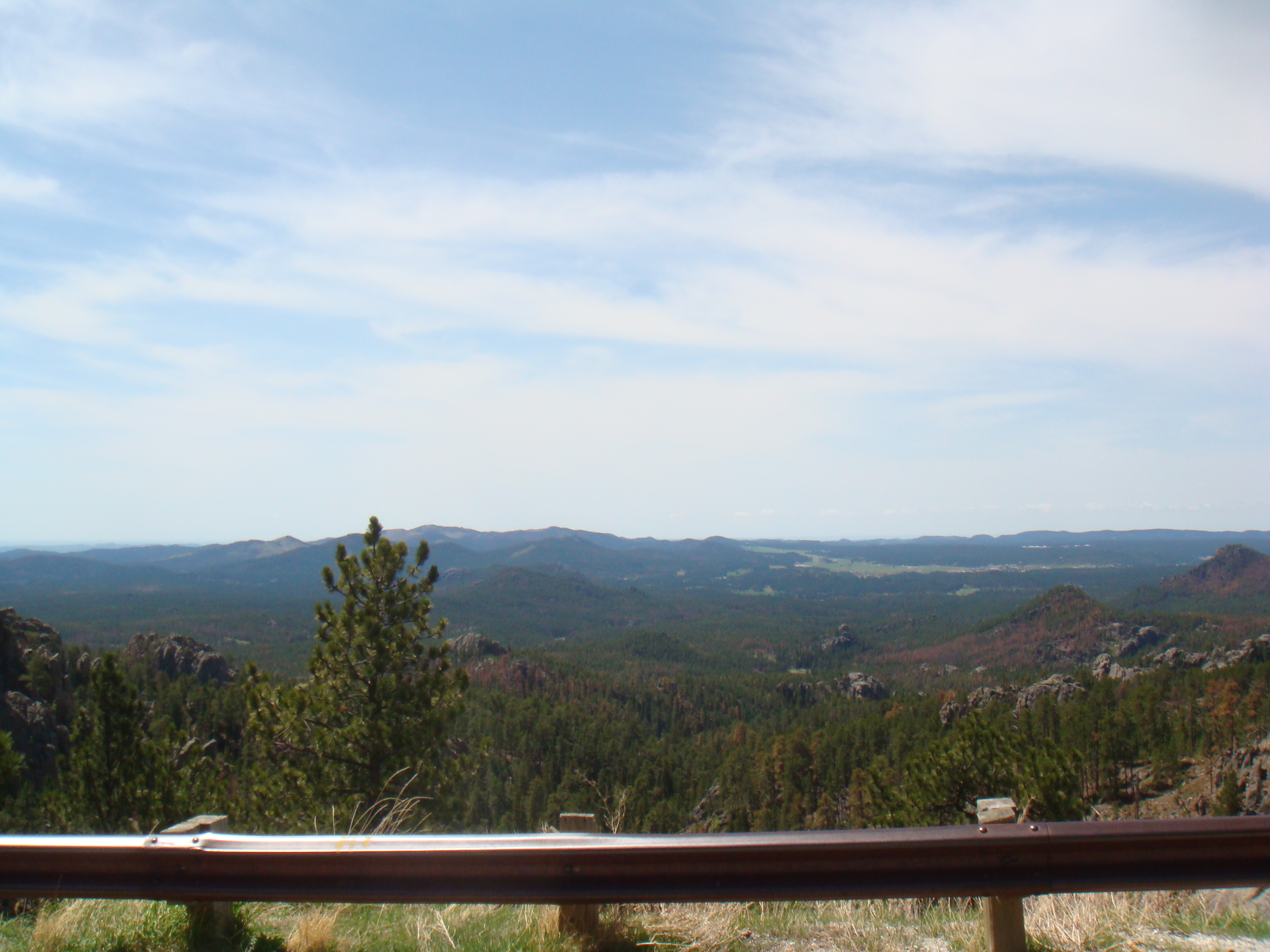
 The next section was fairly easy as we headed across Wyoming on to Sheridan. We passed what appeared to be an open coal mine as we maybe a thousand railroad cars being processed and loaded with coal to ship south. We imagined this was some of the same coal that we saw in Texas from Day 1. As we got closer to Sheridan, the weather started getting worse. Rain and falling temperature. We found a place for lunch with wi-fi and pulled in to rest a bit. The next section would take us up through the Bighorn forest and we wanted to be ready for that.
As we ate our lunch, the rain continued to come down. We watched our bikes get pretty soaked in the parking lot. I had pulled out my iPad and was monitoring the radar. It didn’t look good. The Bighorn forest was getting lots of rain and what appeared to be snow at the higher elevations. Ugh, this was not going to be pretty. Motorcycles are not good in snow. Four wheels can be slippery, but at least the vehicle doesn’t fall down. On two wheels, you are pretty much guaranteed to be fall over if you get into any surface that’s extremely slippery.
Our options were to either go north up through Montana and try to come in to Cody through that route or to go south, skip Cody and come up from Casper to Jackson Hole. We debated the pros and cons of these for about an hour hoping the snow would ease up in the forest and make our decision a bit easier. It didn’t. My wife had been through there earlier in the car she had rented. I sent her a text and let her know we had decided to avoid the forest. Her comment back was “good choice”.
Ultimately, the decision was to head to Casper. My buddy had a friend that lived down there. With the decision made and the rain subsiding a bit, we headed back south. This part of the trip wasn’t too bad – lots of nothing but rainy grasslands and distant mountains until we got close to Casper. The wind really started picking up the closer we got to the town. We could see a windmill farm off to our left – that’s always a bad sign because it means the wind blows fairly constantly. Like Day 2, we were really fighting the wind. Lots of scary moments and leaning the bike way over just to go straight.
Finally made it to our hotel, showered and had dinner with my buddy’s friend and her son. This was a very long day. I got everything plugged in for overnight charging and promptly went to bed and fell asleep. Day 6 complete and day 7 was looking interesting as well given the forecast for more rain and possible snow as we made our way up to Jackson Hole.
Not too many pictures today as the cameras were pretty well put away and covered given all of the rain we were encountering. Here’s a Google map that shows our path for this day:
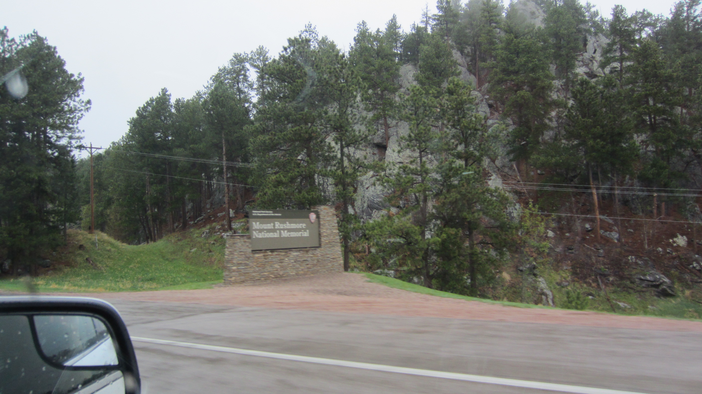
After the gloomy morning of day 4, day 5 started with bright sunshine. Weather that makes you want to ride. We decided to head down to Custer State Park down near Custer, SD. We basically took the same roads to get down there as we did to go see Mt Rushmore. While it was a little chilly, we had the appropriate gear and the weather was no problem.
After the first hour, we finally got to the road we wanted to take to get us into the first part of the park. Guess what? Construction! This was no ordinary construction either. They basically had one lane open and we had to wait until the “pilot car” could bring the traffic from the other direction our way and then slowly follow it back. The slowly following it back was the hard part. It was very slow, 2-3 mph. That’s hard to do on a bike. Especially with ruts in the road that want to grab your front tire and hang on to it causing balance problems.
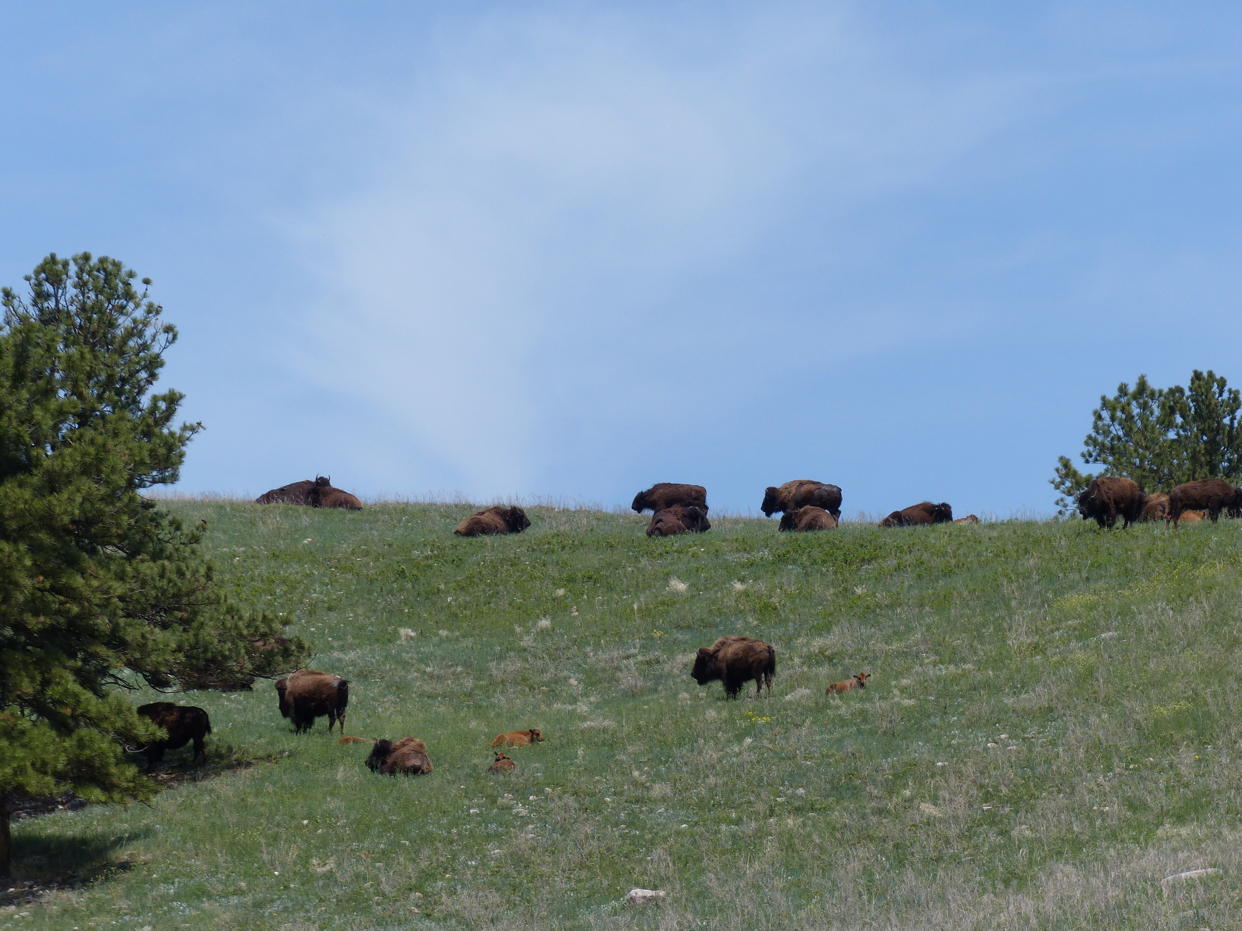
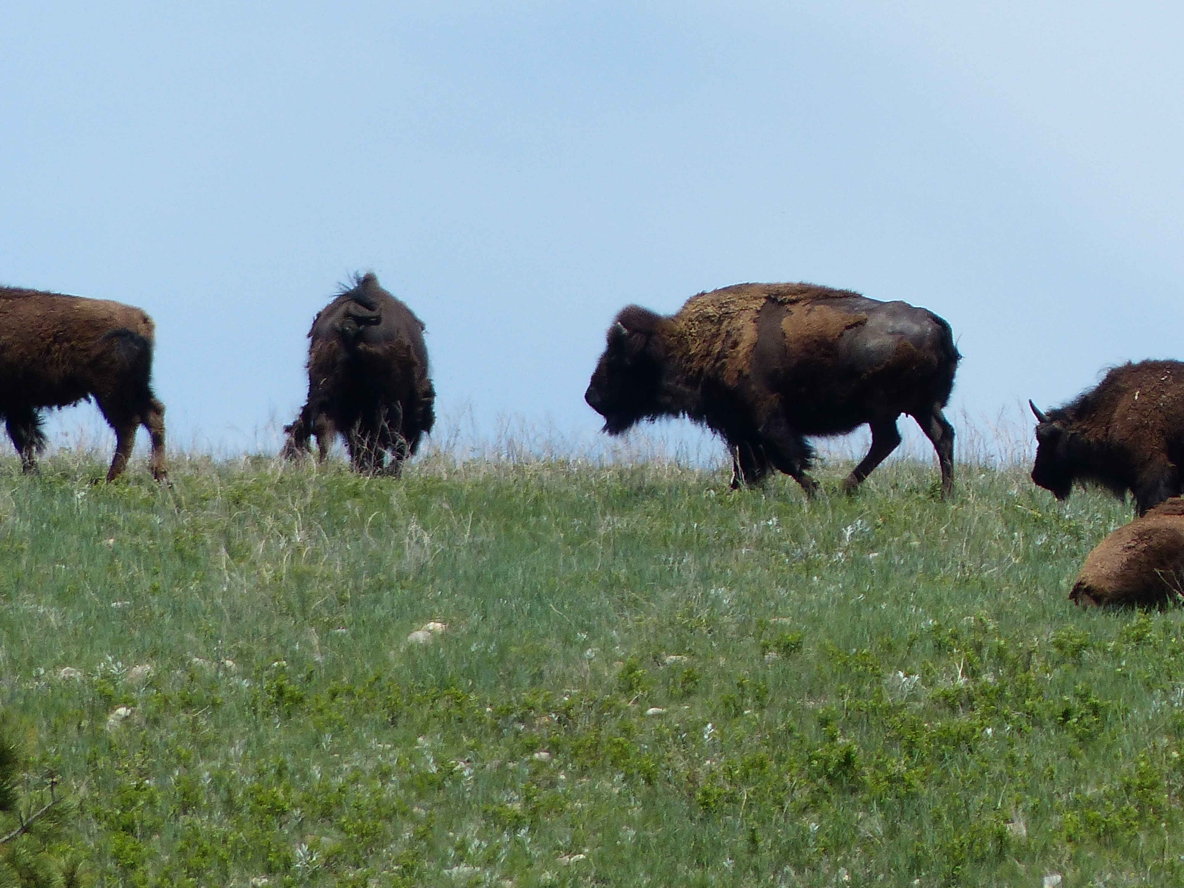
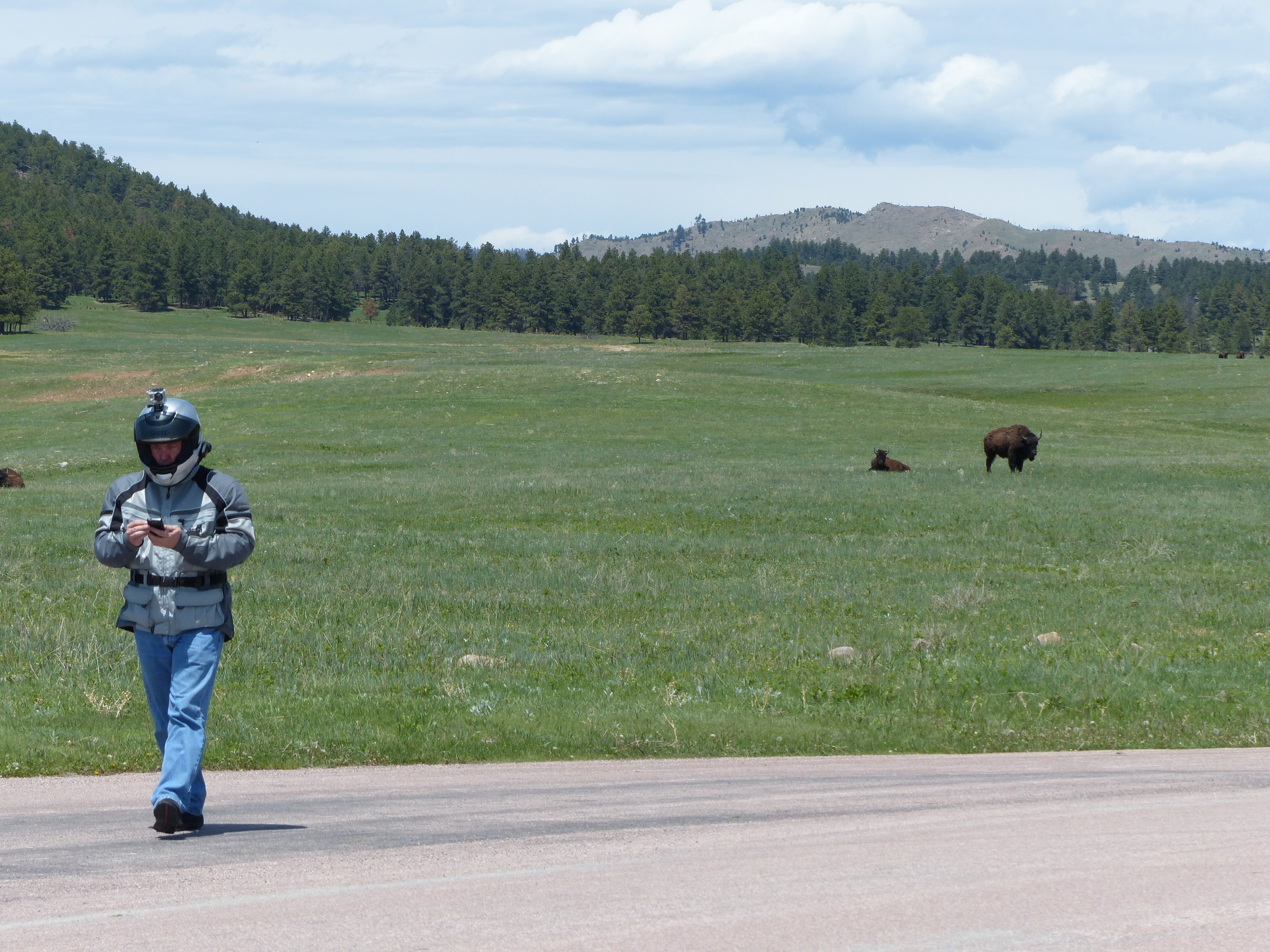
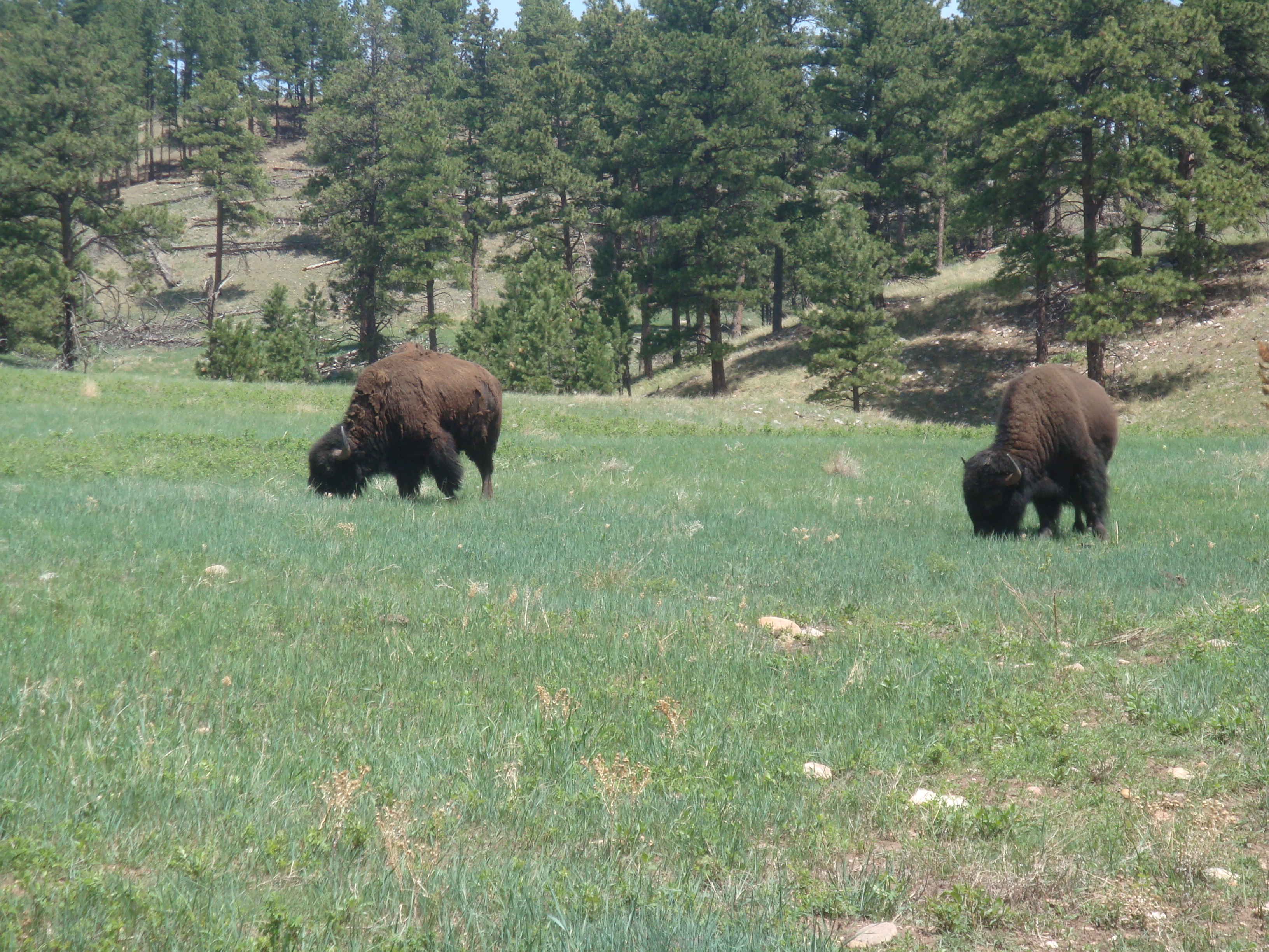
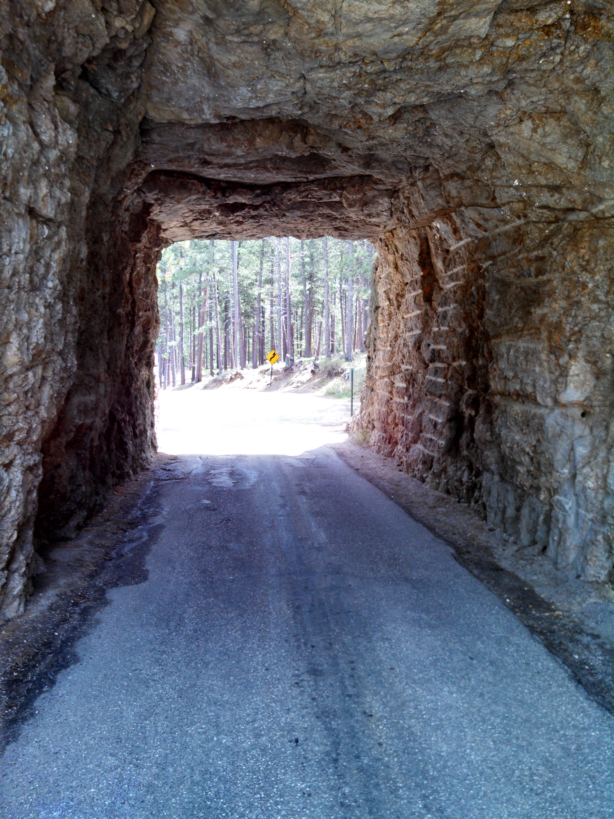
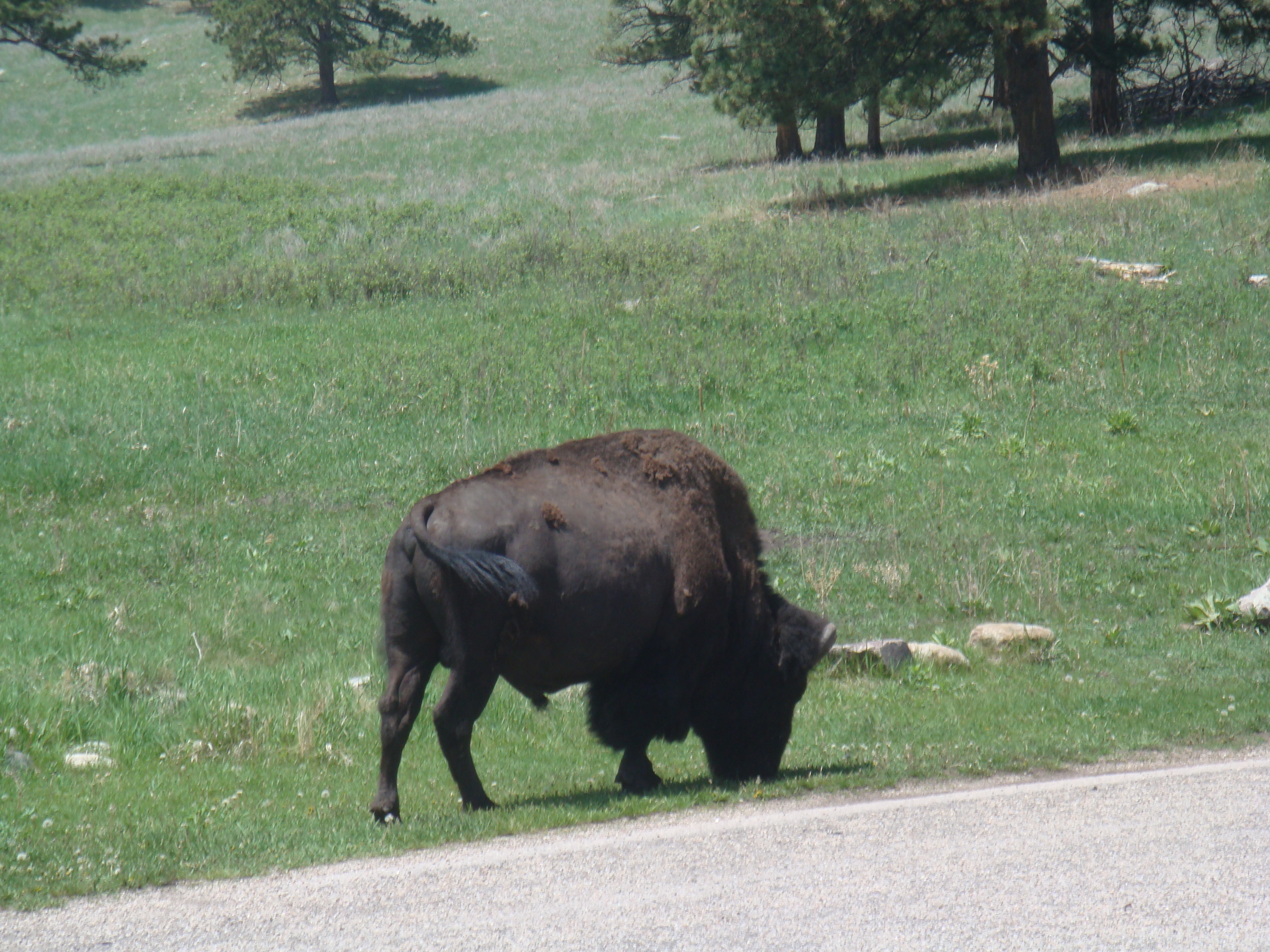
We finally made it through, some very beautiful country down that way. The road we took south from Custer is SD 87. That got us to the entrance of the park where we made our first stop to take care of some business, get a drink and begin the journey. This day was incredibly awesome. We saw much of the wildlife that the park has to offer and probably the best way to demonstrate that is with this video. I titled the video “Through the Tunnels” and it includes all of the highlights from the day. Why that title? We went through a number of short tunnels that the road engineers cut through the rock for the road. Watch for the one near the end that comes out the side of the rock onto a bridge and then corkscrews around back underneath. Very cool. The video is a bit long at 30 minutes, but there was so much I had a hard time editing it down. Pics and story continue below the video.
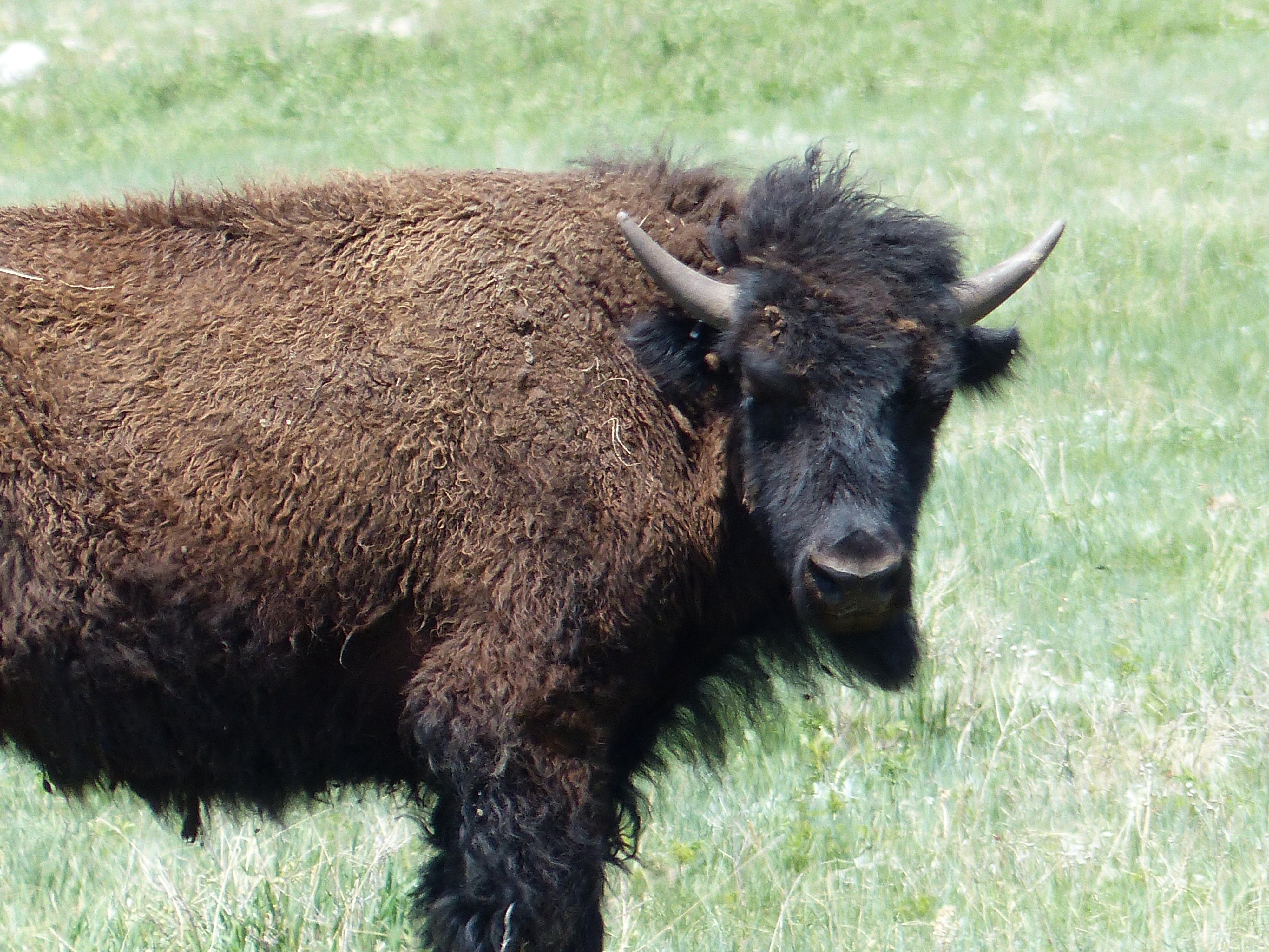
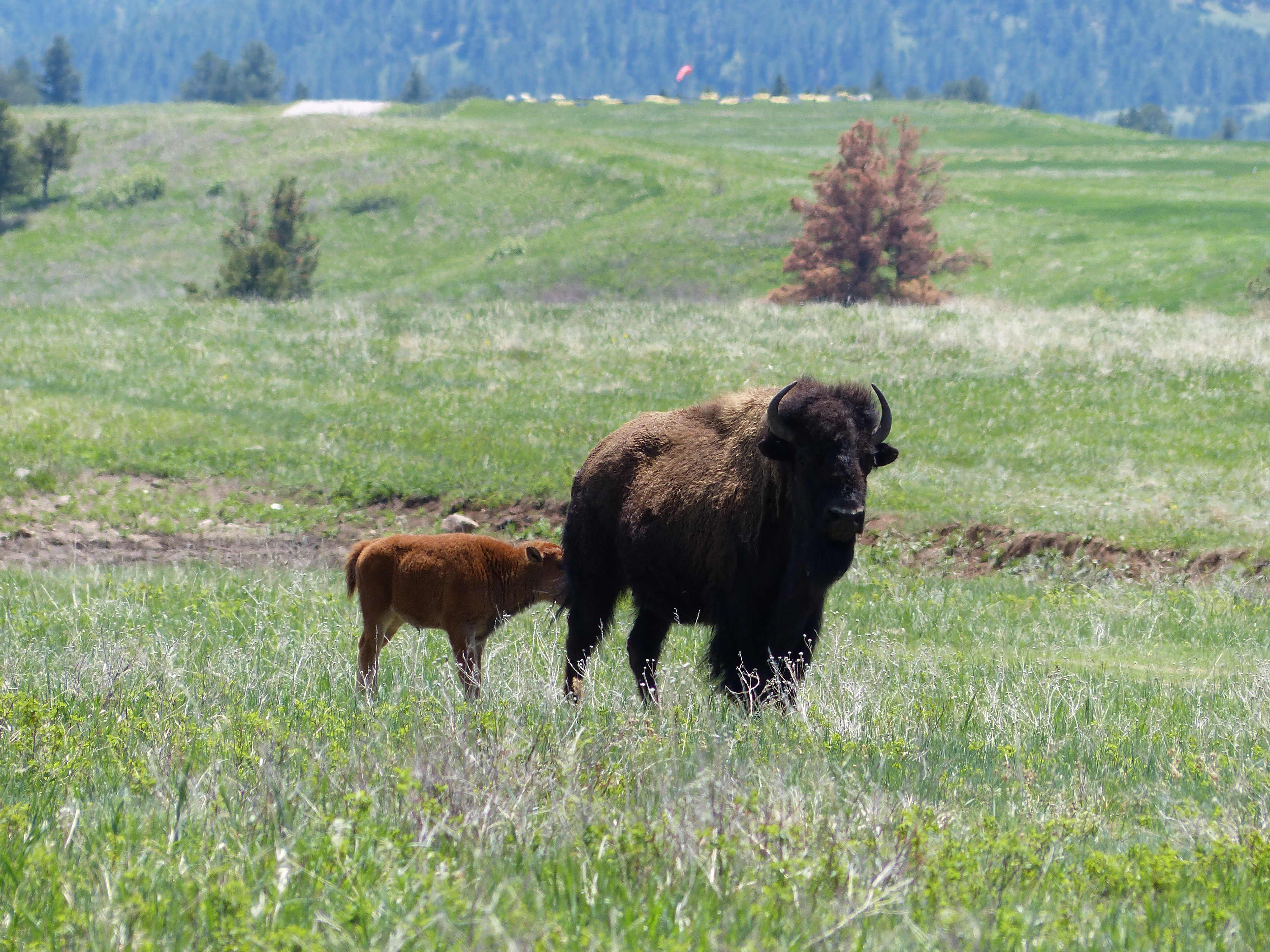


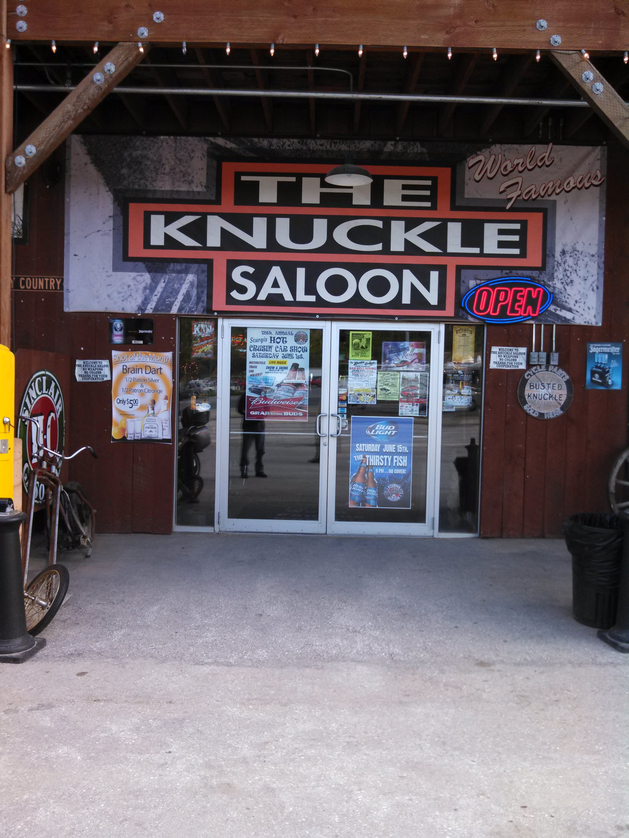
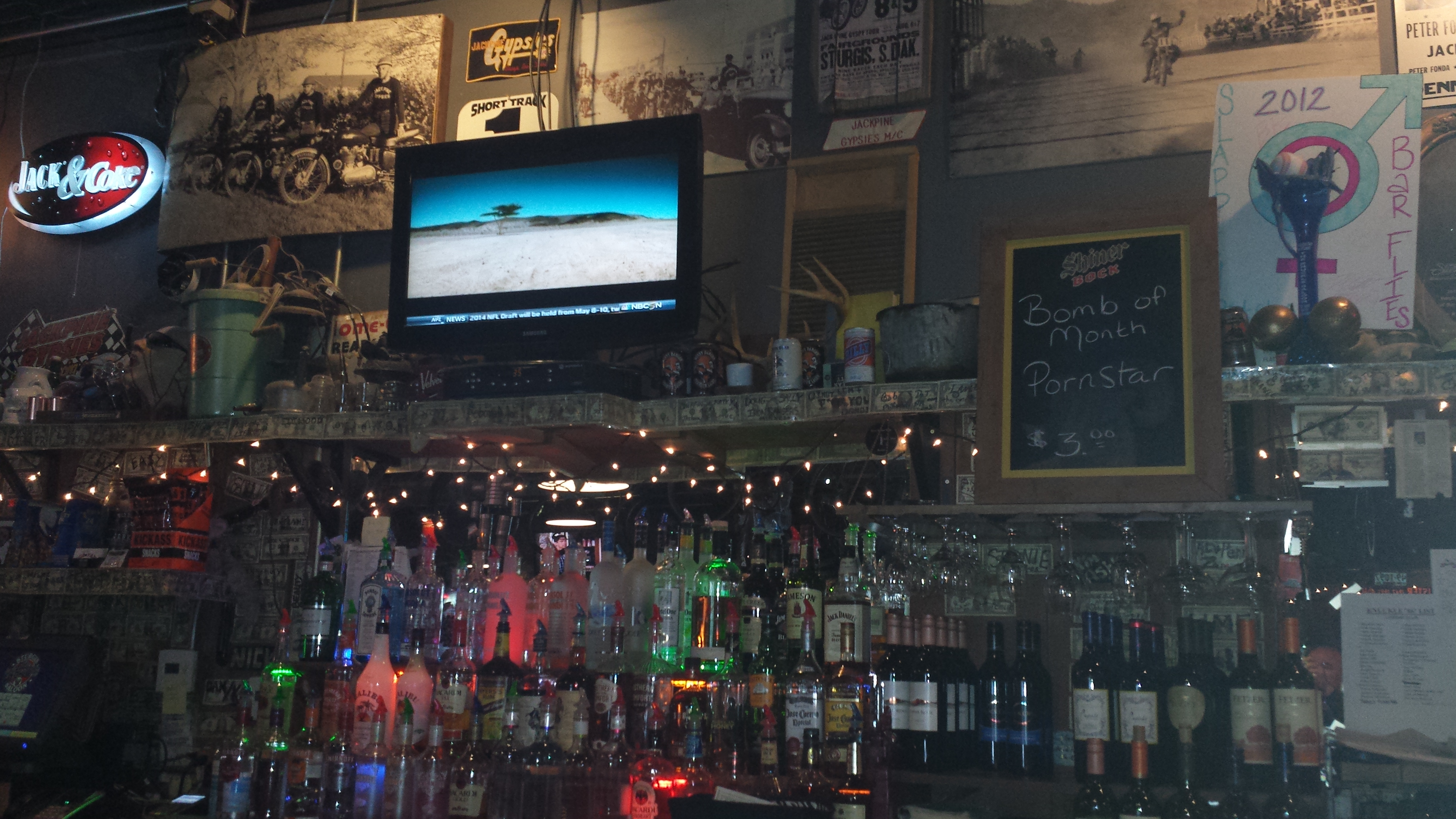
After the buffalo, the park and all of the tunnels, we made our way back to Keystone, SD for lunch. Buffalo soup and a buffalo burger of course. We then angled over towards Rapid City and then on up to Sturgis. Stopped in “The Knuckle Saloon” to have a beer.


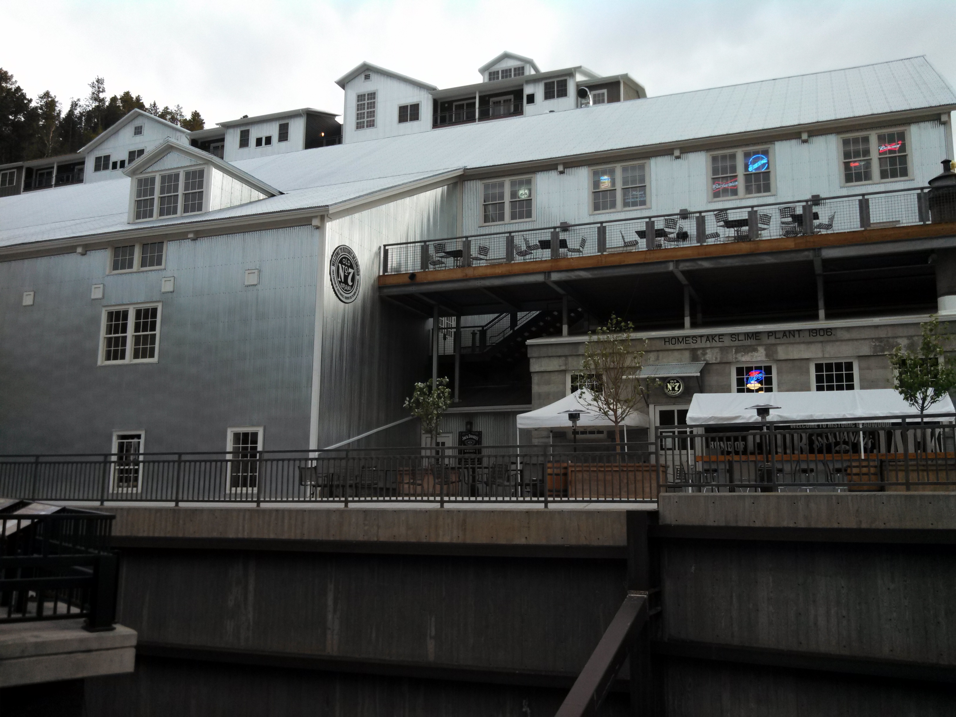
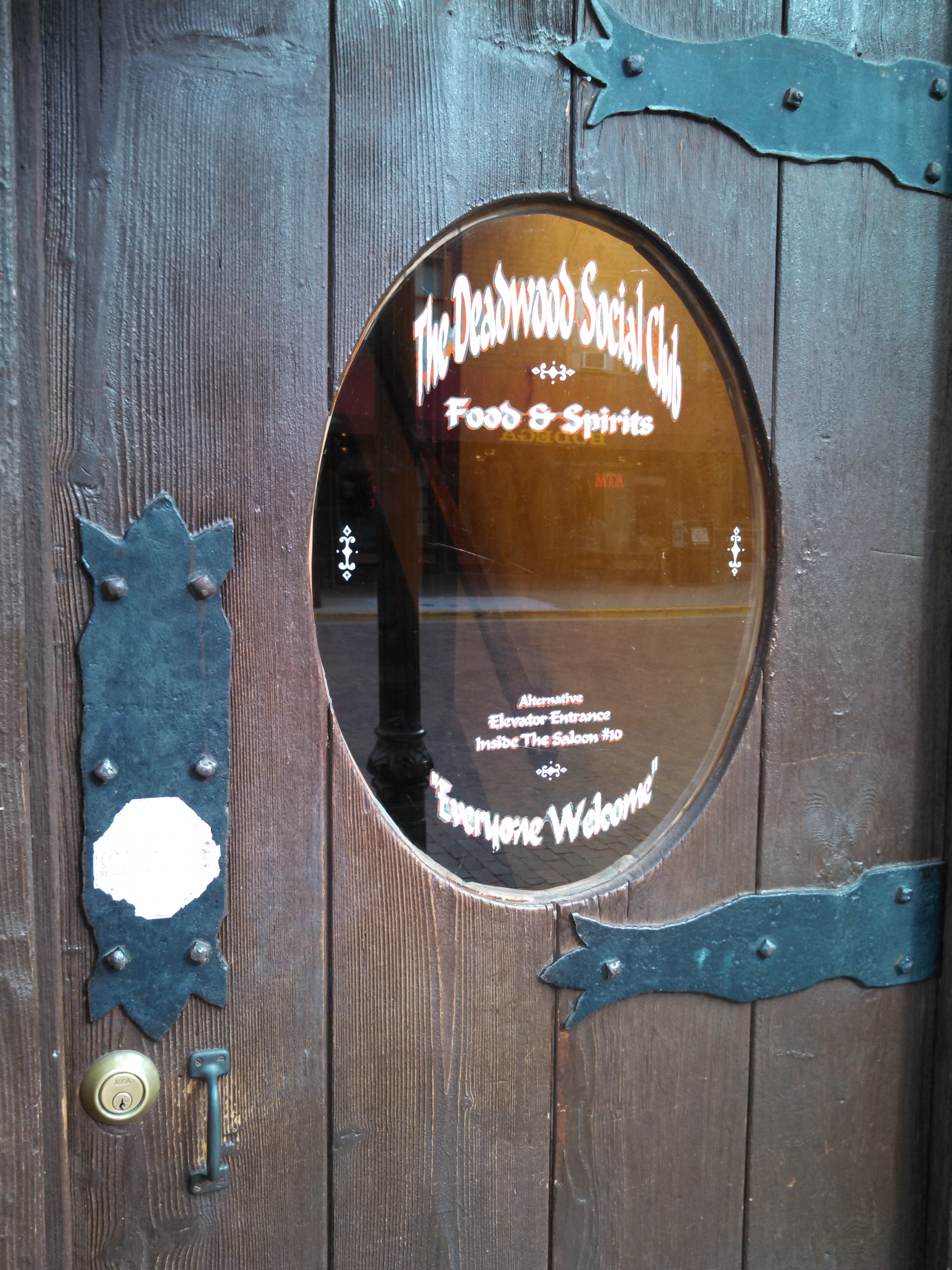
After Sturgis, our next stop was Deadwood for Dinner. We had a great meal, but considering what I had for lunch, I wasn’t that hungry. I ended up just having a seared tuna salad, which is not traditional tuna salad. It was a leafy salad with basic seared tuna on top. Yummy. Got a few pics of the Deadwood bars including where Bill Hickock was shot! Check it out.
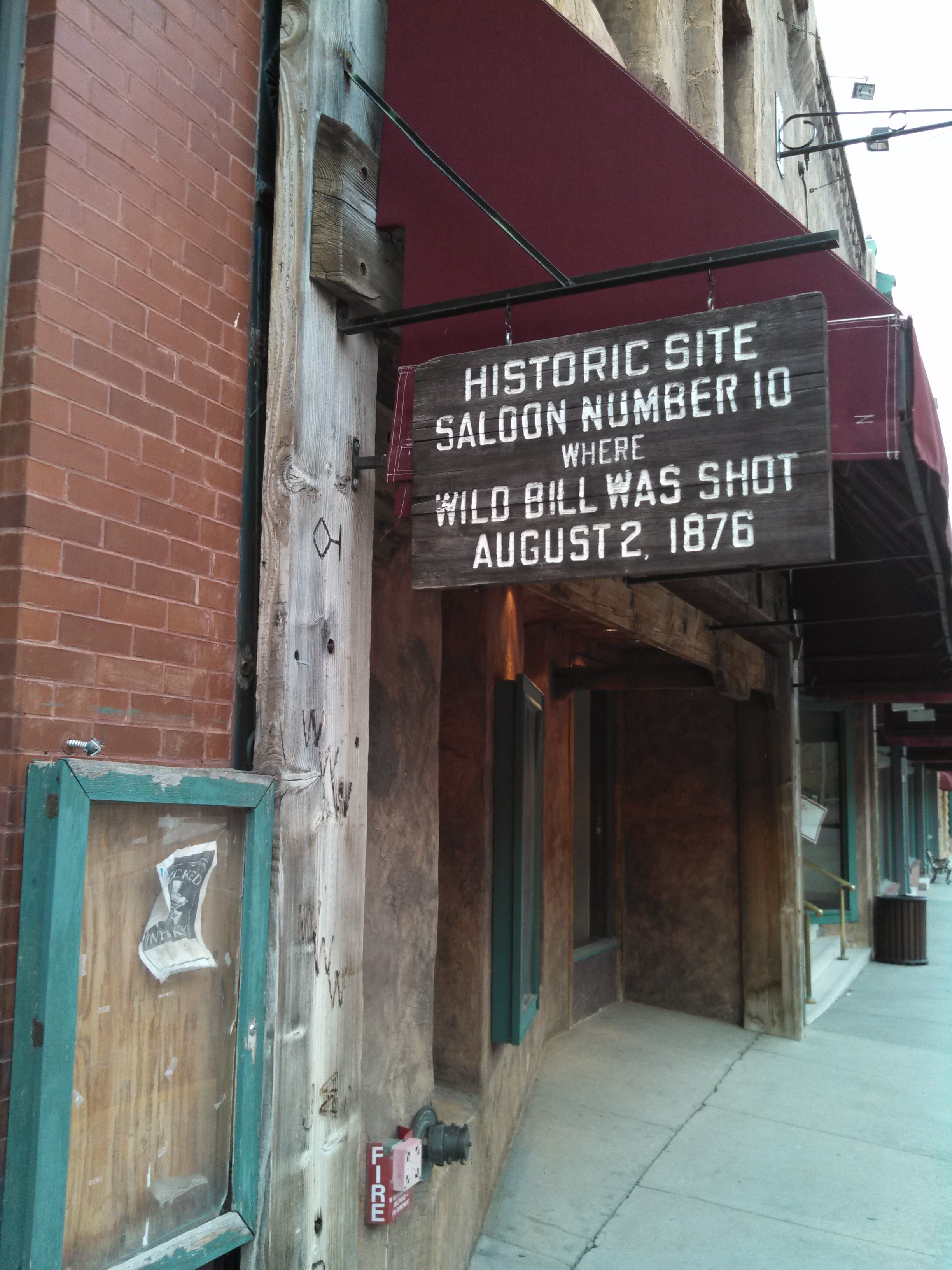
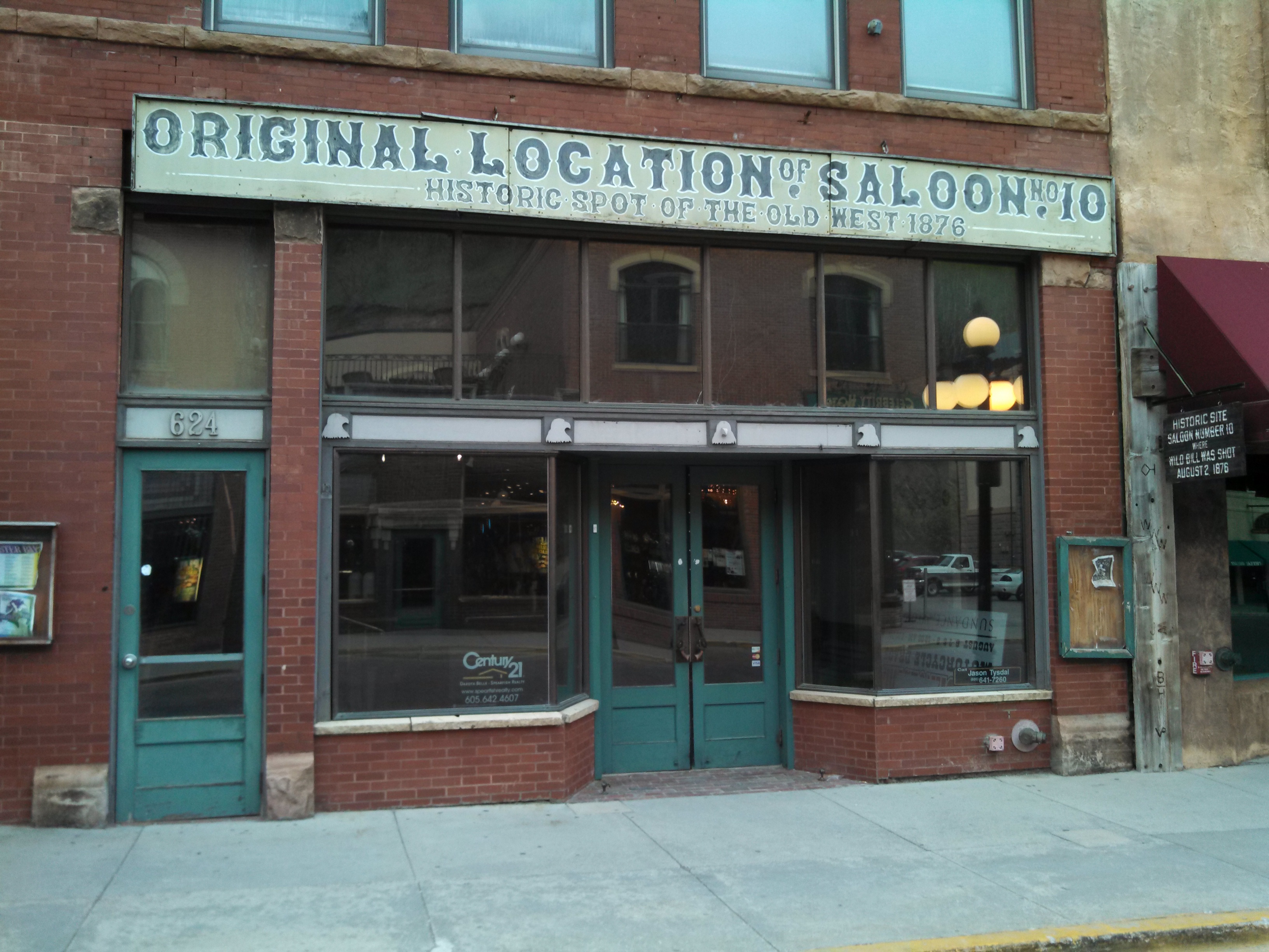
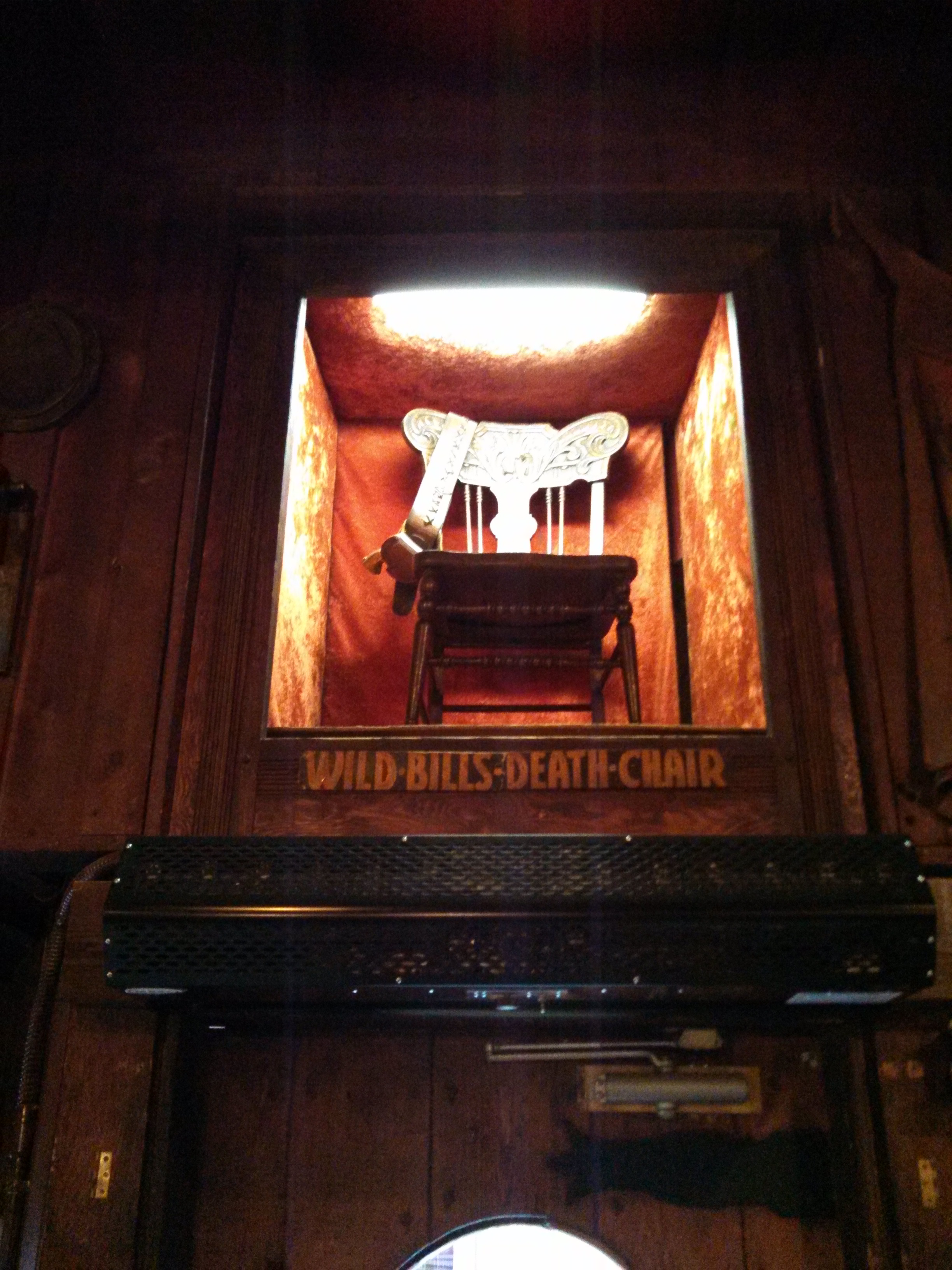
Wild Bill was definitely a legend in this town. After that we drove the bikes on home and did our final packing. Day 6 would see us leaving South Dakota. Fantastic area and I can’t wait to get back up there some day.
Oh yeah, I almost forgot. At one point, Mike and I had to fight this giant killer bee. We slew the bee, saved the princess and continued on our way. All in a days work…

We started the day going to Mt Rushmore. It was a foggy, drizzly day and so we were hoping it would clear enough by the time we got there to be able to see it. The drive down from the cabin was wet. We decided to take the car as all three of us wanted to see Mt Rushmore and the Badlands and with the weather the way it was, taking the car made more sense. We drove by the same lake we saw on day 3. Here are some pics of the ride to Mt Rushmore.
We arrived at Mt Rushmore and could not see it. Too foggy and wet. Dang it! We decided to hang out and go shopping at the gift shop they have there. It’s actually pretty cool as they have tons of “stuff” to buy related to Mt Rushmore. There was even an old guy there who had done some of the drilling on the mountain way back! After buying a few patches and stickers – oh, and a christmas ornament – we headed back outside to check the weather. Nope, still can’t see it.
We then decided to walk down what felt like a thousand steps down to the sculptors studio where we saw smaller versions of the faces. Here is what that looked like.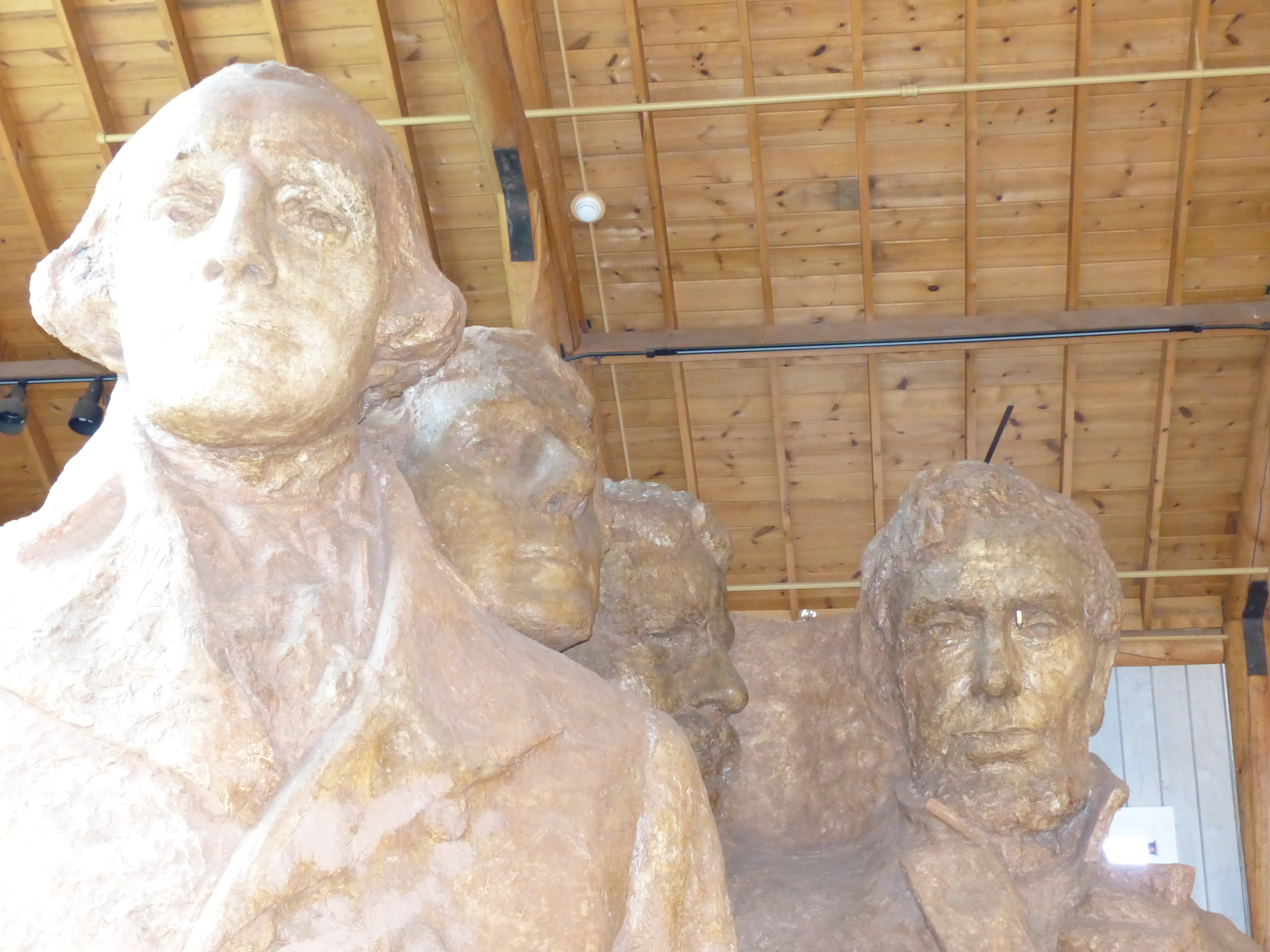 After visiting this area a bit, we then walked the ten thousand steps back up to the statue. Being flat landers and not used to this kind of activity at altitude, I was breathing hard by the time we made it back to the top. At this point, you could just barely see the faces coming through the fog.
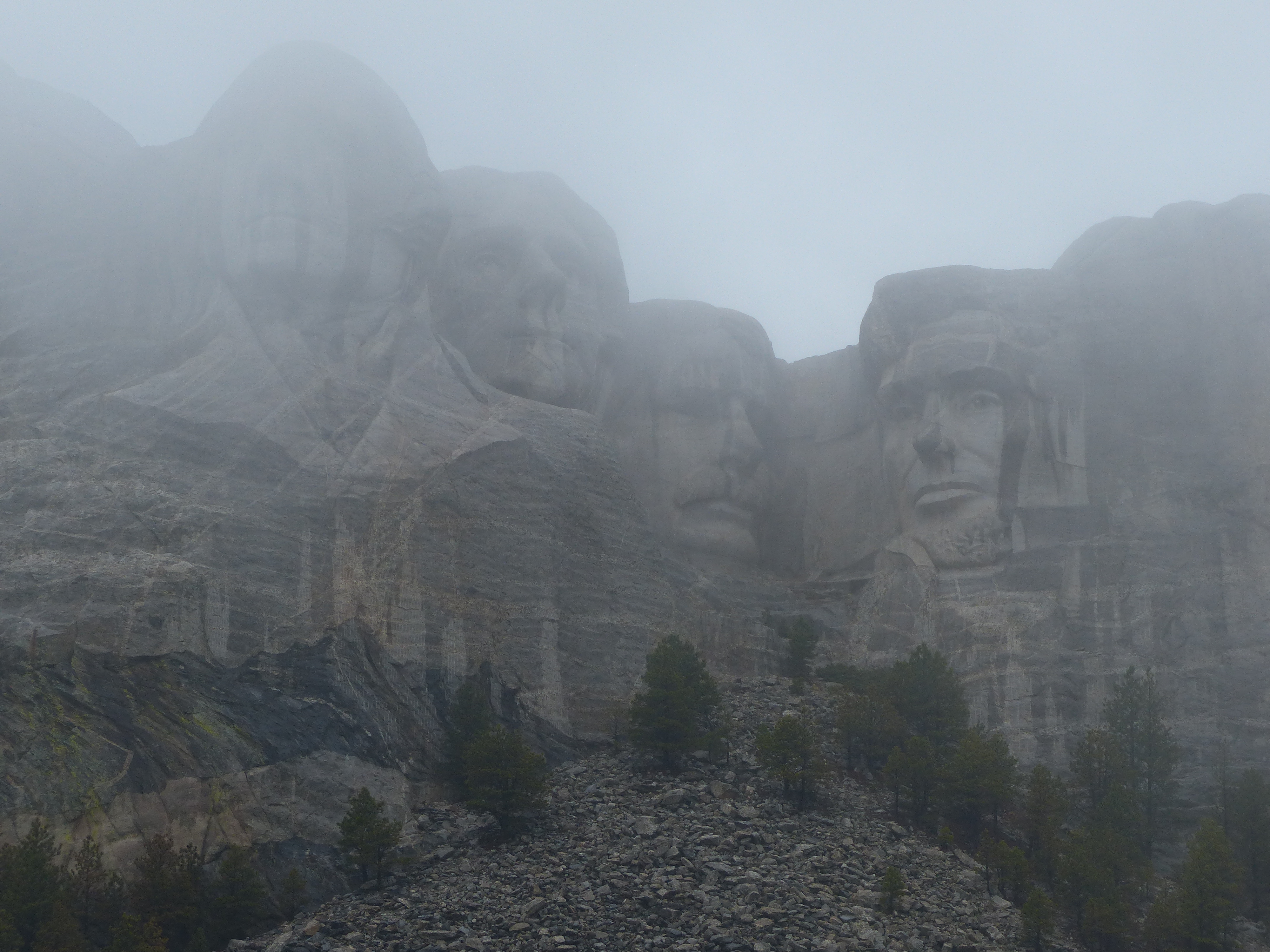
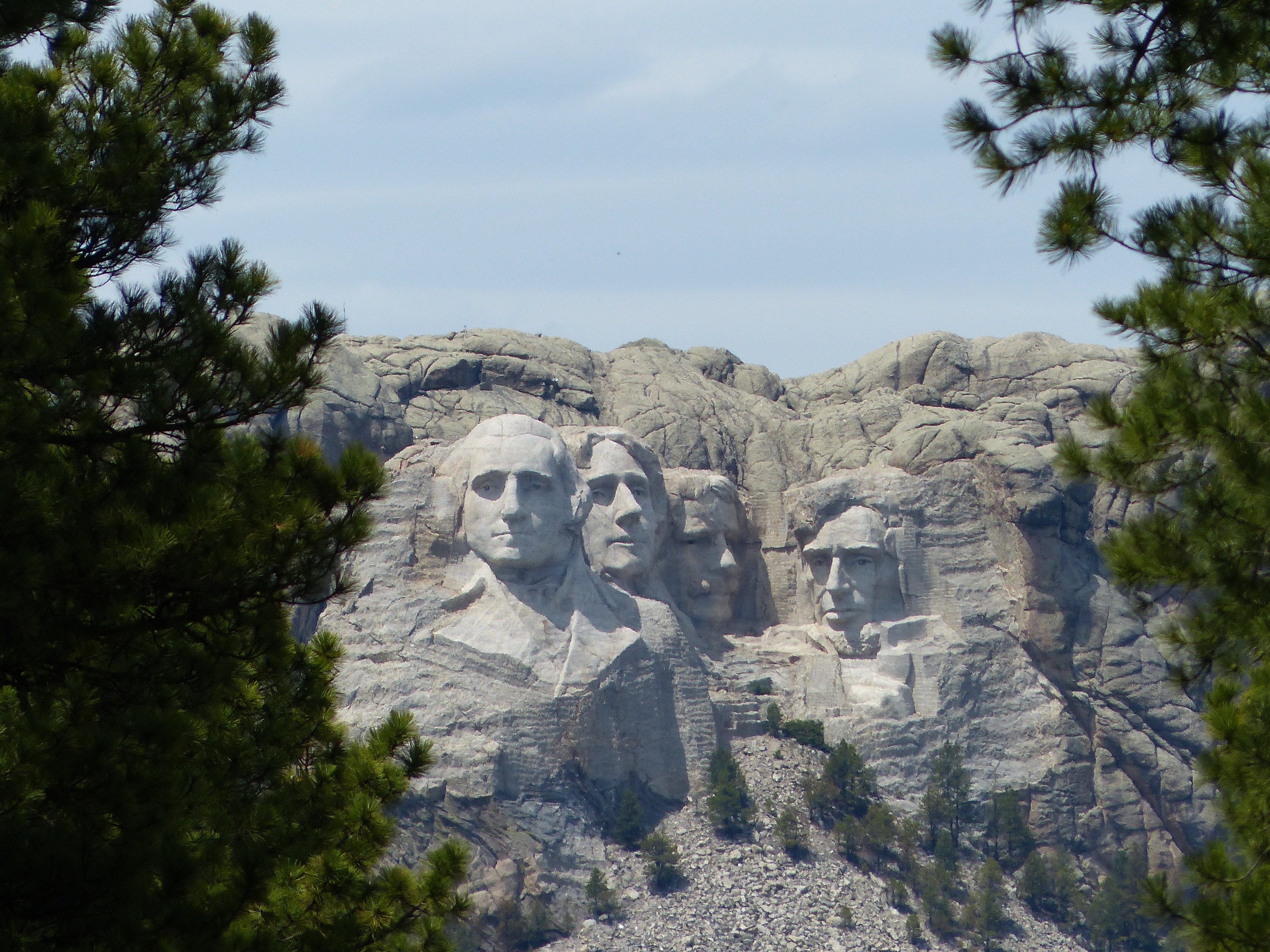
There was a short video playing explaining how it was built and so we decided to watch that to see if the weather would continue to clear. The video was interesting in explaining how workers basically drilled into the rock and then used dynamite to blow up the rock. From there, they would come back with with drills to shape the final formation of the rock. They would use the smaller version of the faces to calculate how much rock to remove. Amazing how they were able to bring it together. The artists comments were that he hoped that as generations came to see this sculpture, that they would see the faces of the men that created the best country in the world. After the movie, we caught a better glimpse.
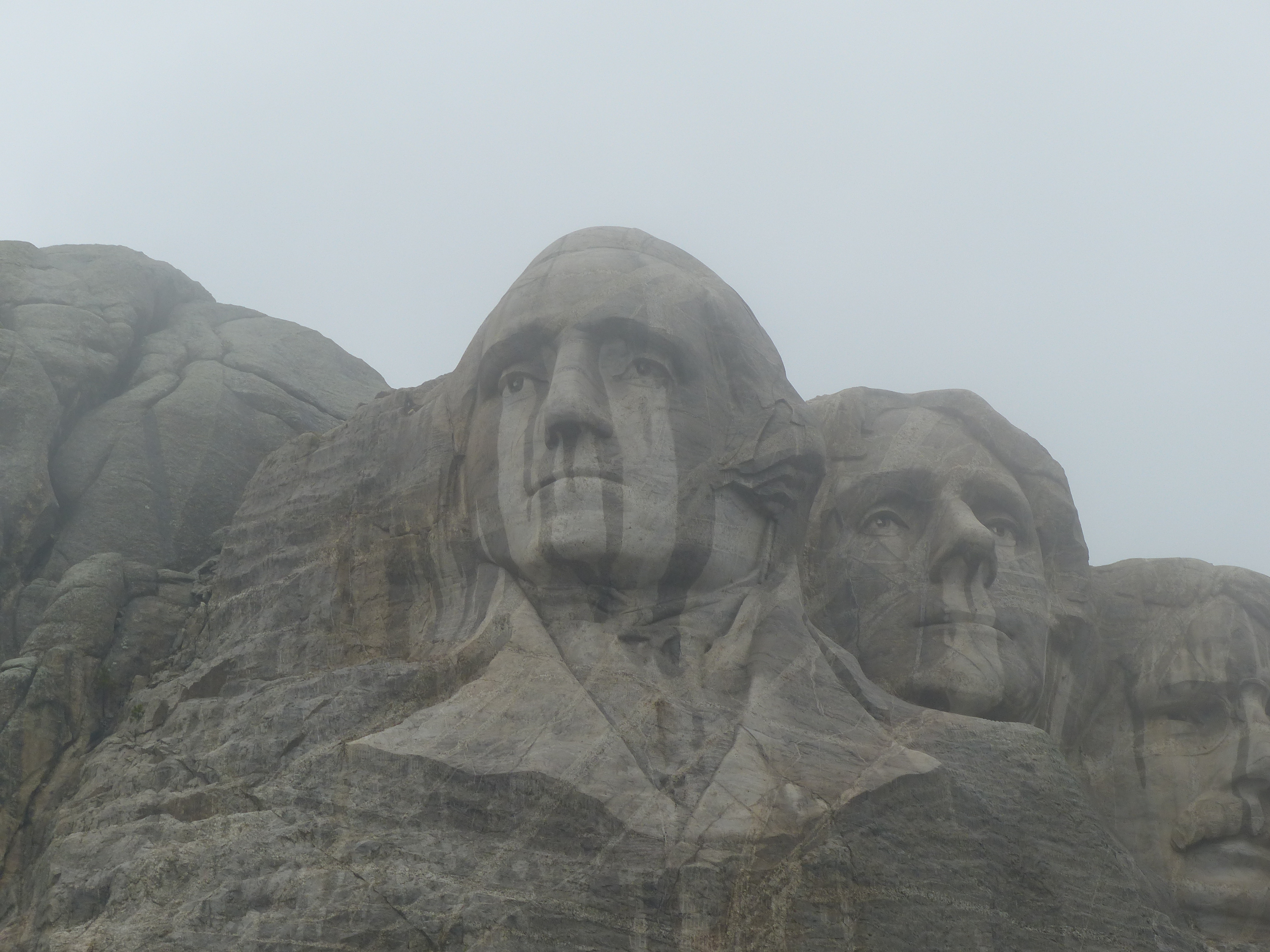
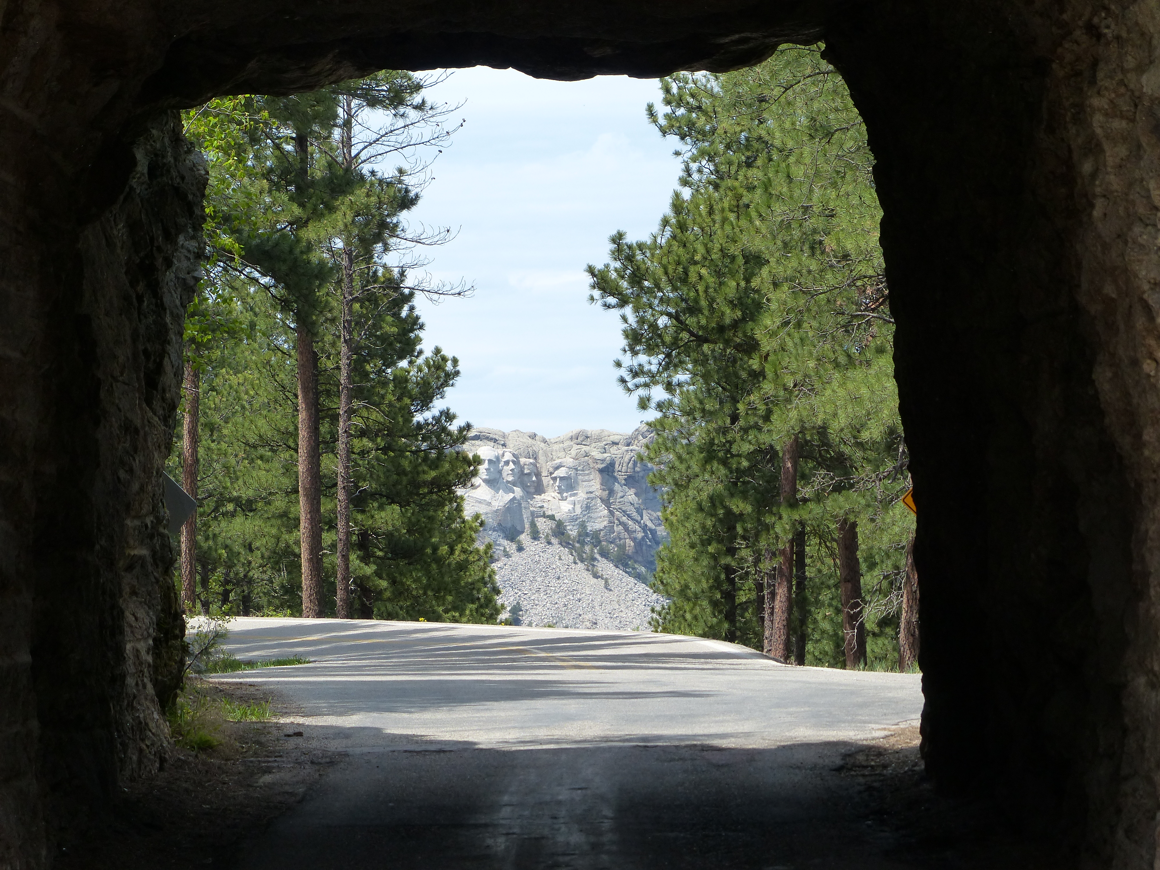
 As fate would have it, these would not be the best shots of Mt Rushmore, those would come on day 5.
We left Mt Rushmore and headed down to Keystone SD for lunch. Buffalo burger at the Ruby house was excellent as was the pecan praline ice cream next door. Next stop, the Badlands…or so we thought.
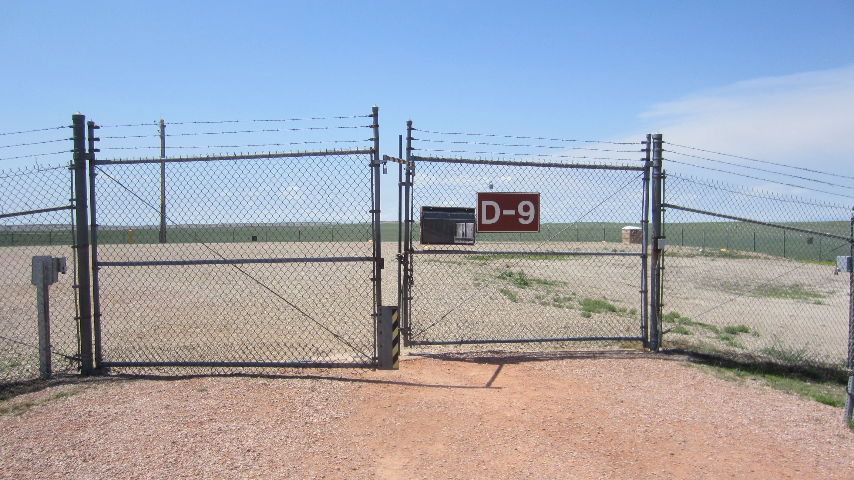
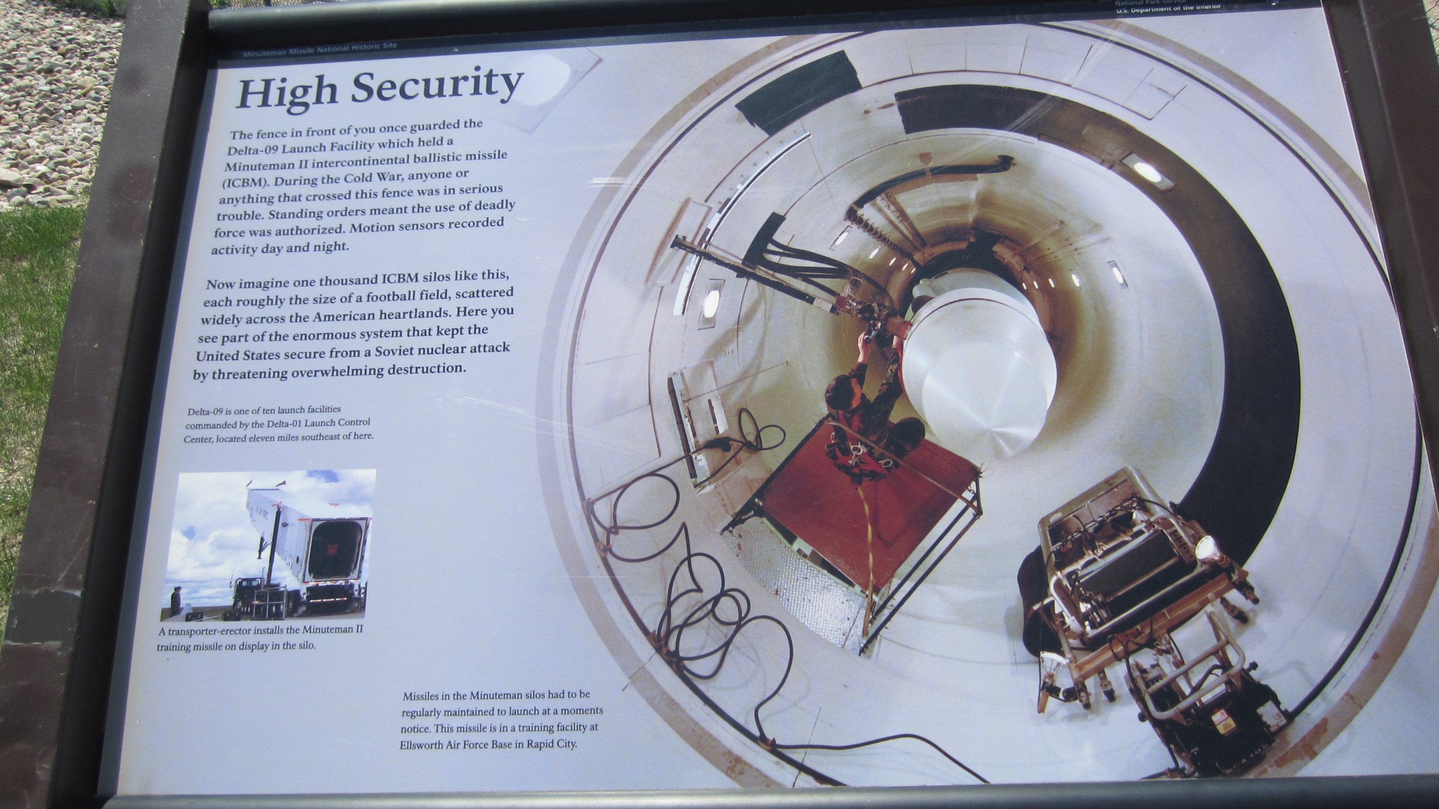
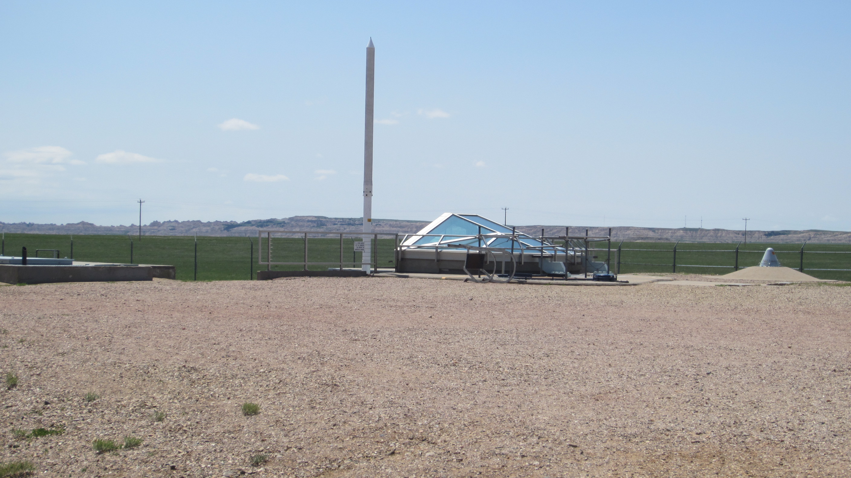
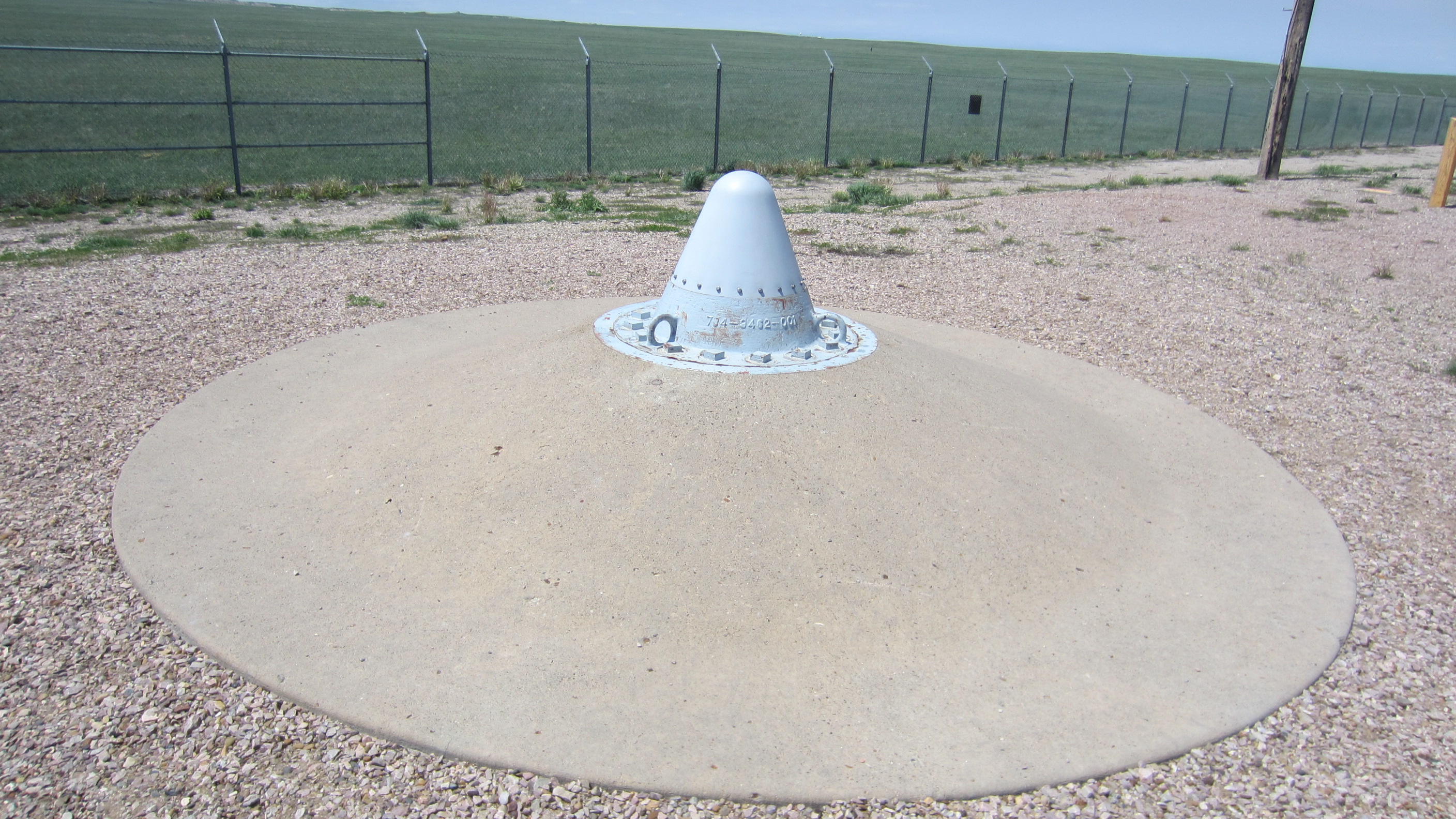
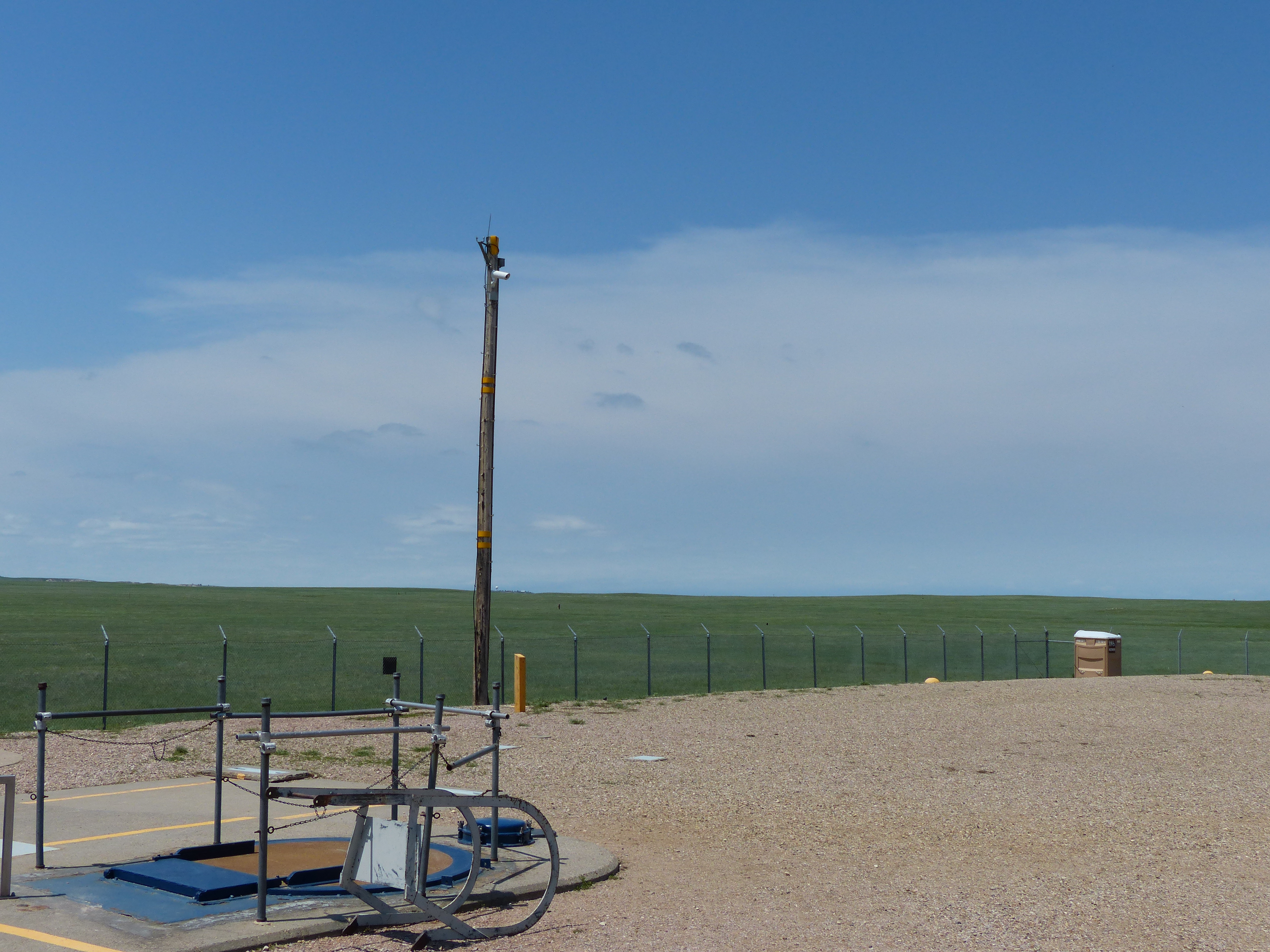
Back up to Rapid City and then east on I90. We had seen a sign or two for the Minuteman missle historic site in the area and decided to go check that out. Heading east on I90 close to Wall SD is a silo for one of the missles. I suppose I should explain a little bit about what these are for people not familiar.
Back in the 1960’s during the height of the cold war, America deployed 150 minuteman nuclear missles across Wyoming, Montana, North and South Dakota. The intent was that if you shoot nukes our way, we are going to shoot our nukes your way. Thus a stalemate occurred and obviously no nukes went off. However, during the Cuban missle crisis, we were very, very close to launching. The movie 13 Days does a terrific job of explaining what was going on with our leaders during that difficult time period. Be that as it may, we (the US) developed and maintained all of these missles until 1994 when we signed the Strategic Arms Reduction Treaty (START) that began the process of decommisioning all (or so we think) of these sites. If you have seen the movie Wargames, then at the very beginning, you see a scene with two officers down in a bunker being told to launch their weapons. That’s basically what we were going to go tour.
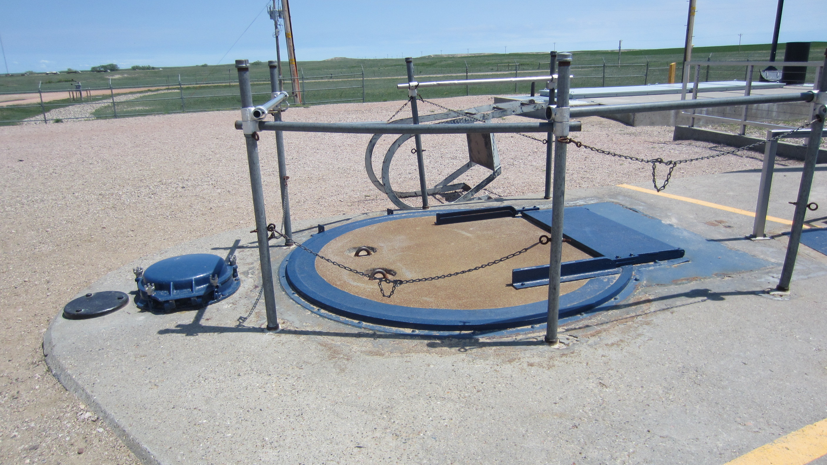
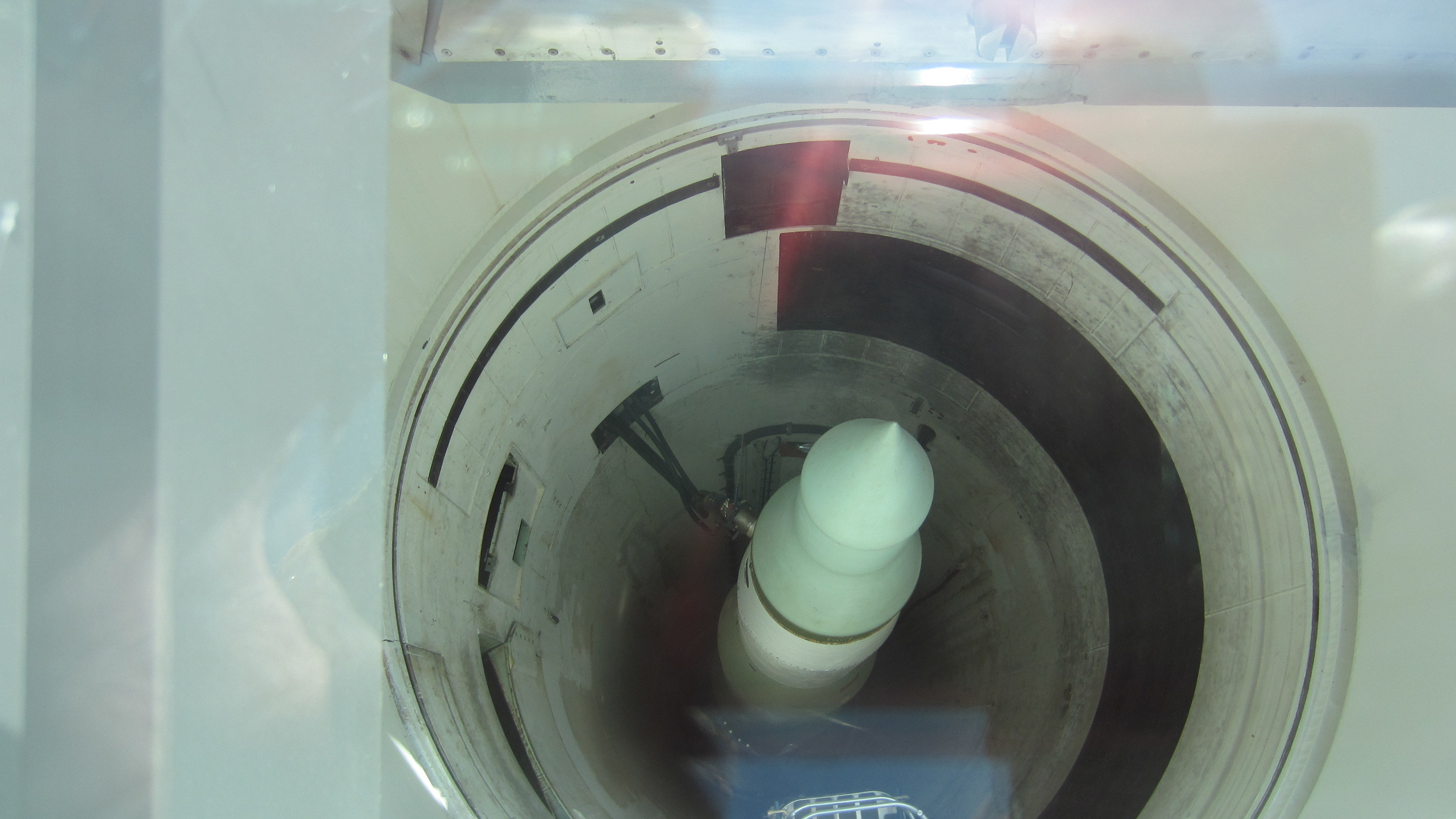
Here’s a few pictures of the actual missle site. The missle in here is a fake as is the glass top that was put in place for people to be able to look down into the bunker.
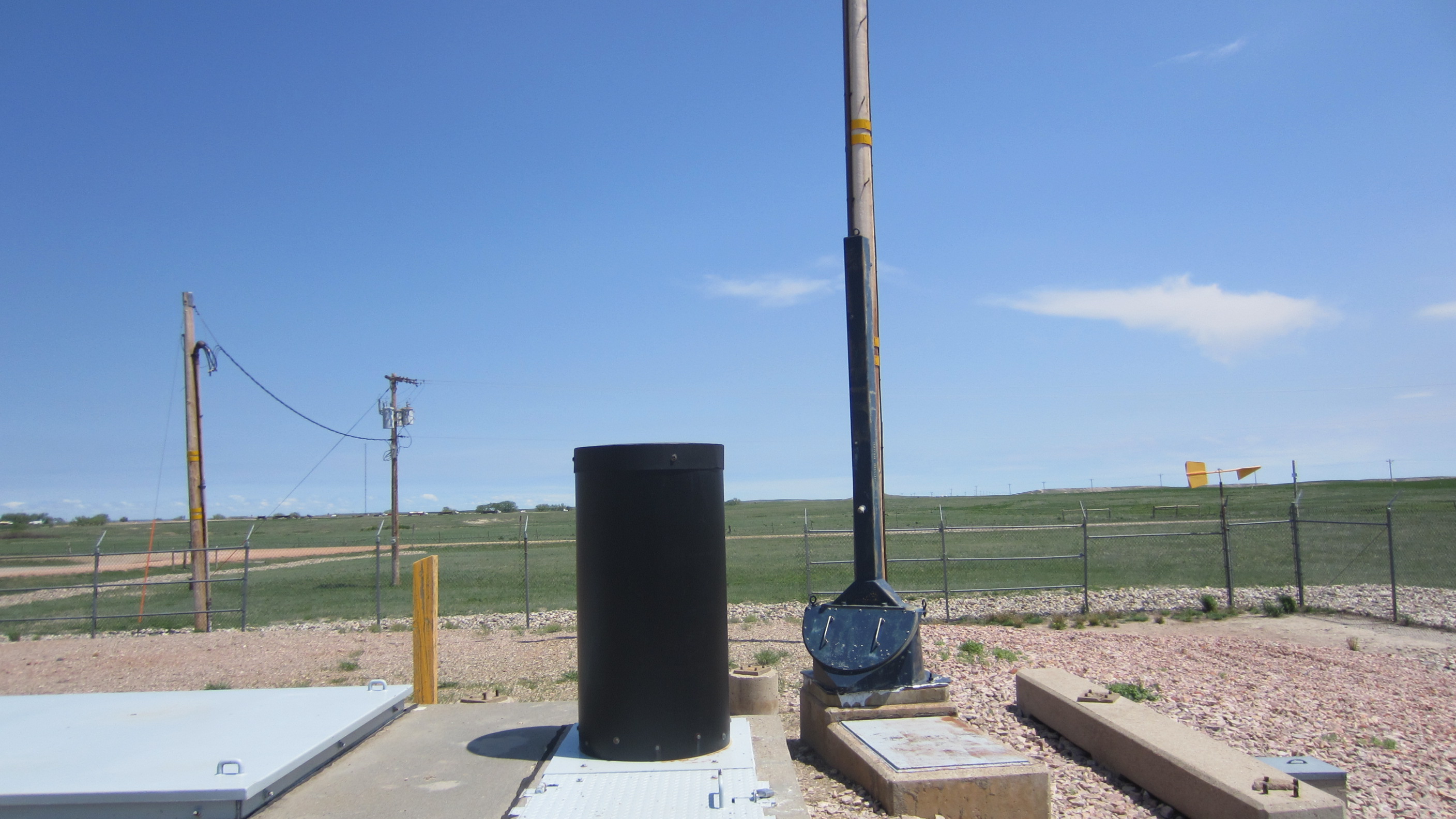
After viewing the missle silo, we decided to head to the command bunker and check that out. That was located about 5 miles down the road. Here is a picture of that site:
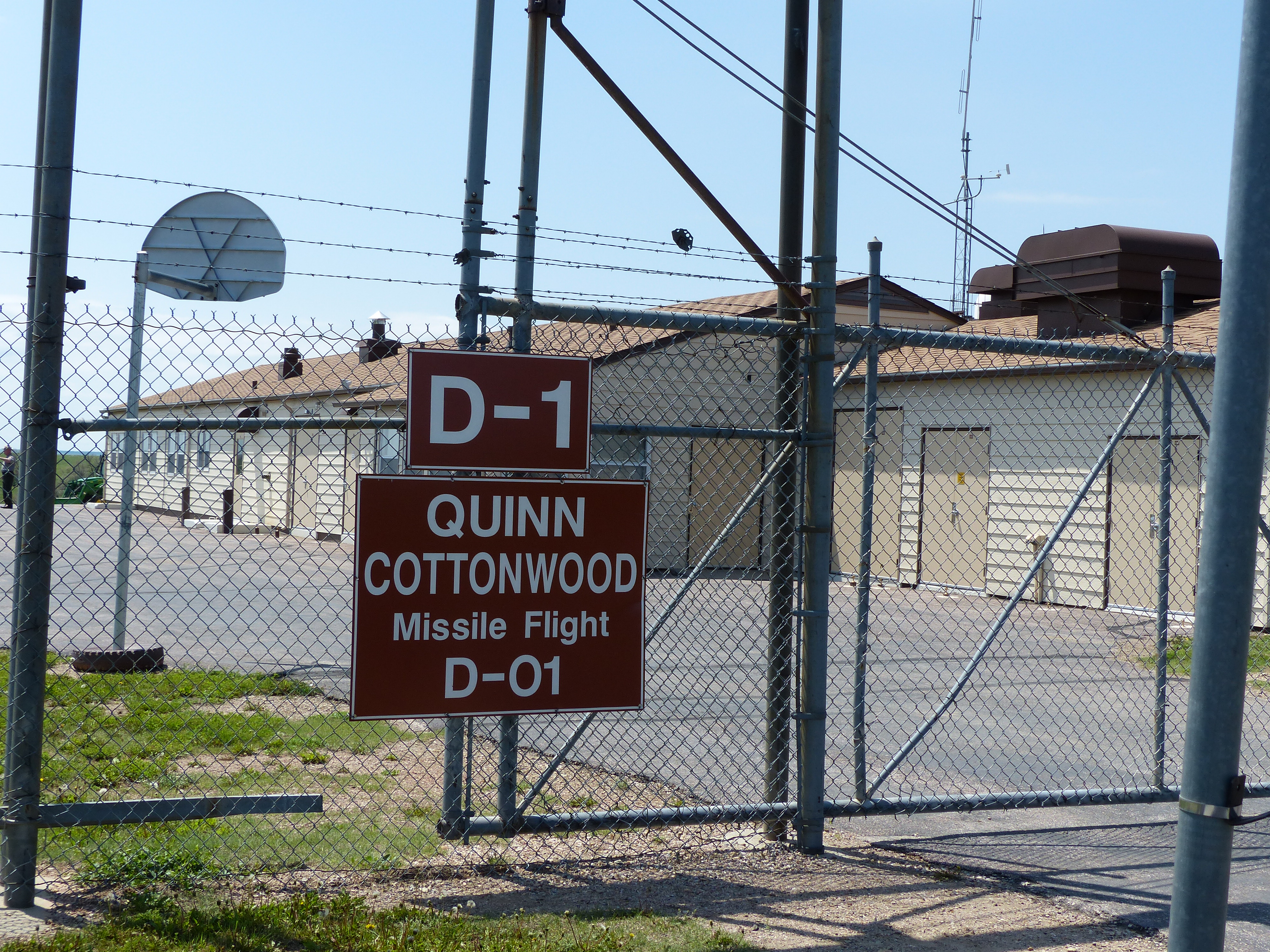
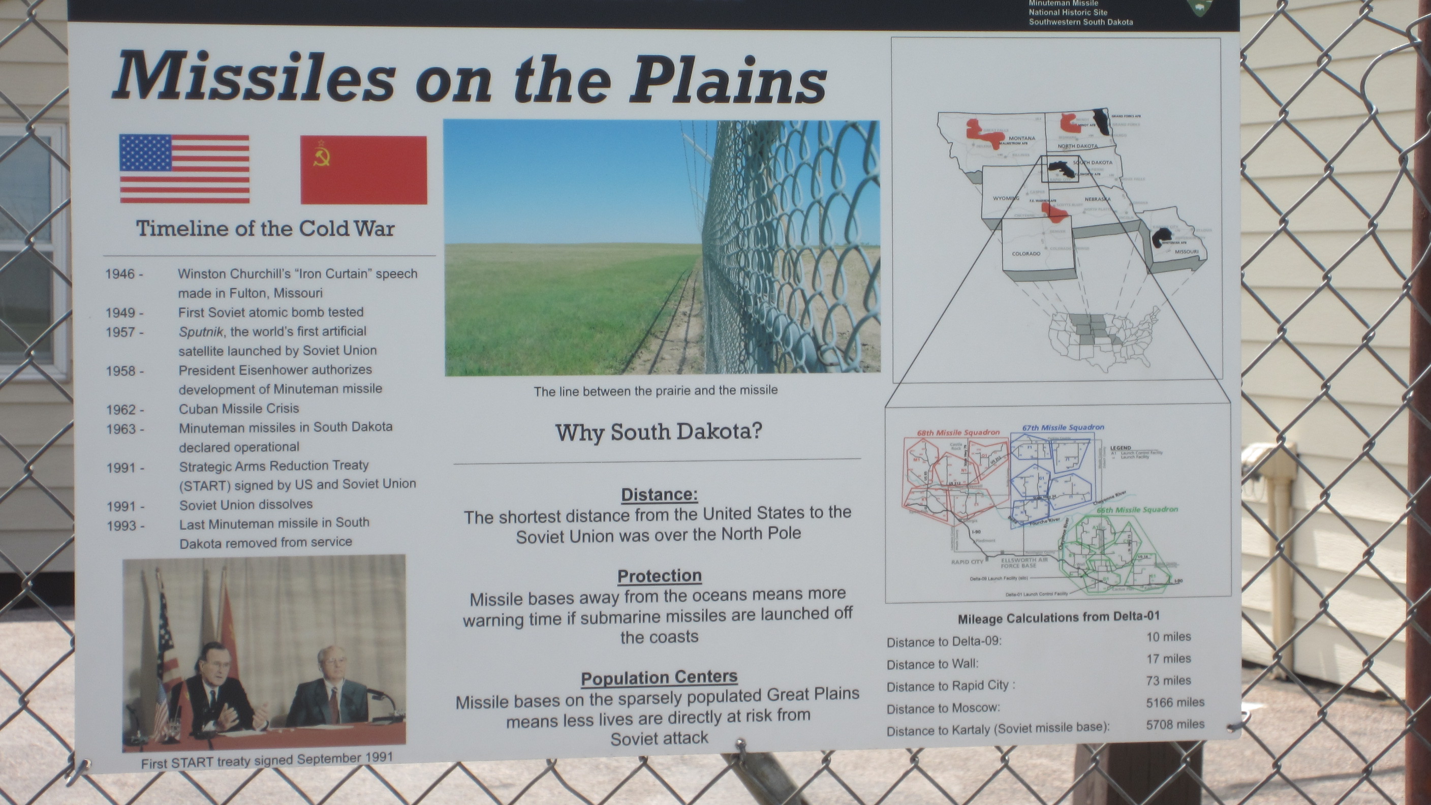
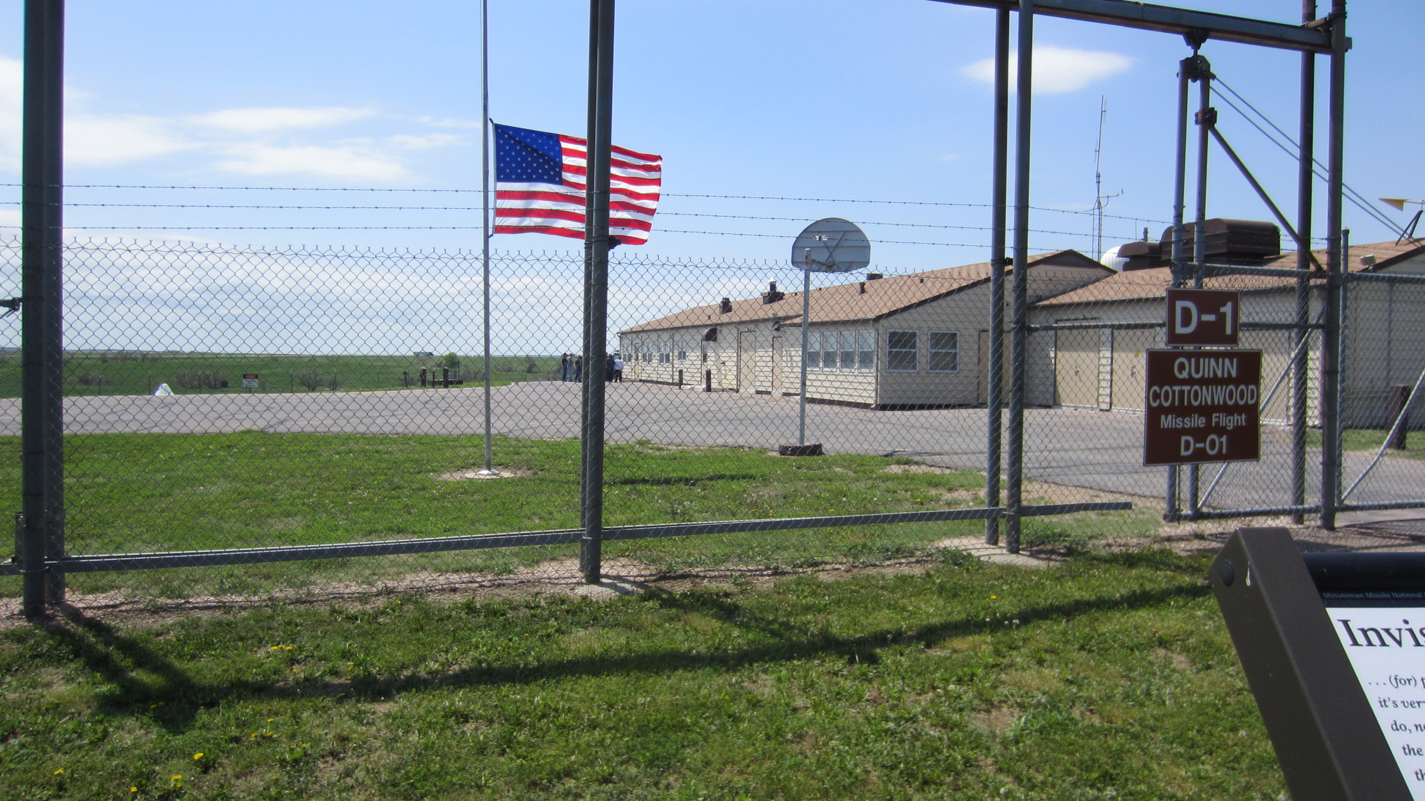
Each command bunker like this controlled 10 missles. There were 15 of these command structures around the area. Some of them looked like farm houses. I asked about the secrecy of this place and did the Russians know about it. The answer was a definitive yes, the Russians knew about it. That was the objective to make sure they were aware that we could kick their ass anytime we wanted. Of course they could kick ours and so the MAD (“Mutually Assured Destruction”) doctrine prevailed.
Here are a few pics of the above ground structure including the security desk. I will explain what the big cable is below.
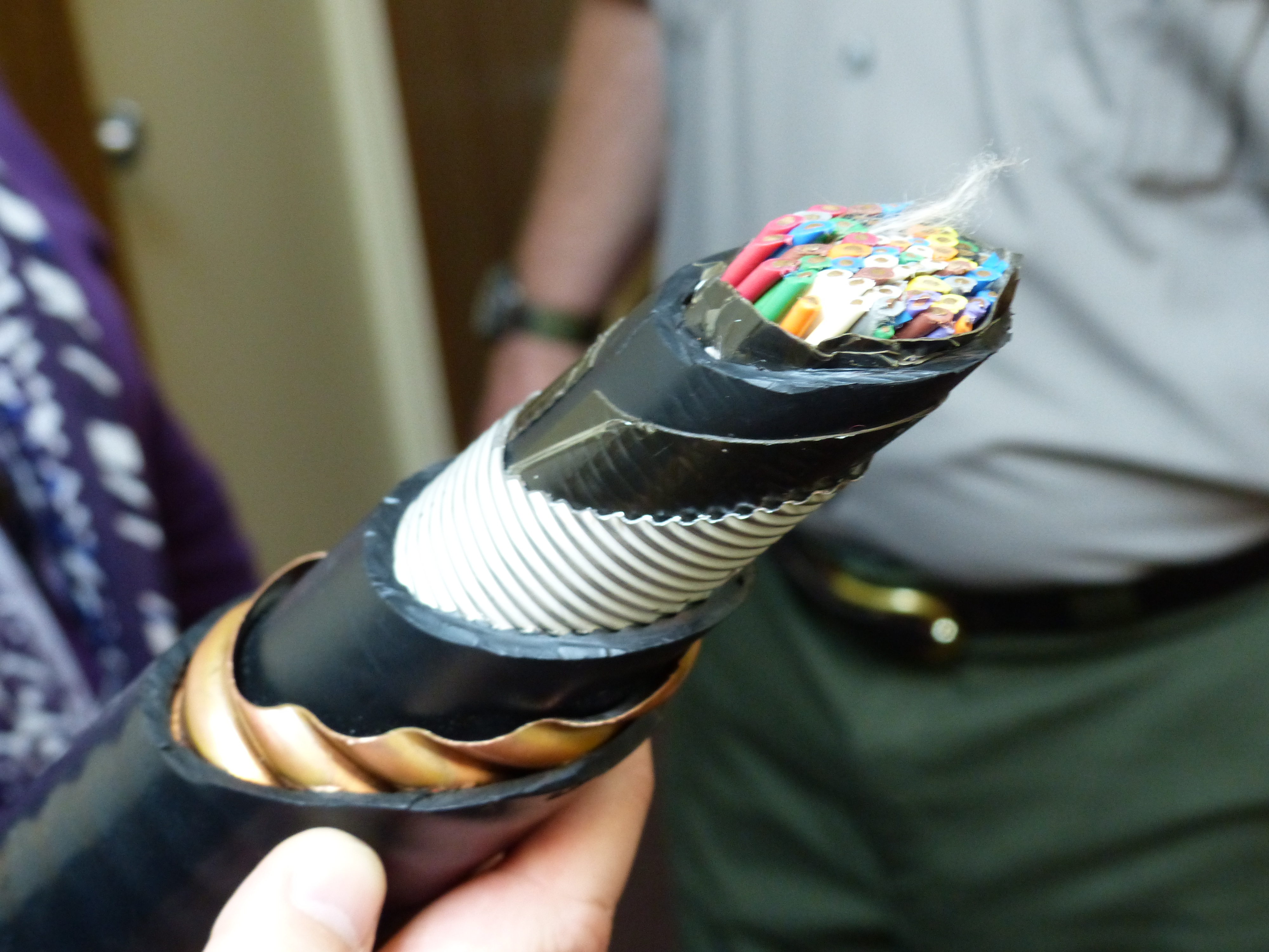
The cable that you are looking at above went from the command bunker below ground to each of the 10 missles controlled by this location. The cable contains around 50 twisted pair wires that connected to various sensors and computers at the silo. The cable was then shielded with multiple techniques you can see in the picture. The outer copper shielding was to prevent any negative impact from an EMP (“Electro Magnetic Pulse”) that would fry normal electronics. In addition, this cable was pressurized which allowed the commanders to determine if the cable had been cut or broken. Any type of break would instantly get the security force stationed above ground headed out to determine the cause. There were 1600 miles of this cable deployed to the missles.
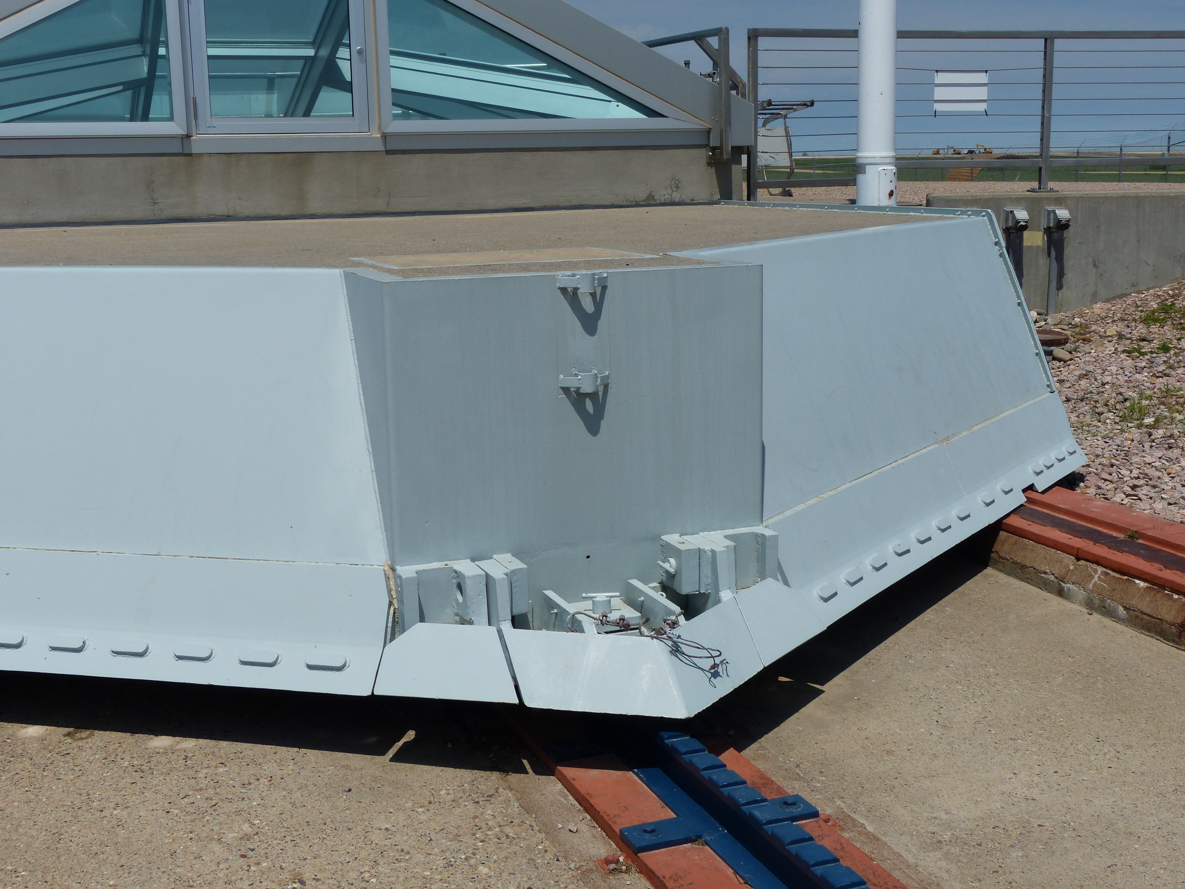
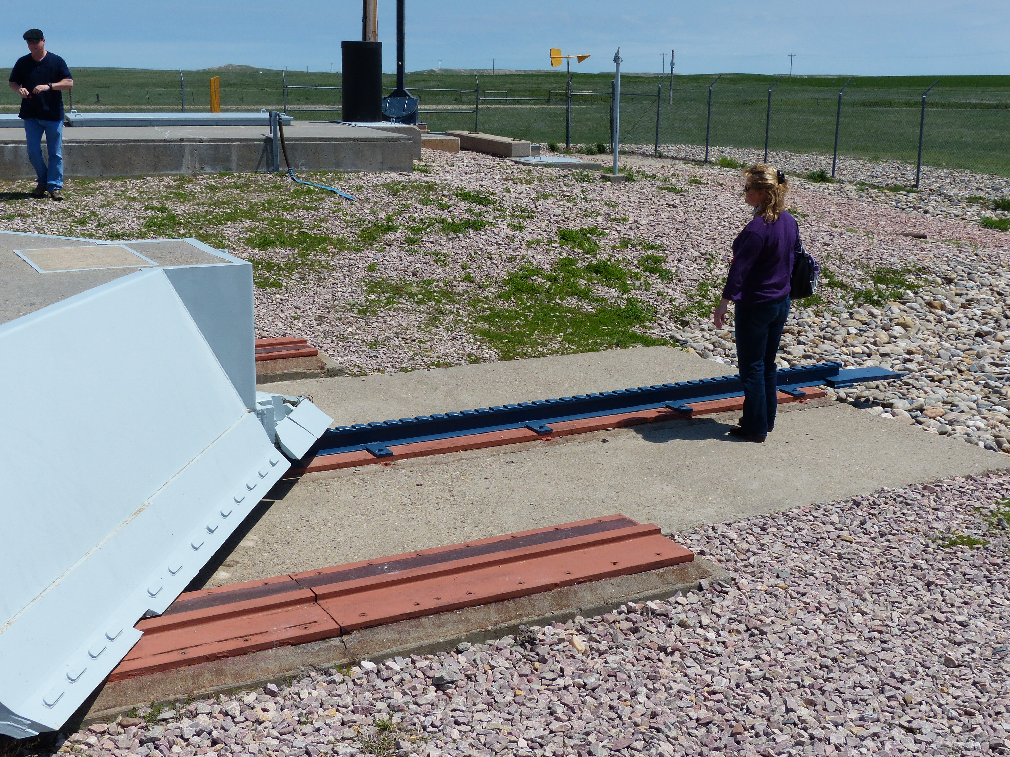
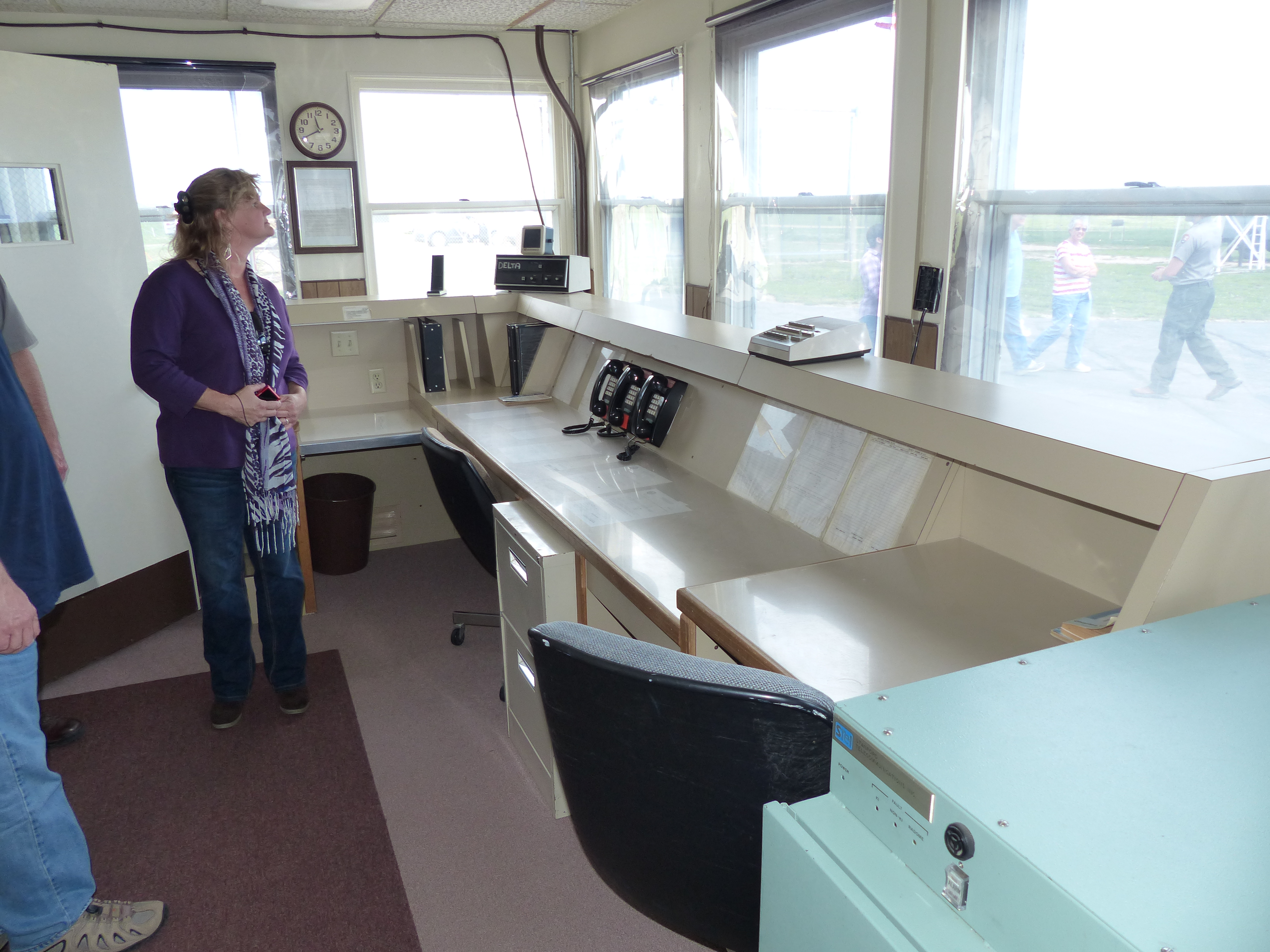
In addition to the above ground, we were also allowed to go down to the underground bunker as well. Here are a few pictures from that experience.


This door weighs 10,000 pounds and yet could be opened and closed by 1 person given the bearings and balance for how it was installed. No one other than the “missleiers” and the cook were allowed below ground. Crews maintained a 24 hours on and 24 hours off rotation. Security was tightly controlled for who got access to this area. In the event maintenance work had to be done, it was always in the prescence of a commander and armed security. They took this very seriously.
After visiting the bunker, we were overwhelmed by how impressive all of this was. I highly recommend taking the time to do this if you are ever in the area.
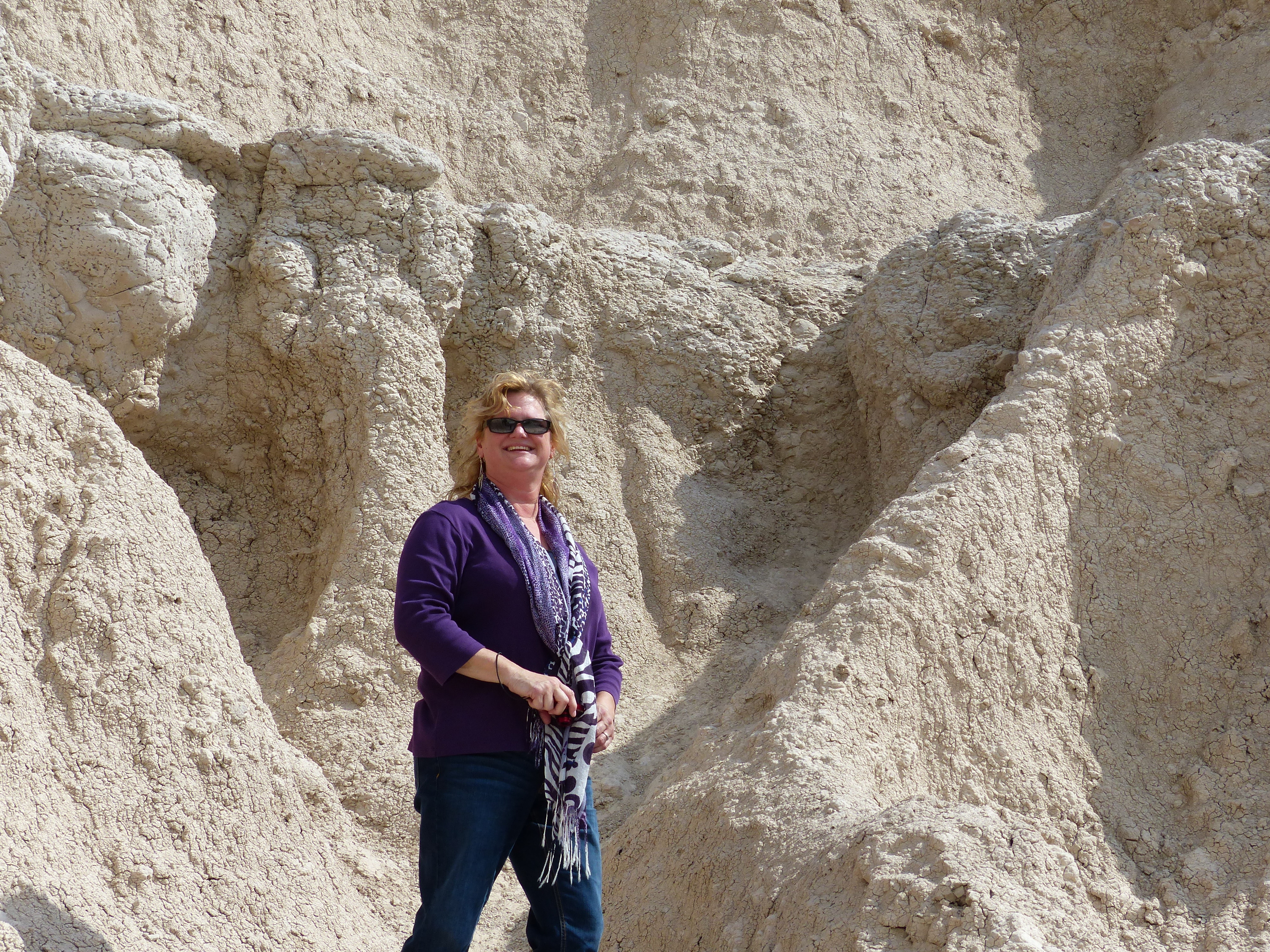
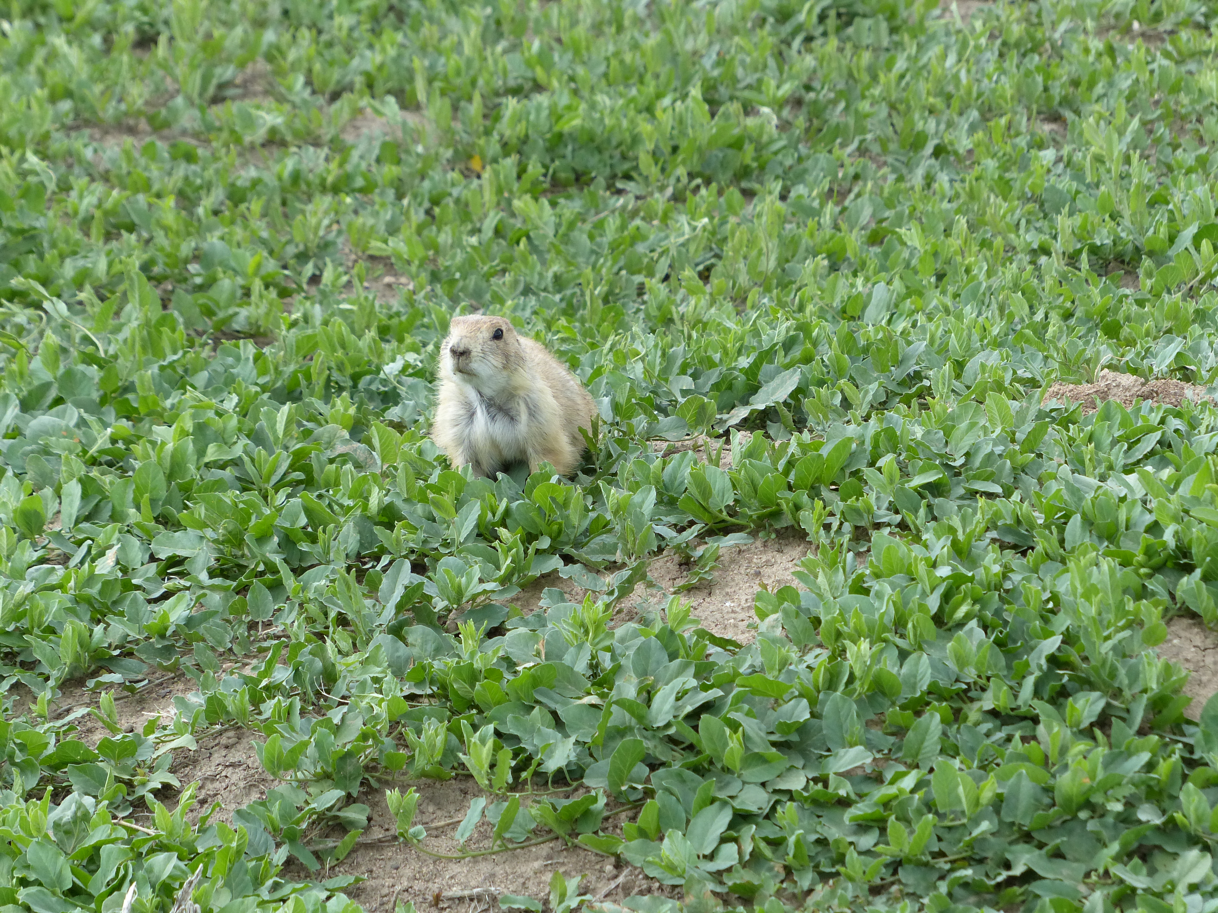
Day 4 was still not done. We next headed to the Badlands…
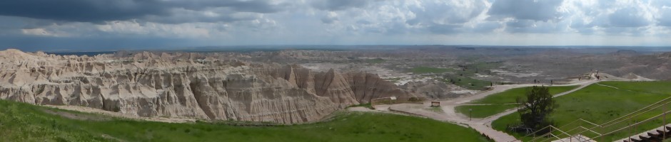
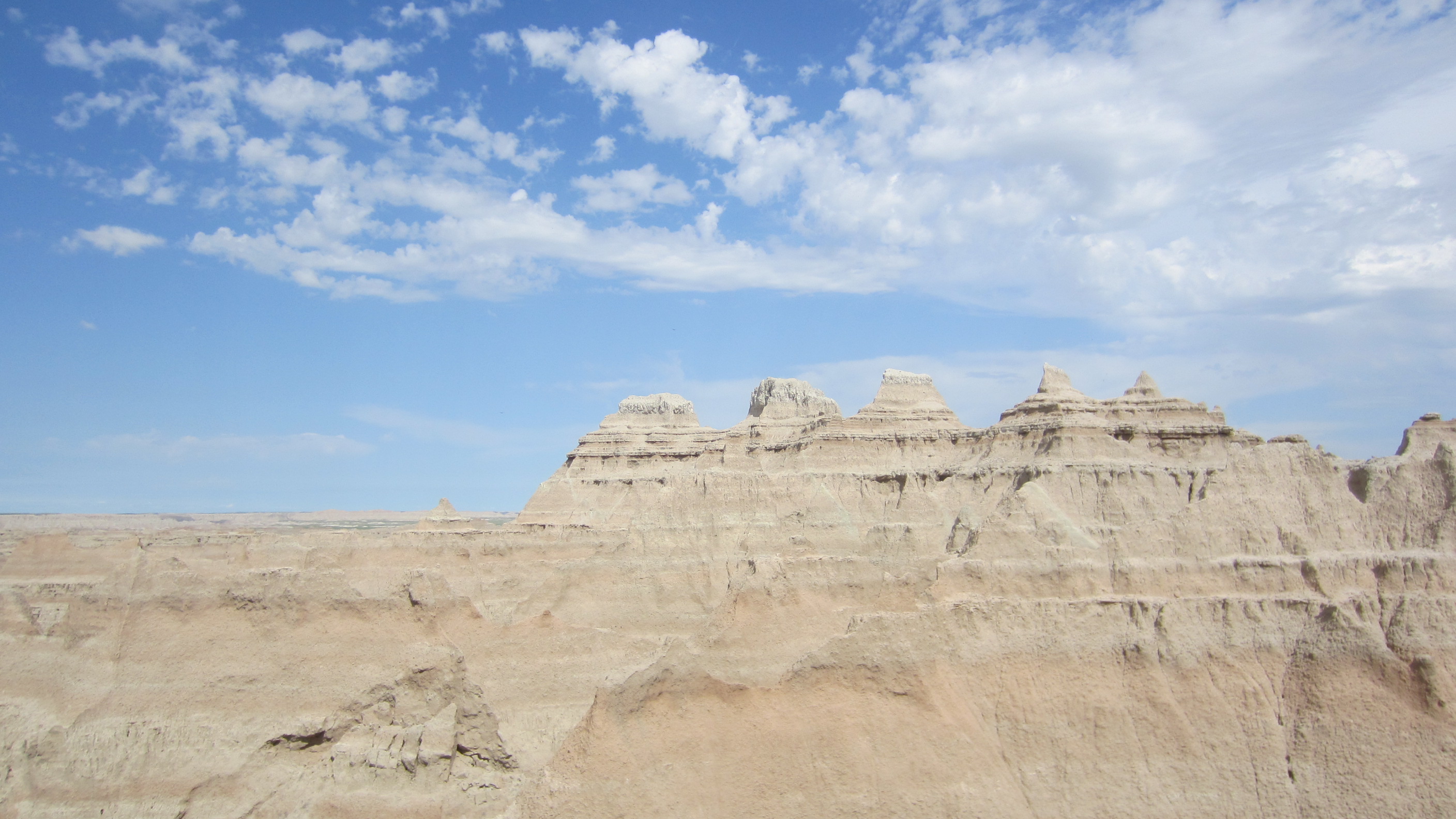
The panoramic shot was taken near the end. The larger version of this shot is even more impressive. The Badlands are this very interesting geological area of, well, they are not really mountains, nor are they hills per se. They are just sticking up in the middle of South Dakota. This link from the National Park Service does a good job of describing how the Badlands were created.
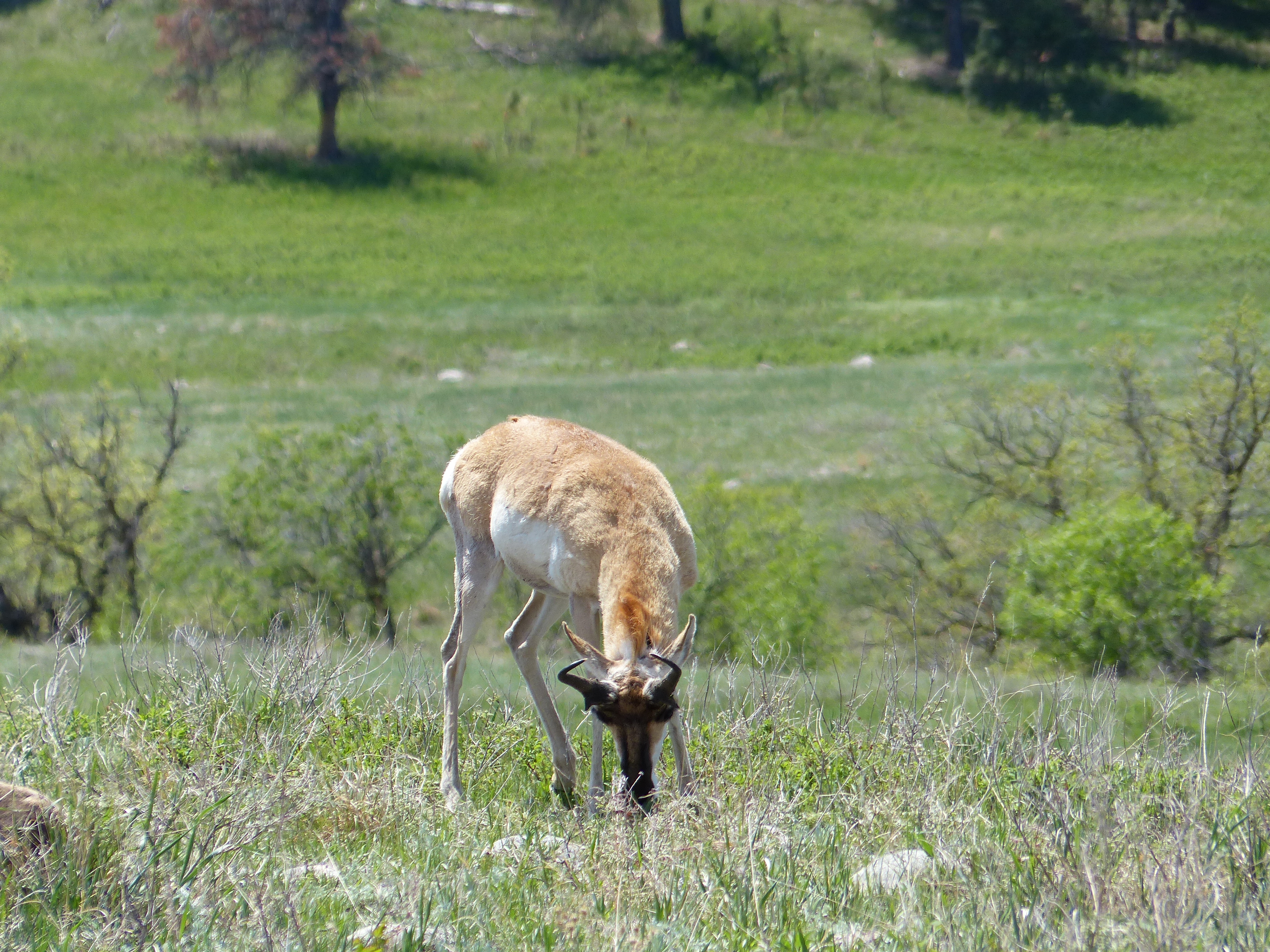
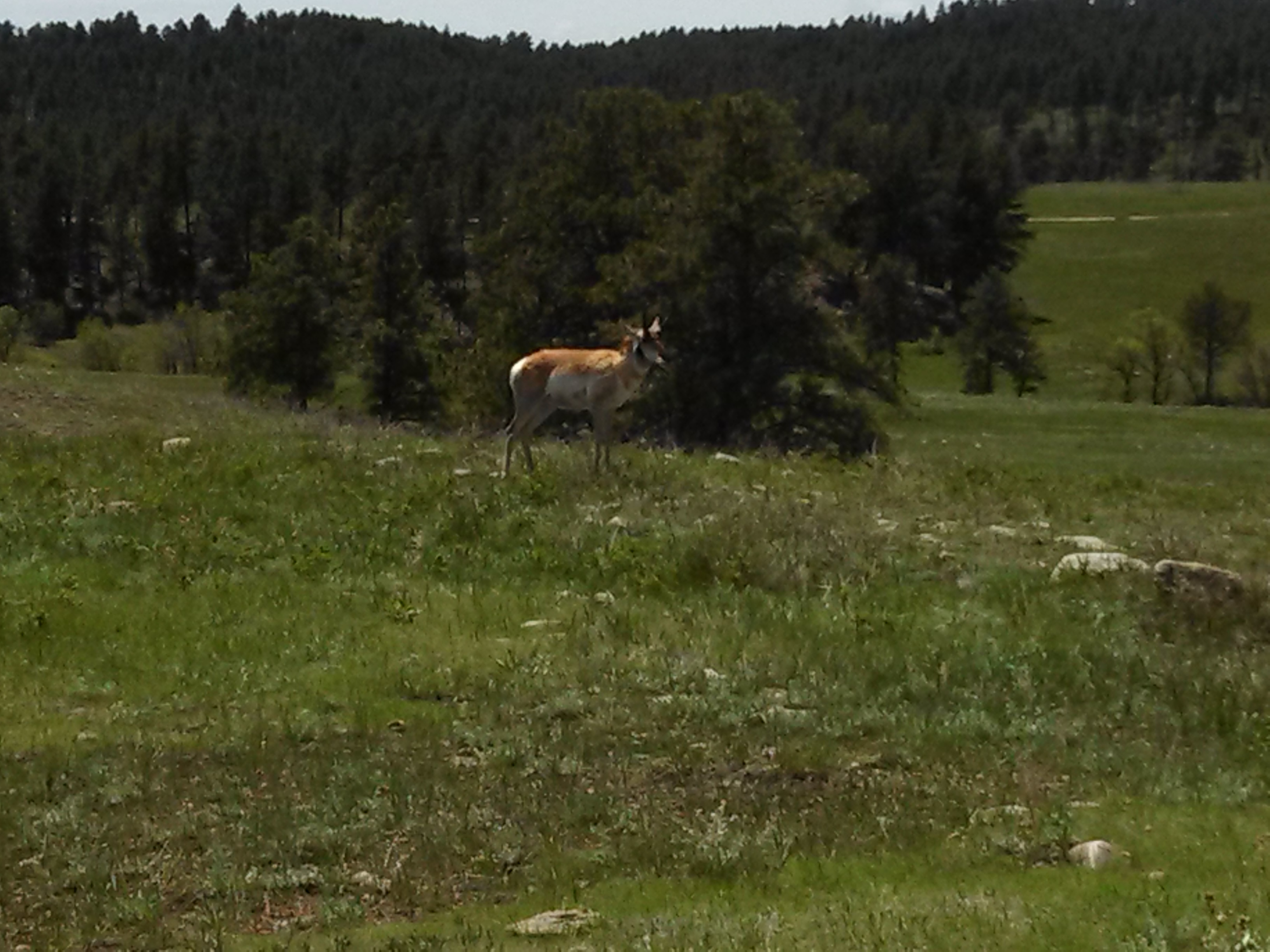
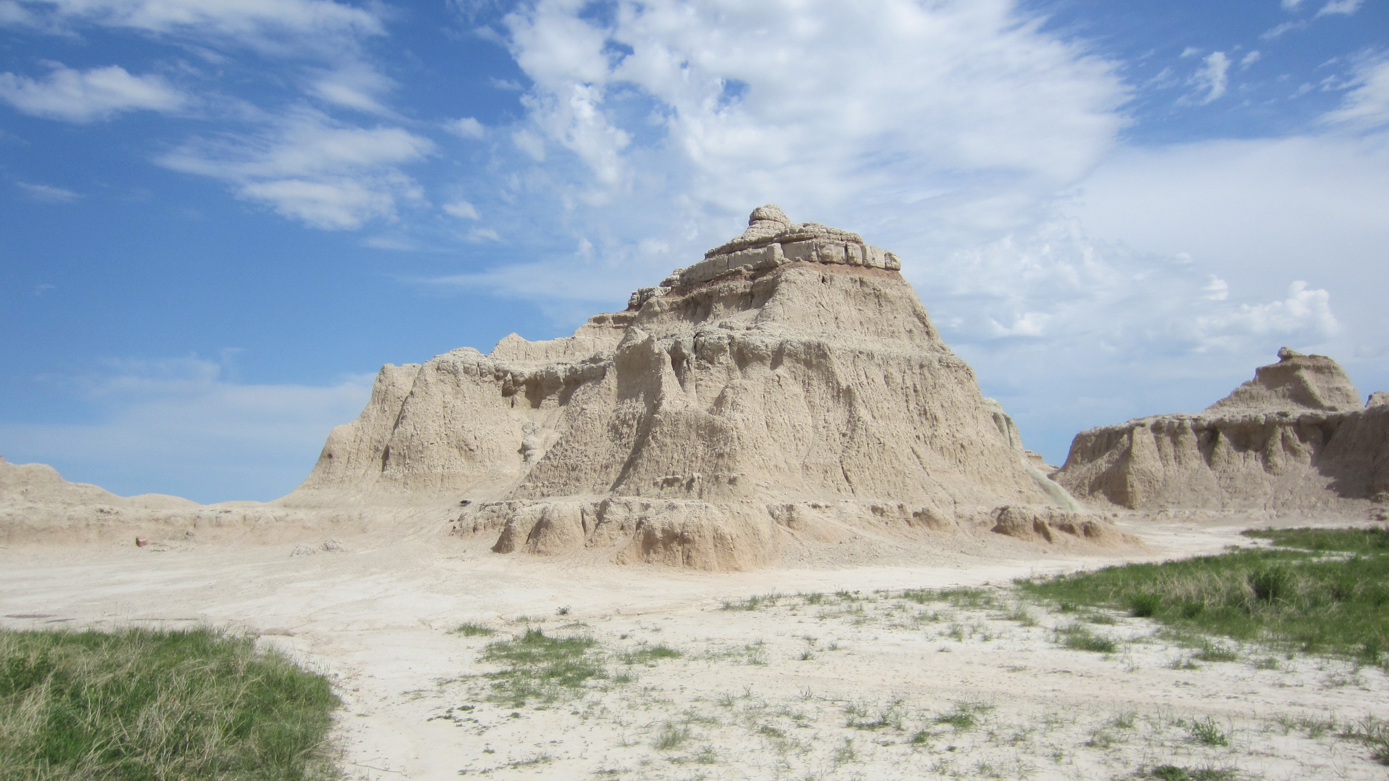
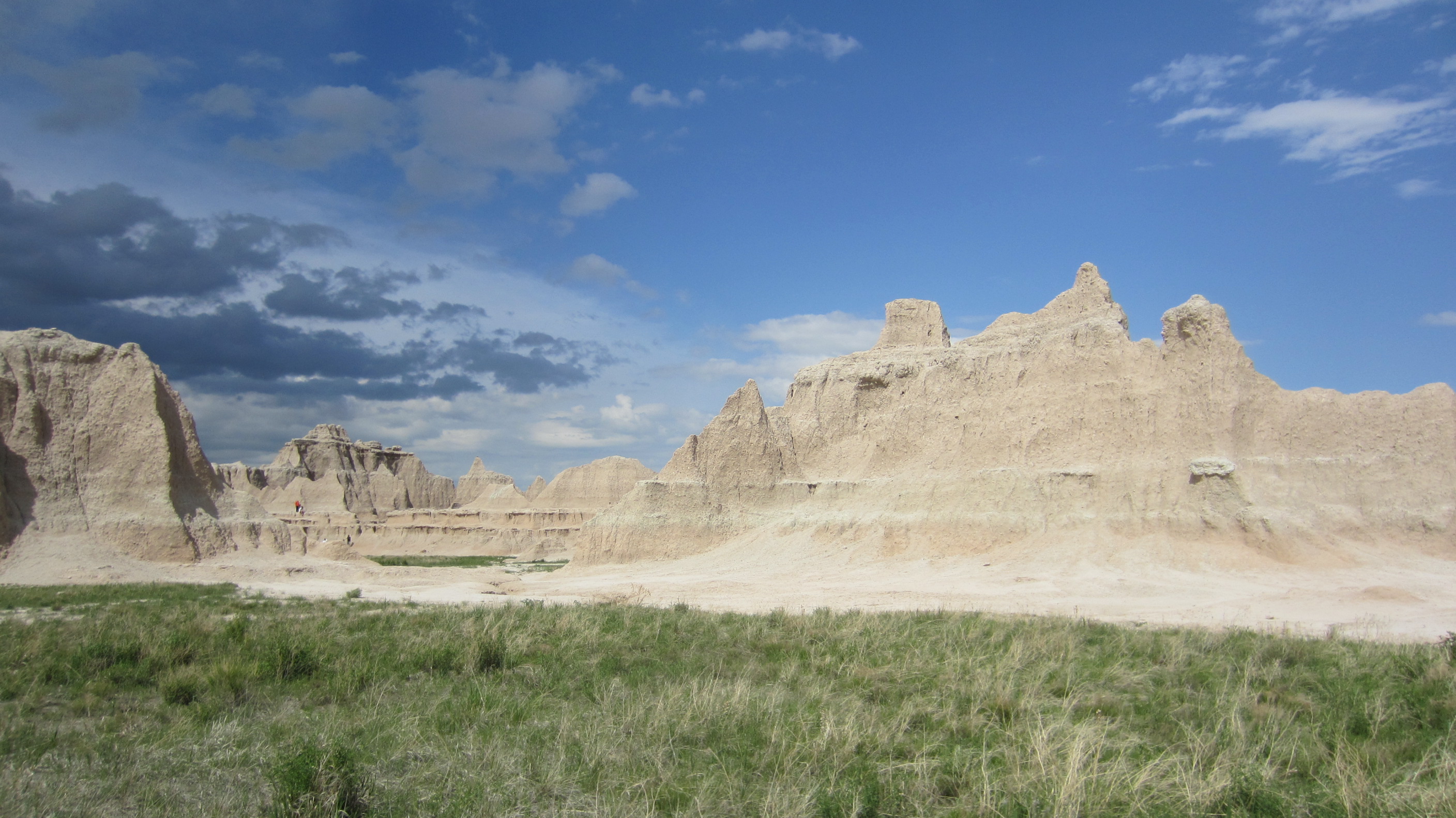
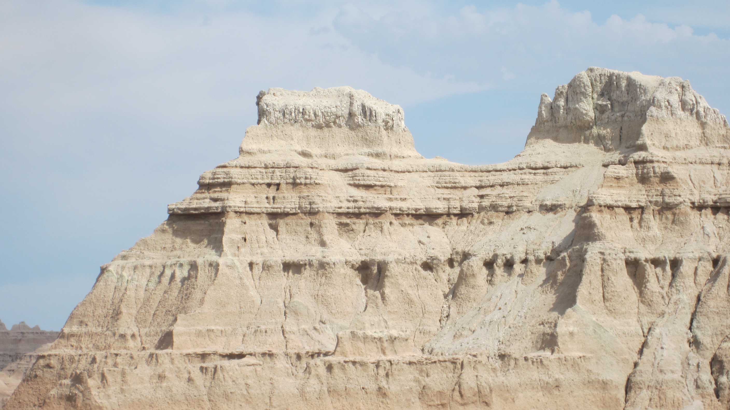
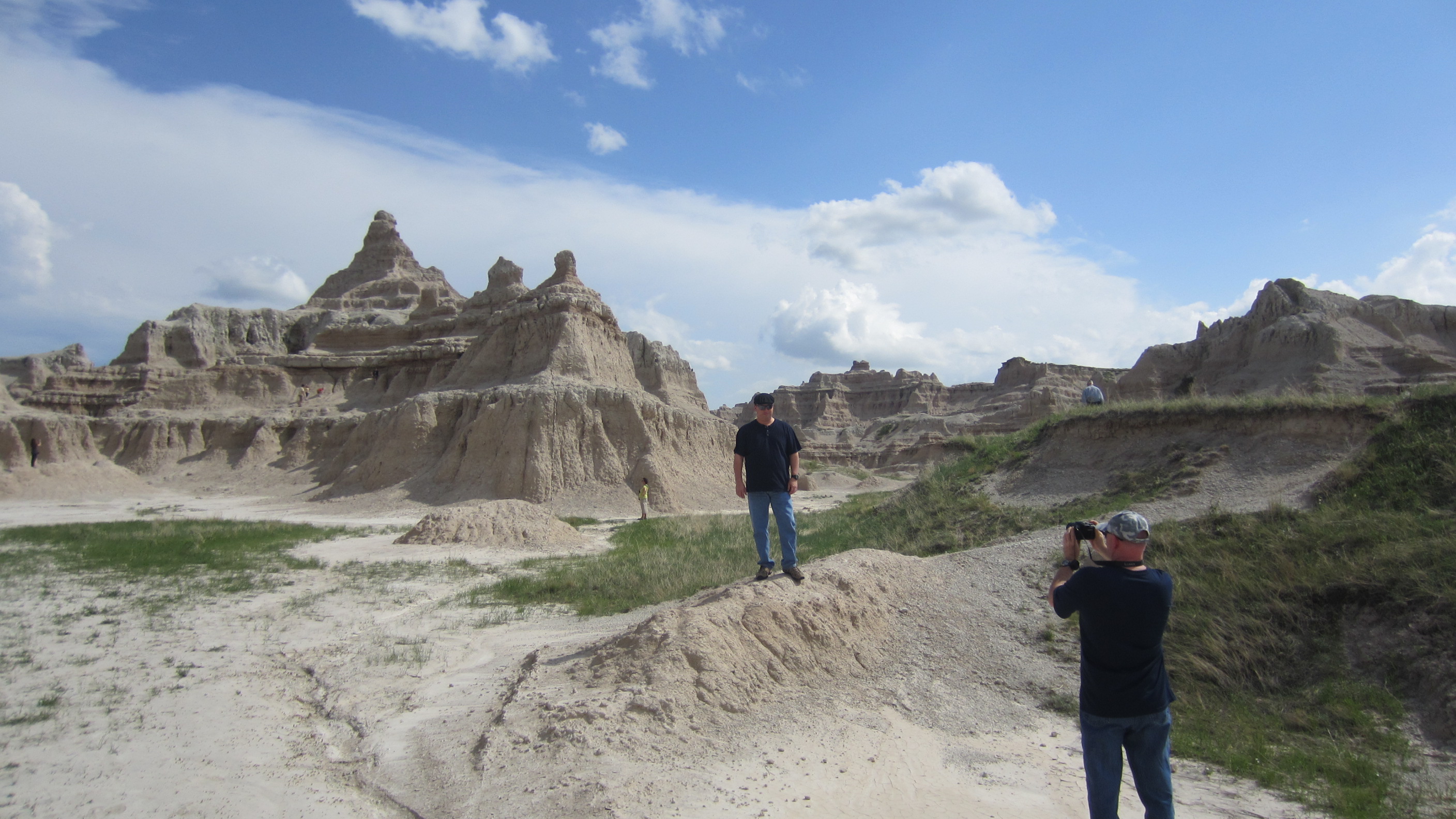
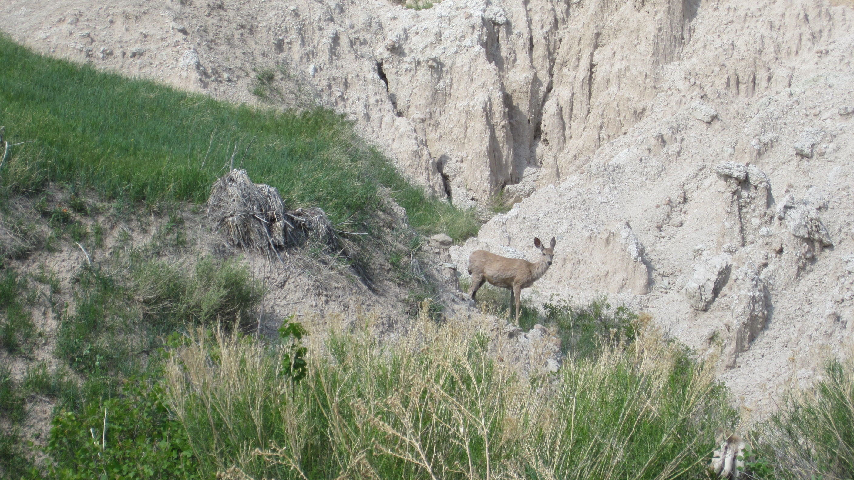
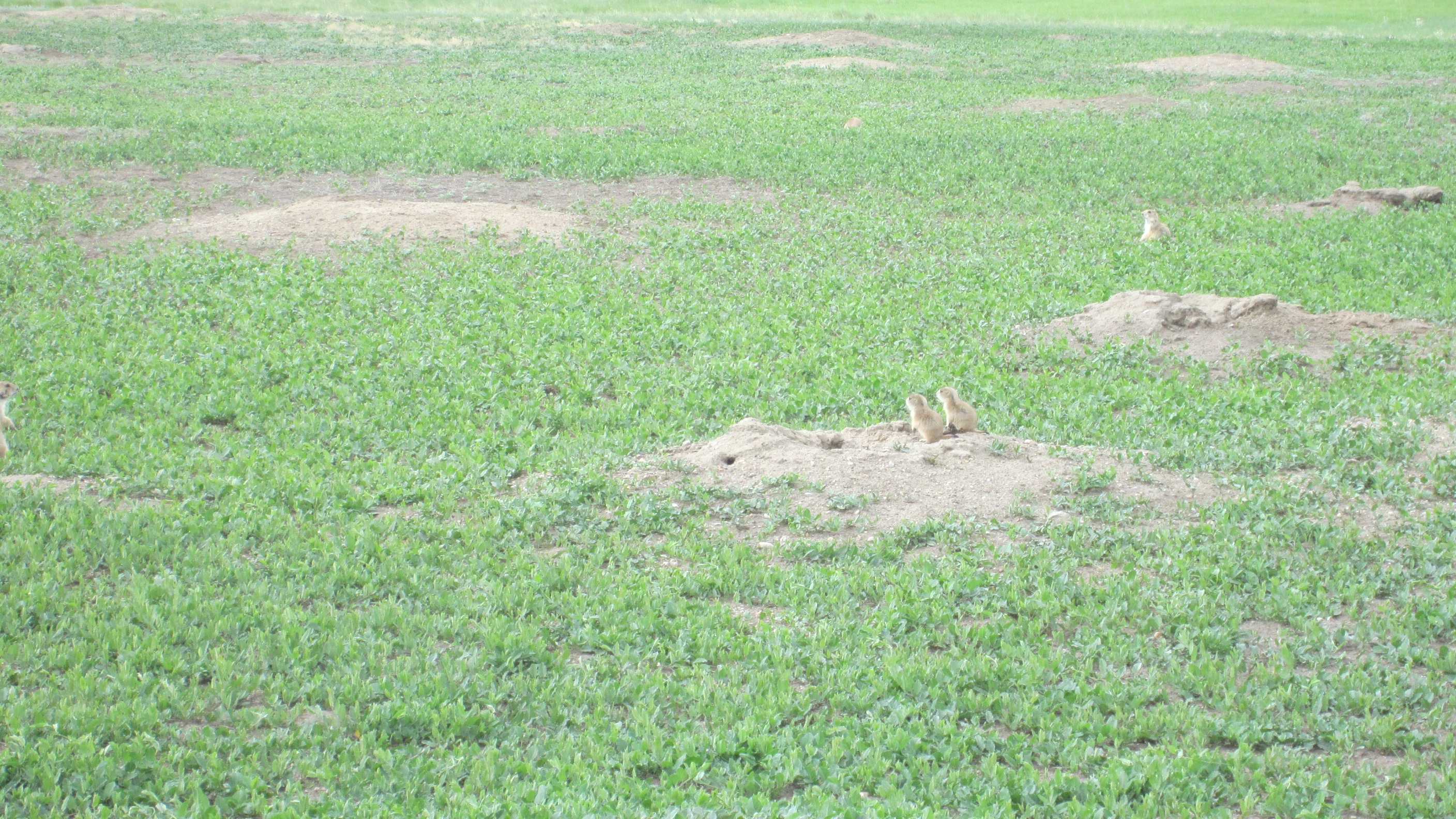
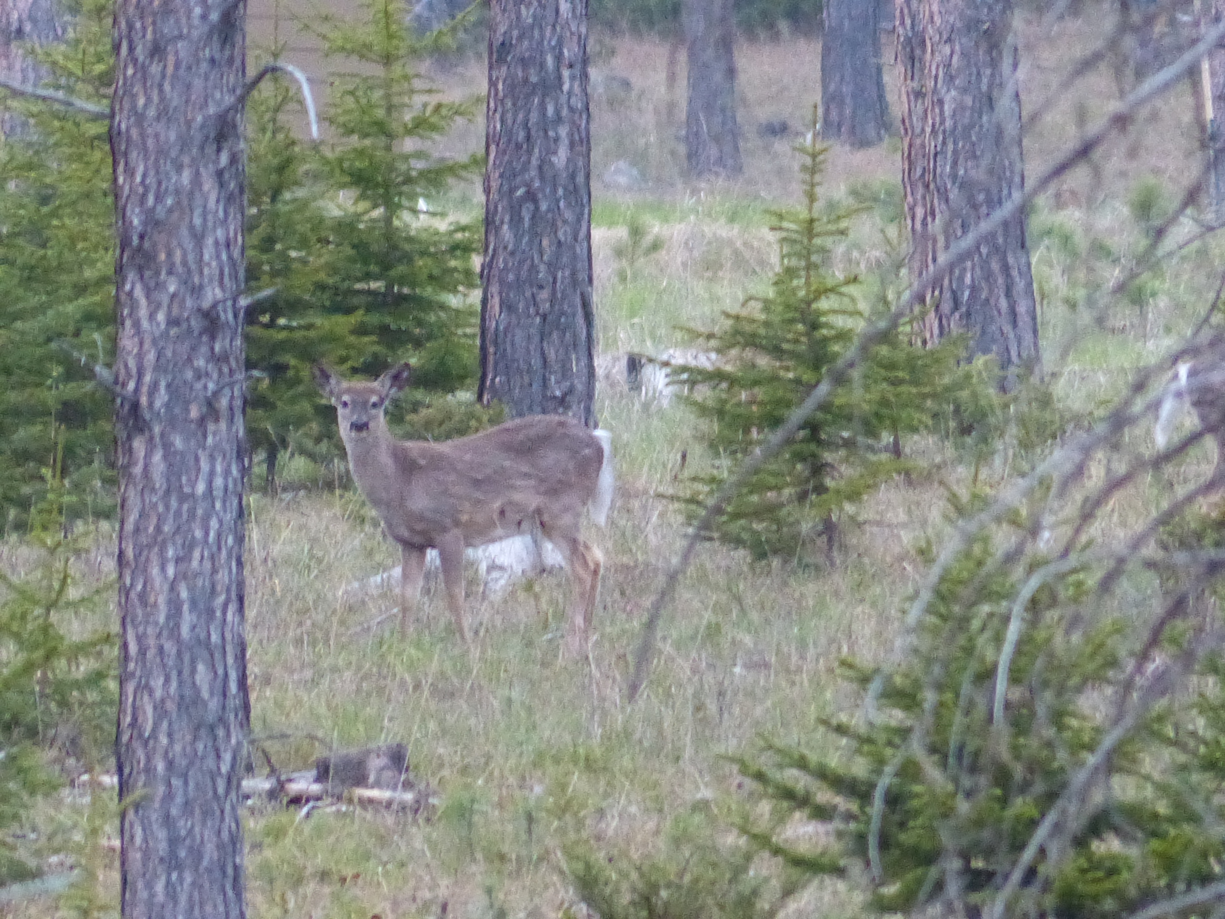
Here are some pics from our time spent there including the wildlife we saw.


 The Badlands are cool and worth seeing. After that we went to Deadwood where Bill Hickock was shot and killed. We ate at the Number 10 Social Club which had amazing food. Did a wee bit of gambling, lost $20 and called it a night. Drove back to our cabin and called day 4 done…well, almost. By nightfall, the sky had cleared and we were able to see the most amazing number of stars. Everywhere you looked were thousands and thousands of stars. Even through binoculars was just amazing to see. A great day in South Dakota.
Mileage Report
Morning odo reading: 3,639
Evening odo reading: 3,639
Miles for the day: 0
Trip start odo reading: 2,417
Total miles for trip: 1,222
I got up early on Day 3. Couldn’t sleep for some reason. By 4am, I was writing day 2 and then getting that published. By 5am, the first thing I noticed is that the sun was coming up quickly? The farther north you are, then the earlier the sun comes up in the summer and more daylight you have to work and play. Since we were playing, this gave me the opportunity to head downstairs and get the bike washed. Lots of bugs accumulate over 500+ miles. We ate breakfast at the hotel, packed the bikes and headed out.
 That concluded day 3.
We are having a great time. Too bad our wifi at the house we are staying at is not working. As soon as I can, I will post more updates.
The day started early…around 5:30 or so, I began loading the bike. I had done some re-arranging of my gear to make it fit a bit better on the bike and allow easier access to rain gear should the need arise. By about 6:15 or so, we checked out of the hotel and headed across the street to iHop for breakfast. Knowing that lunch was going to be later in the day, we loaded up on eggs and pancakes and were out of there by 7:00.
Our direction would take us north out of Amarillo up 287 pretty much the entire way until we hit I-70. Coming out of Amarillo, the weather was overcast and cool – mid-60’s. Perfect riding weather. A little windy, but the wind was out of the south and since we were going north, we had a perfect tail-wind. Traffic was light on the highway and we were making decent time. About then is when we smelled it.
Imagine the most god-awful stink you can think of…ok, now multiply that by 10 and you have just smelled a cattle yard. Initially, we didn’t even see it and the smell just hit us. Yikes, was it bad. For those of you not familiar with this area of Texas, Amarillo and some of the surrounding cities are known for their cattle yards and processing of meat. That’s how it makes it to your local grocery store. After about a mile, the smell dissipated and we were back to driving.
About 45 minutes down the road, we decided to make a pit stop in Dumas to top off and take care of some “business” post-breakfast. Now don’t get me started on the Dumas / “DumbAss” jokes. We tried to not snicker too much, but when we saw the Dumas police roll by, we did snicker a little. This proved to be fateful as I will explain later…
On northward through the panhandle of Texas some of the rolling nature of the land began to flatten and we were able to see miles and miles of prairie land. Nothing followed by more nothing-ness. We did run across a wind farm that we estimated had over 200 of those large electric generating windmills. Each blade is probably 100ft long. Amazing machines.
The wind was doing great initially being exactly at our backs, but then it shifted and began coming in over our left rear quarter. Wind speed was probably 30-40 mph. For those of you that have not ridden motorcycles, let me explain how this works. In a perfectly calm day, all choices of direction of travel are made by the driver. To steer the motorcycle, the driver pushes the handle bar in the opposite direction of how they want to go. It is called counter-steering. Huh? That make no sense! Sure it does, think of it like this. When the wheels are spinning they are creating a gyroscopic effect that causes the bike to remain upright. That’s what keeps it upright even at low speed. Without getting into too much of the physics behind it, that spinning wheel does not want to change direction and any turning of the wheel causes it to “fall” in the opposite direction. Turn the spinning wheel right and it wants to fall left to maintain the balance of the mass.
As I said, turn the wheel right and the bike falls left. This along with the shape of the motorcycle tire, allows the bike to actually make a left turn. Too prevent too much “fall”, the driver has to balance it with turns back in the opposite direction. It’s this constant balancing act that allow the driver the steer the bike through a corner. So what does this have to do with wind coming off the left rear of the bike?
Riding along with a wind coming in from the left pushes the bike to the right. Because the bike only has too wheels, it is much more sensitive to cross-winds than cars. If a driver maintains a straight up line and a wind comes along from the left, it will push the driver right. We were constantly fighting this wind by steering right, “falling” left and keeping the bike in a somewhat straight line. So basically, we were trying to steer into oncoming traffic to keep the bike on the road. Nice… What’s worse is that on-coming traffic would create a vacuum where there was no wind and it would pull the bike right into the other lane. Seriously not fun!
We continued this fight for about 180 miles over all. We found that by going faster, it helped somewhat with the balance, but also just the mental hope that we would be out of it soon. We were traveling anywhere between 85-105mph to try and get through it quickly. Unfortunately, we rolled by an Oklahoma Highway Patrol doing 87. And while he understood our plight, gave us tickets anyway for 75 in a 65. Me, I think it was somewhat worth it to try and get through the madness as quickly as possible.


We stopped for gas and a rest in Lamar CO. Nice little town. Ate some beef jerky and drank most of a gatorade. By the way, the nothing-ness, continued all the way through eastern CO until we started heading toward Denver on I-70. We did stop in Limon as well to take care of some more “business” and hit the gift shop. I bought a patch that says “The Rockies” on it. I’m not really a fan of CO and their liberal ways so no state flags or anything like that.
Once we were on I-70 about 50 miles outside of Denver, we caught a glimpse of Pikes Peak. Just beautiful. A little hazy so it wasn’t perfectly clear, but gorgeous none the less. We didn’t see mountains again until we were about 20 or so miles from Denver. That finally gave us something to look at besides the flatness of Texas, OK and CO.
My buddy has a friend that lives in Aurora so we stopped to have lunch with them at a Chili’s. We topped off the fuel tanks and from there headed up the toll-way on to I-25. As we were traveling north, I kept glancing at the mountains. I imagined that they were calling out to me to come dance along their twisty roads which I desperately desired to do after the last 2 days of riding flat, mostly straight roads. Patience however. I will get there soon enough and then it will be time to play.
I-25 north from Denver thru Fort Collins sucks!! Traffic on a Saturday late afternoon was horrendous. The worst traffic we been in for the entire trip. Add to that, the temperature was around 91. Surprisingly hot. We could not wait to get through that. As we had just crossed over into Wyoming, a van comes hauling ass driving past us. We estimated that they were doing 110 or more as we were doing about 85 (the speed limit was 75 here, not 65). As we got closer to Cheyenne, we saw a WY highway patrol coming the opposite direction, make a hasty u-turn and flew past us doing probably 120-130. Presumably to go catch that van. We never did see what happened as the exit to our hotel came up too soon.
Made our way to the hotel, a Holiday Inn Express. Cleaned up and went to dinner at a restaurant called Shadow. It’s an old train depot and supposedly one of the most important pieces of western architecture from the late 1800’s. Cool place; was recommended by a friend and I’m glad we went. Water, beer, whiskey, chips and salsa, pulled pork with sweet potato fries (in that order) was enough for me. Made it back to the hotel, to the room and crashed.
Mileage report:
Morning odo reading: 2796
Evening odo reading: 3317
Miles for the day: 521
Trip start odo reading: 2417
Total miles thus far: 900


Day 2 map:
Day 1 is done…in the books so to speak. Over 350+ miles today primarily on 287. I’ve also just discovered that the camera I was using to take some cool pics on the road uses a memory stick and not an SD card. Argh!! I don’t have the adapter with me for the memory stick so no pics tonight.
In terms of the trip, the traffic was fairly light and we were able to make good time. Pretty much the 6 hours that google maps suggested it would take. I left my house at 7:02am and we rolled into the hotel parking lot around 1:30. This included a couple of stops for lunch and one for gas. That is fairly uncommon for us as we normally stop about every 100-120 miles. Today we pushed that to close to 160-180 miles before stopping. Basically 7:20-9:30 straight driving.
Lunch was at the Dairy Queen in Childress. This particular DQ had plenty of senior citizens partaking of the DQ offerings. Nothing wrong with that. A few other travelers also stopped in for a quick bite before getting back out on the rode. We knew they were travelers because we ended up passing them later on down the road.
Once we got to west Texas, the scenery definitely flattened out. You can see for miles out here. We saw one windmill farm churning out electricity and an entire new set of high voltage wiring being setup. We also saw about 3 coal trains. A coal train is exactly what it sounds like. Cars full of coal being pulled south. Not sure where they come from or where they were going, but each of them was anywhere between 1/2 and 3/4 of a mile long. Very long trains!!
We also saw plenty of highway patrol although we did not get the opportunity to meet any of them in person. Thankfully the radar detector was working and saved us a couple of times.
Our average speed today was up around 82-87 mph. Speed limits out here are 75, so we pushed it a little to get past trucks and other slow moving traffic.
Once we got to Amarillo, we unloaded the bikes and sat down for a bit. We then decided to go see the movie Star Trek Into Darkness in iMax 3D. The picture and sound were incredible. When explosions occurred, the seat actually rumbled from the volume of low bass the sound system was pumping out. Great movie!! Better than the first one (relative term as the first one is actually number 11).
After the movie, we made our way over to the Big Texan to eat steak. Although I did consider the 72oz steak challenge, I decided that the better course would be to order a small rib-eye. Yummy, good choice. After that, headed back to the hotel, showered and am ready for tomorrow. We leave early so updates when I can!!


Here is a map for day 1:

Getting fuel in chilllicothe at the allsupss. 193 miles from home.
