
Time to leave the Lead / Deadwood area. We thoroughly enjoyed this part of South Dakota and can’t wait to return in years to come. The Badlands, Mt. Rushmore, Crazy Horse, Custer State Park, Deadwood – too much to do in too short of a time. We only spent 2 and a half days here and that didn’t do it justice. We could probably stay a week and still not see it all. But, we are on day six of a twelve day trip and more excitement is calling us on to the next adventure.
Here is our plan for Day 6 – get up early, drive to Devil’s Tower, stop in Sheridan, WY for lunch, through the Bighorn forest and then on to Cody for the night. It didn’t quite happen that way.
We did get up early and left the cabin dressed for chilly, wet weather which mother nature was more than happy to provide. We headed up highway US-14 Scenic from Lead up to Spearfish. This is a very nice road through a canyon with the hills rising on both sides. The road was wet from various light rain showers that would move through from time-to-time. The speed limit was a paltry 35mph and we cruised through there doing anywhere from 45-60 depending on pavement conditions and visibility. Not much traffic on a Wednesday morning.
We made it up to the interstate and began our trek on towards Devil’s Tower. As we got on the highway, I detected a faint hint of cigar smoke. Sure enough about a mile down the road, we caught up with a guy in a small car chomping on a big cigar. Strange sight, but we kept on going. Weather was cooperating – cool and cloudy, but no rain. Perfect conditions to sit back and cruise on the bike.
Our first stop that morning was a small town called Sundance, WY. You’ve heard of “Butch Cassidy and the Sundance Kid“? Yep, this is the town that the “Kid” was named after. The movie is about two bank robbers that end up in Bolivia and stars Robert Redford and Paul Newman. Redford plays the “Kid”. Another bit of irony here is that Sundance sits in Crook county. Sundance itself is named after the “Sun Dance” of the North American Indians.
We bought gas and made our way to downtown where we hoped to find a cafe for breakfast. After a bit of looking around and asking, we found the small cafe. Of the 12 tables available, 10 were open so we had an easy time finding a seat. At one of the tables was a group of men who you could tell worked outside most of their life. Nothing wrong with that by the way. I was amused at one of the t-shirts the guy had on. On the front, it had that outline of the woman you see on 18-wheeler tire flaps with wording around it of “Support your local hooker”. On the back was an advertisement for a towing firm out of Sundance WY. Grinning, we ate, paid and left.
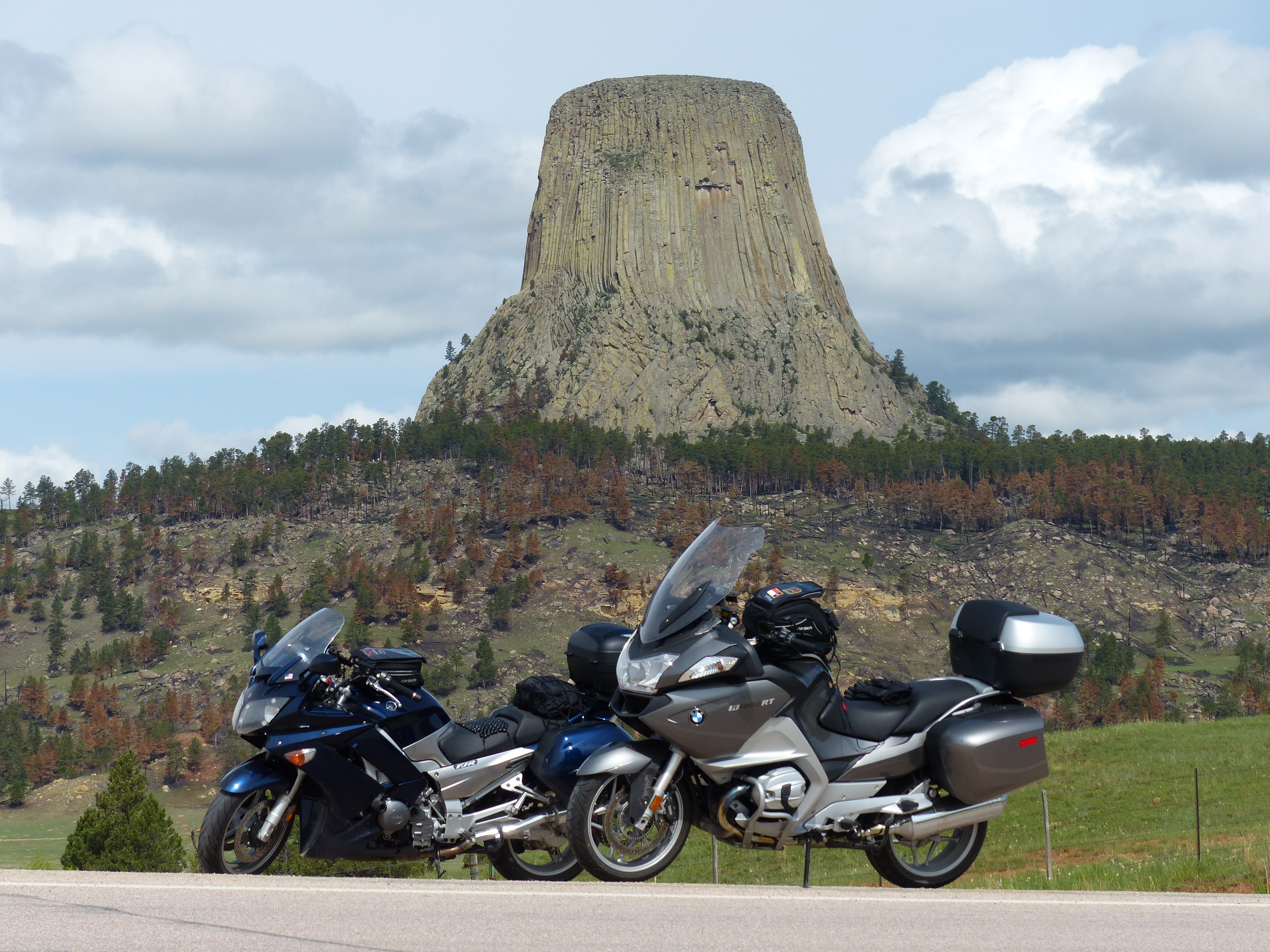
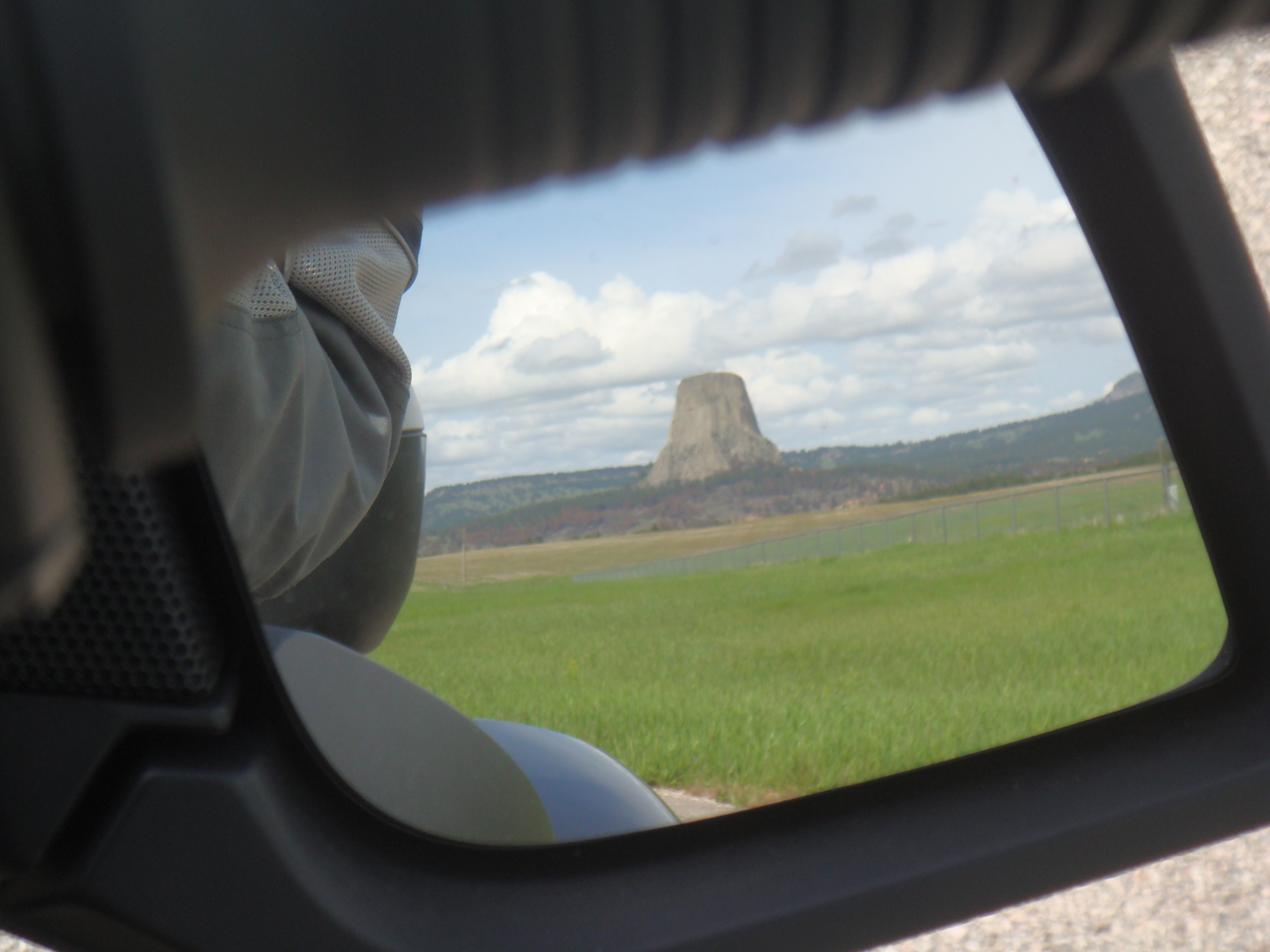
Just outside of town is the turn off to head up to Devil’s Tower. The Lakota Indians call it “Bear Lodge” or “Brown Buffalo Horn”. Interesting reading on Wikipedia about it. We cruised on up and pretty soon were greeted with this:
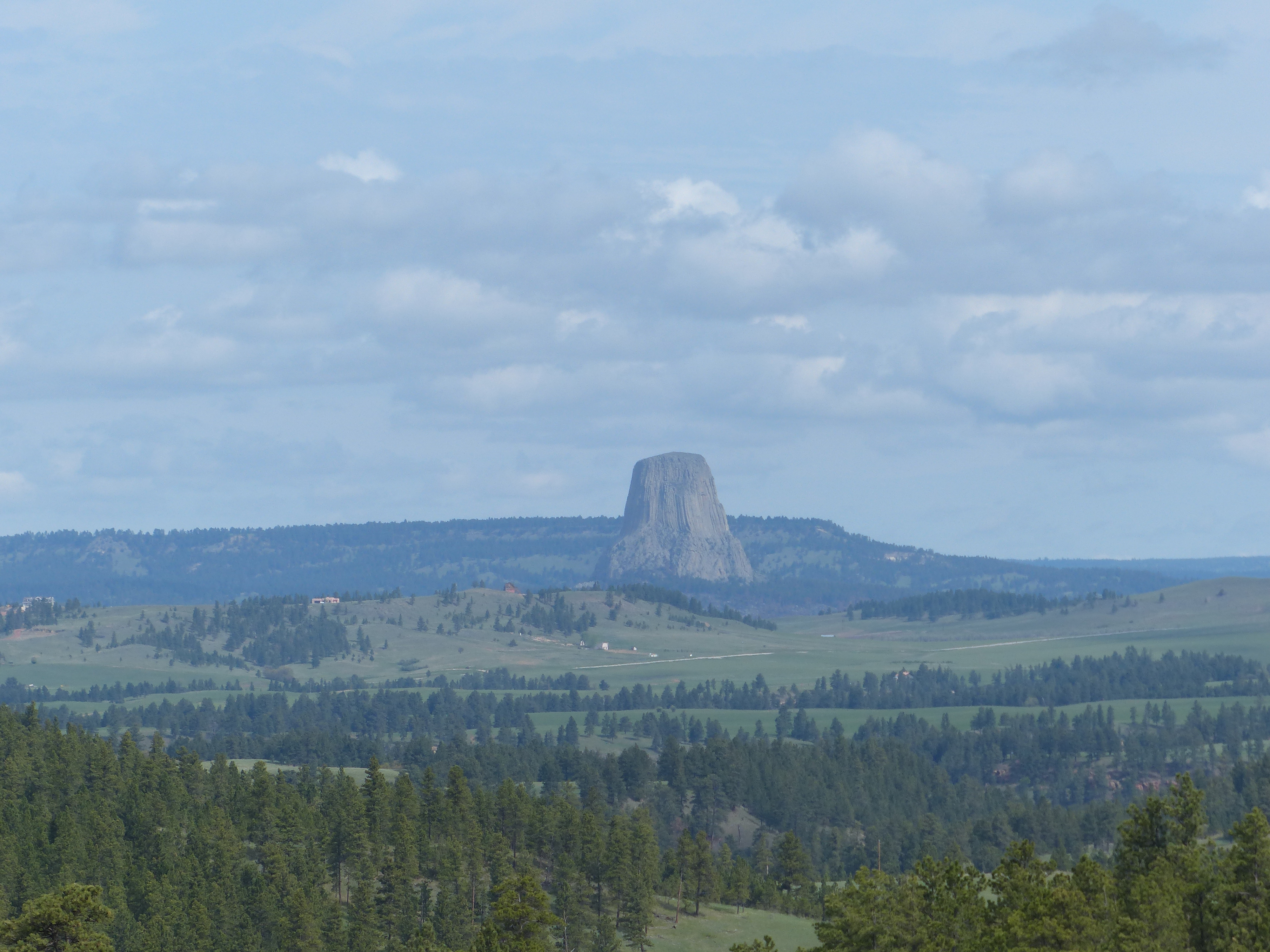
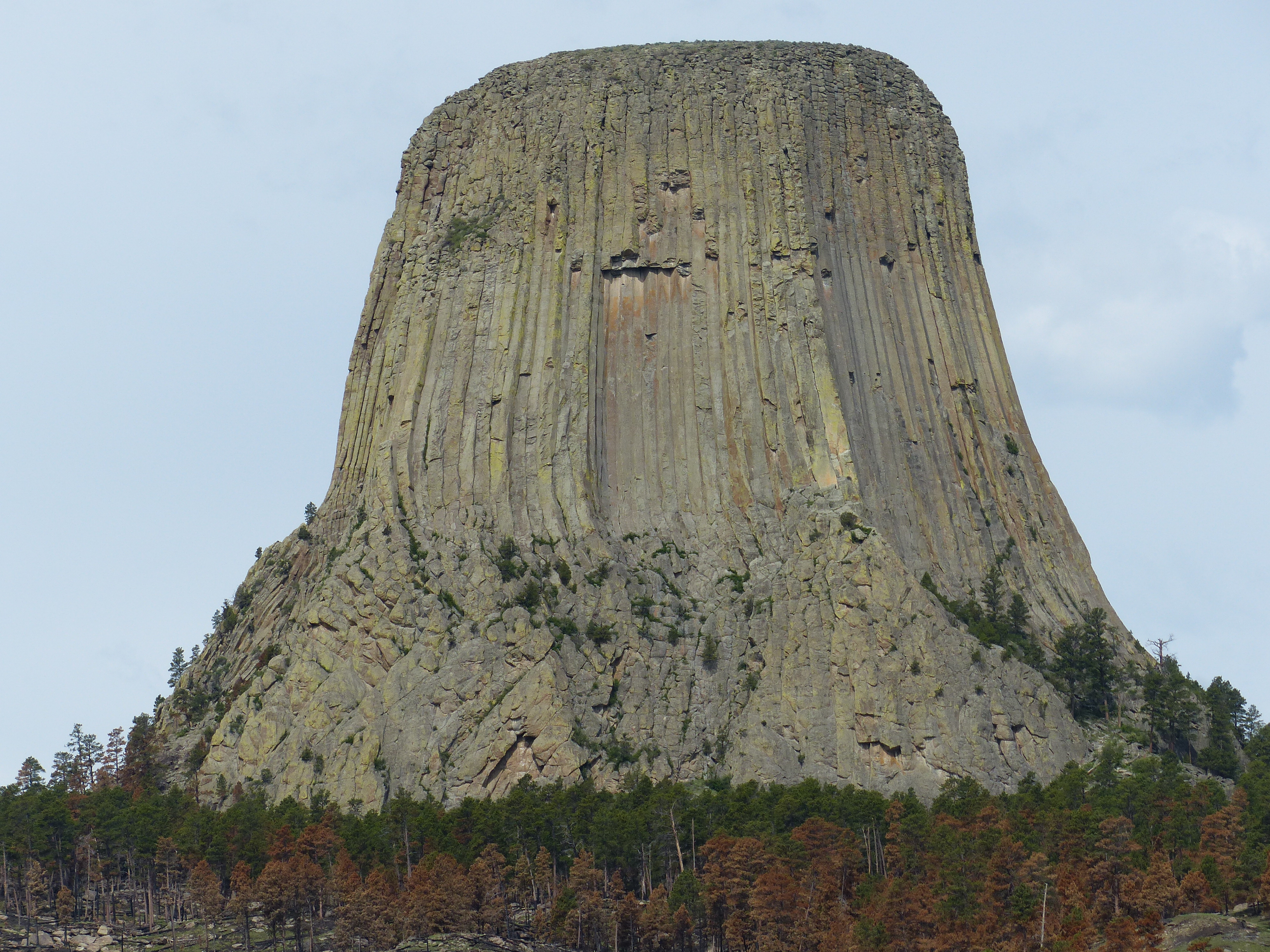
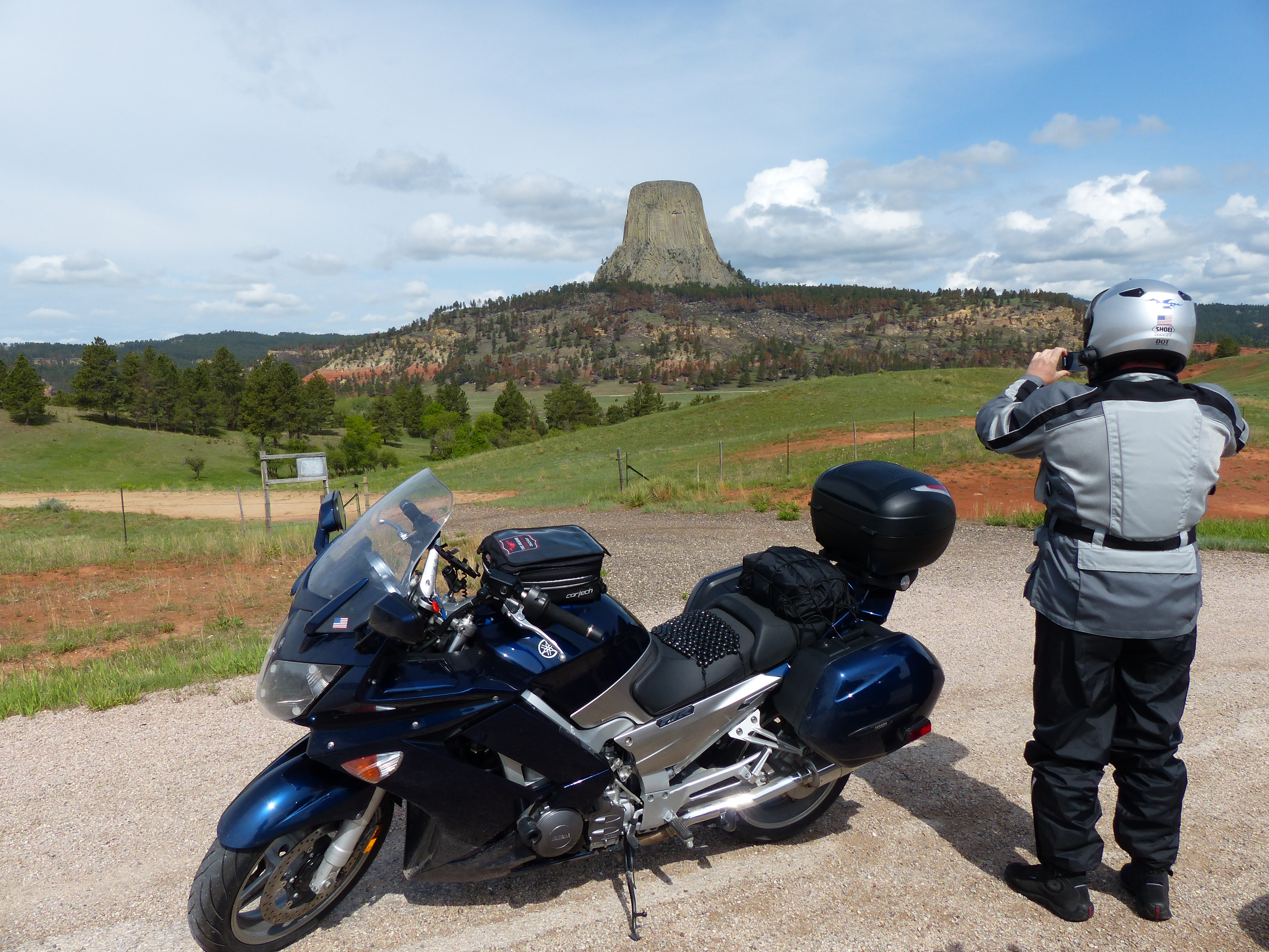
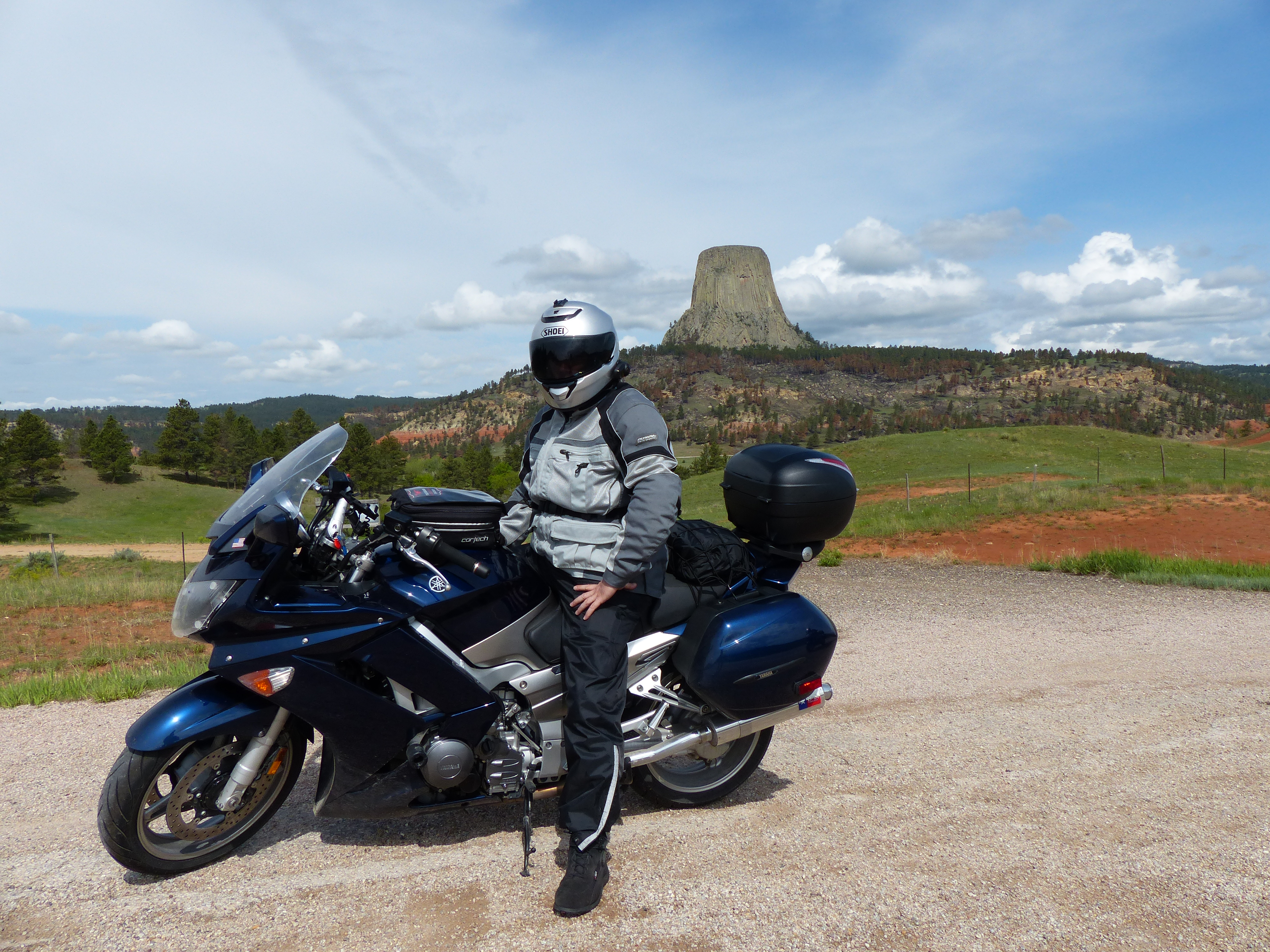
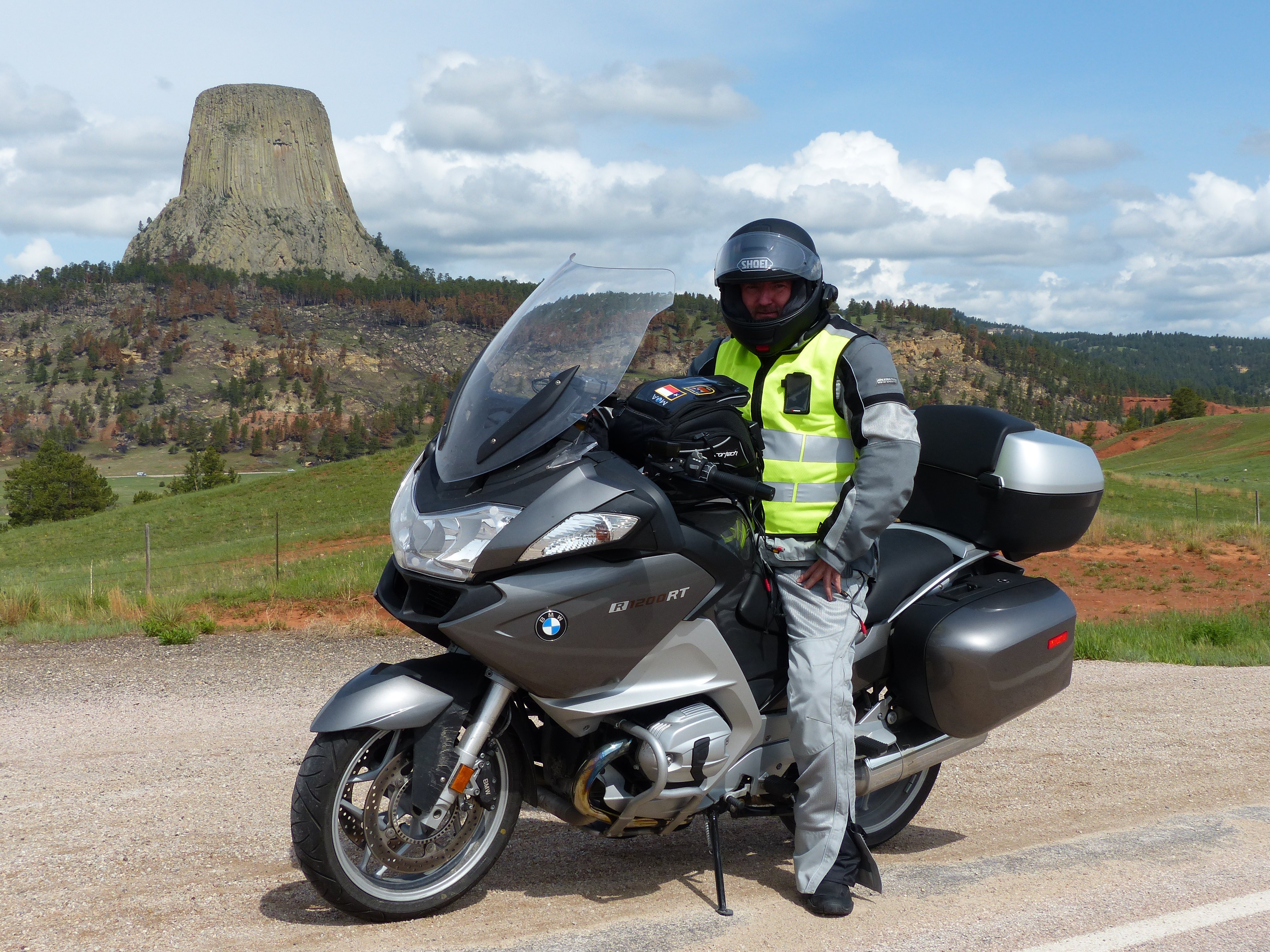
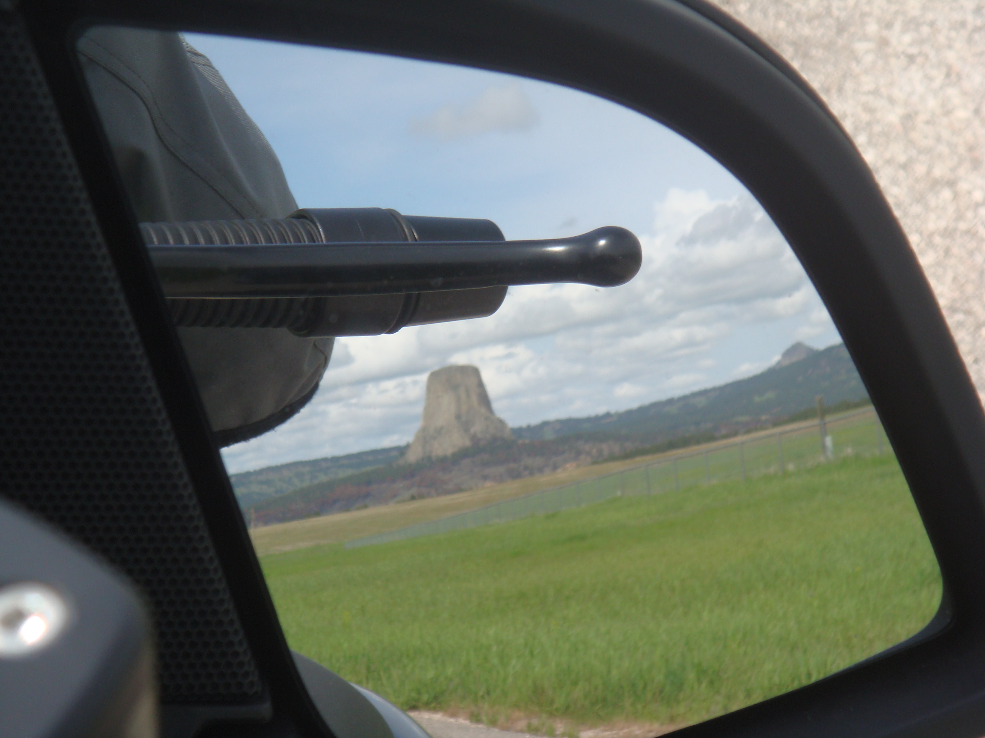
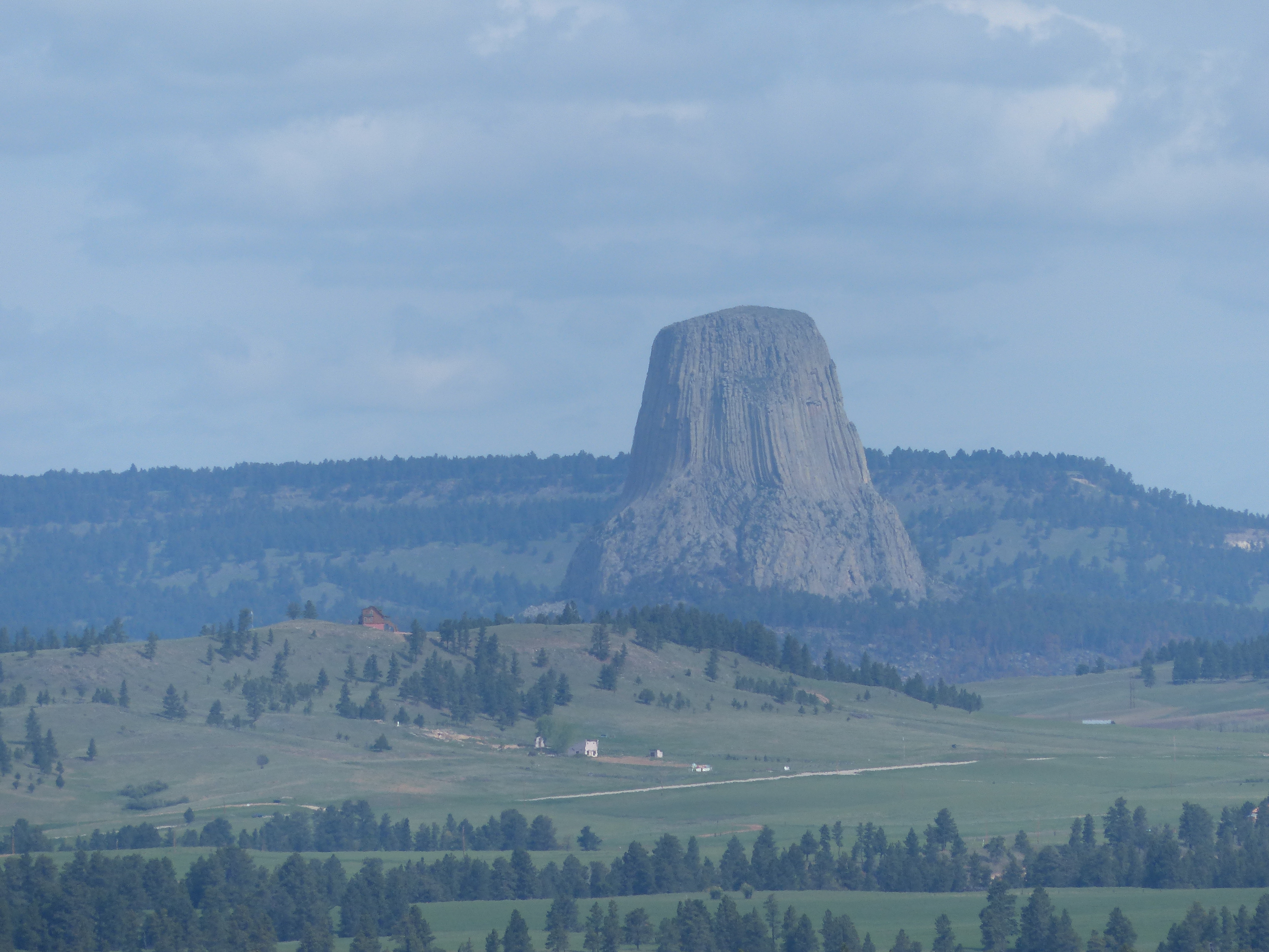 As you can see, Devil’s Tower just sort of sits in the middle of nowhere Wyoming. It is most famous as the tower where the aliens arrived in “Close Encounters of the Third Kind“. In the movie, Richard Dreyfus makes a replica of the tower first out of mashed potatoes and then dirt and mud in his living room. The movie is a classic and I highly encourage you to see it if you haven’t. Of course, we kept making jokes about dead sheep, alien probes, helicopters with knock-out gas and hoping we would get to see at least a UFO or something. Alas, it didn’t happen so we took a few more photos and headed out.

 The next section was fairly easy as we headed across Wyoming on to Sheridan. We passed what appeared to be an open coal mine as we maybe a thousand railroad cars being processed and loaded with coal to ship south. We imagined this was some of the same coal that we saw in Texas from Day 1. As we got closer to Sheridan, the weather started getting worse. Rain and falling temperature. We found a place for lunch with wi-fi and pulled in to rest a bit. The next section would take us up through the Bighorn forest and we wanted to be ready for that.
As we ate our lunch, the rain continued to come down. We watched our bikes get pretty soaked in the parking lot. I had pulled out my iPad and was monitoring the radar. It didn’t look good. The Bighorn forest was getting lots of rain and what appeared to be snow at the higher elevations. Ugh, this was not going to be pretty. Motorcycles are not good in snow. Four wheels can be slippery, but at least the vehicle doesn’t fall down. On two wheels, you are pretty much guaranteed to be fall over if you get into any surface that’s extremely slippery.
Our options were to either go north up through Montana and try to come in to Cody through that route or to go south, skip Cody and come up from Casper to Jackson Hole. We debated the pros and cons of these for about an hour hoping the snow would ease up in the forest and make our decision a bit easier. It didn’t. My wife had been through there earlier in the car she had rented. I sent her a text and let her know we had decided to avoid the forest. Her comment back was “good choice”.
Ultimately, the decision was to head to Casper. My buddy had a friend that lived down there. With the decision made and the rain subsiding a bit, we headed back south. This part of the trip wasn’t too bad – lots of nothing but rainy grasslands and distant mountains until we got close to Casper. The wind really started picking up the closer we got to the town. We could see a windmill farm off to our left – that’s always a bad sign because it means the wind blows fairly constantly. Like Day 2, we were really fighting the wind. Lots of scary moments and leaning the bike way over just to go straight.
Finally made it to our hotel, showered and had dinner with my buddy’s friend and her son. This was a very long day. I got everything plugged in for overnight charging and promptly went to bed and fell asleep. Day 6 complete and day 7 was looking interesting as well given the forecast for more rain and possible snow as we made our way up to Jackson Hole.
Not too many pictures today as the cameras were pretty well put away and covered given all of the rain we were encountering. Here’s a Google map that shows our path for this day:
